National Geographic Custom Topographic Map - Any U.S. Location (USGS)
Select any location in the United States from city block to backcountry and we'll craft a seamless, high-resolution topographic map using the most detailed USGS data available (up to 1:19k), printed to museum-quality standards. These custom area topo maps show essential landmarks and navigational aids that make them ideal for backpacking, mountain biking, kayaking, and fishing adventures.
Tell us about your map
Material:
Size:
Title:
Best Sellers Material Info
We use museum grade papers and canvas along with high quality solid wood mounting options.
Made in the USA
Archival Paper
Premium Giclée fine art print on thick acid-free paper with a matte finish. Features rich, vibrant colors with precise detail.
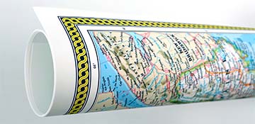
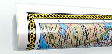
Laminated Map Print
Matte finish durable full encapsulation lamination using 3 mil thick film laminate. Features a washable surface that is compatible with dry-erase markers.
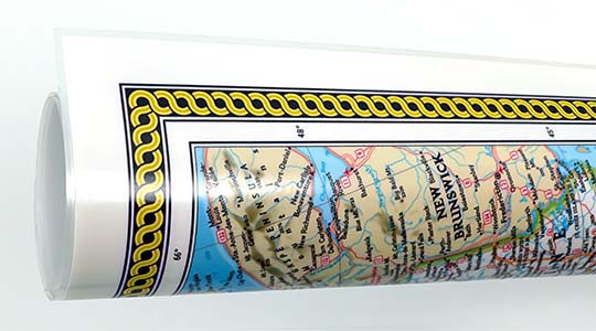
Peel & Stick Wall Decal
Versatile peel & stick fabric material with repositionable self-adhesive backing. A polyester canvas material that can be used multiple times without damaging walls or leaving a residue.
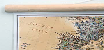
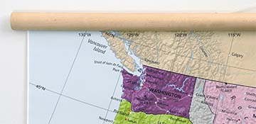
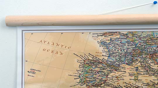
Laminated on Wood Rails
Matte satin finish laminated map print mounted to natural finish solid wood hanging rails placed along the top and bottom of the print. Features a hanging cord and dry erase markable finish.
Canvas on Wood Rails
High-quality giclée print on artist-grade canvas mounted to natural finish solid wood hanging rails placed along the top and bottom of the canvas. Hanging cord at top.
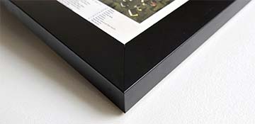
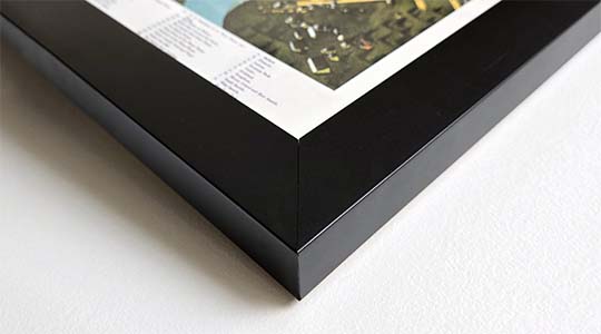
Framed Map Print - Black
Printed on high-grade fine art paper and mounted in a solid wood frame with a black finish. The print is protected behind optical-grade clear acrylic.
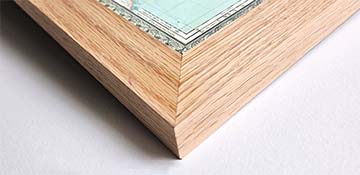
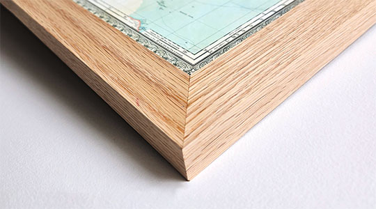
Framed Map Print - Natural Oak
Printed on high-grade fine art paper and mounted in a solid wood frame with a natural oak finish. The print is protected behind optical-grade clear acrylic.
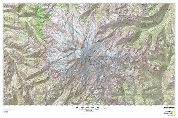
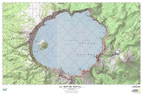
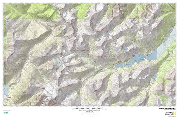
Custom Area Topo Maps Full PDF Examples
Click the images below to view full detail examples of custom area topographic maps. Zoom in to view detail.
Create a Custom Area Topo Map of Anywhere in the USA
From a first home to a favorite summit, choose any U.S. location (including Alaska & Hawaii). National Geographic's topo maps are generated using the highest‑detail USGS topographic mapping available for your area.
Choose your map size, scale (from 1:19k to 1:148k) and compose a seamless, single map with clean contour lines, hydrography, and refined labeling.
Map product features
Any U.S. location — neighborhoods, shorelines, national & state parks, lakes, peaks, and more.
Seamless USGS topo data — stitched cleanly across quadrangles to remove visible joins.
Detailed topography with shaded relief.
High-quality paper and laminated finish
Waterproof and tear-resistant (laminated print)
National Geographic's TOPO! equips backcountry explorers with the maps they need to reach mountain peaks, secluded lakes, and every road in between.
Features on the maps
Crisp elevation contours — legible linework representing topography with elevations labeled in feet
Hiking trails, camping locations, points of interest
Mountain peaks, rivers, lakes, and creeks
Interstate & state highways, local roads
We use top-notch materials printed on demand using the Giclée printing method, so you get amazing detail and bright colors every time.
Archival Paper
Premium fine art paper that provides accurate color reproduction with high-contrast, high-resolution print output and maximum image permanence. A high-quality Giclée print ready for framing.
Museum quality paper for high-quality fine art.
Ultra smooth, neutral white matte finish.
Heavy-weight 230 gsm, 9.5 mil thickness.
Printed with pigment inks for longer print life and enhanced fade resistance.
Pigment based Canon LUCIA inks provide smooth tones and rich colors in fine, precise detail.
Canvas on Wood Rails
A canvas giclee print that is mounted to wood hanging rails placed along the top and bottom of the map. Rail mounted maps are ready to hang via the attached hanging cord. Solid wood rails have a natural finish.
Premium 19 mil canvas material.
Wood rails are 1 1/8" wide, round front.
USA sourced solid maple wood.
High quality giclee fine art print with a lightfastness rating of over 100 years.
Pigment based Canon LUCIA inks provide smooth tones and rich colors in fine, precise detail.
Laminated Print
Print that is fully laminated (front & back) using 3 mil laminate with a satin matte finish. Durable and compatible with wet or dry-erase markers.
High quality 3 mil hot lamination.
Print is laminated both front and back with full encapsulation. Completely waterproof.
Compatible with dry or wet erase markers. Perfect for classroom use.
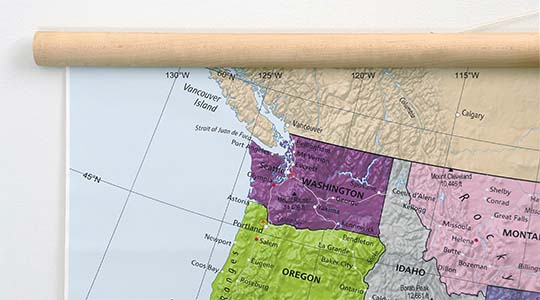
Laminated on Wood Rails
A matte laminated print that is mounted to solid wood hanging rails placed along the top and bottom. Ready to hang on the wall via the attached hanging cord. Wood rails feature a natural finish.
Durable 3 mil laminated print.
Wood rails are 1 1/8" wide, round front.
USA sourced solid maple wood.
Laminated map features a satin matte finish and is compatible with wet or dry-erase markers.
Framed Map Print - Black Finish
Our gallery quality frames are made of solid wood and feature optical-grade acrylic. Each framed map is printed on premium archival matte fine art paper.
Printed on thick, luxurious acid-free fine art paper & dry-mounted to foam board.
Pigment inks ensure a vivid print with amazing colors and excellent fade resistance.
Solid wood frame with a black finish has a 1.25" face & 7/8" depth.
Kraft paper protective backing & hanging wire installed.
Framed Map Print - Natural Oak Finish
Our gallery quality frames are made of solid wood and feature optical-grade acrylic. Each framed map is printed on premium archival matte fine art paper.
Printed on thick, luxurious acid-free fine art paper & dry-mounted to foam board.
Pigment inks ensure a vivid print with amazing colors and excellent fade resistance.
Solid wood frame with a natural oak finish has a 1.25" face & 7/8" depth.
Kraft paper protective backing & hanging wire installed.
Peel & Stick Wall Decal
Versatile peel & stick fabric material with repositionable self-adhesive backing. A polyester canvas material that can be used multiple times without damaging walls or leaving a residue.
Easy to install and sticks to just about any flat surface.
Removable without damaging walls or paint. Can be re-positioned / re-applied multiple times without losing adhesion. Leaves no residue!
Adhesive stays in place for many years even under high humidity. Does not weaken.
Non-toxic, safe for a kids room. No PVC, Glycol-Ether or Formaldehyde.
Great for rental houses & apartments. Resists wrinkles, bubbling, shrinking, and tears. Simply peel, place, & stick!
Free Ground Shipping within the contiguous United States and a flat rate of $20.00 to AK and HI.
Canada via UPS Standard is $40.00 USD.
Worldwide Shipping is available and shipping costs will be calculated at checkout.
Shipping Times
Most items are made to order and ship from our Seattle, WA facility. Typical production lead times are listed below. Shipping transit time is 2-5 business days depending on the delivery location. If you need your map by a certain deadline please contact us for expedited options.
Archival Paper, Laminated Maps, and Peel & Stick - 5-7 business days
Wood Rail Mounting - 3-4 weeks
Canvas Gallery Wraps & Framed Maps - 3-5 business days
Push Pin Maps - 3-5 business days
Spring Roller Maps - Varies, see product description
Wallpaper Map Murals - 7-10 business days
Returns
If you are unhappy with your order for any reason you can return it within 30 days of the delivery date. Customized items are non-returnable.
Yes, we can produce a majority of the map titles found on our website in a custom size. If you would like to request a custom size, take note of the map title and item#, then follow one of the links below to make your request. We will follow up with a link to checkout.
(for rolled or mounted prints)
(for larger peel & stick / wallpaper maps)
All of our maps are currently labeled as "Gulf of Mexico". Since our map products are printed to order, we can offer the alternate "Gulf of America" labeling by request.
If you would like your map to be labeled Gulf of America instead of Gulf of Mexico, simply request this in the comments section at checkout, and we will update the map.
We accept purchase orders from schools and government entities. You can e-mail a copy of your PO to [email protected].
View more information and download our W-9.
No problem, send a screenshot or PDF of your shopping cart to [email protected] and will promptly follow up with a quotation.
Our products are printed on demand and have the following production lead times:
Archival Paper, Laminated Maps, and Peel & Stick - 5-7 business days
Wood Rail Mounting - 3-4 weeks
Canvas Gallery Wraps & Framed Maps - 3-5 business days
Spring Roller Maps - Varies, see product description
Shipping transit time is 2-5 business days and will vary depending on your location. Most products ship from Seattle, WA.
Many of the maps found on our website can be customized, including adding a personalized title/legend or company logo, modifying the color scheme, change text labels, adding points of interest, and placing GIS data on the map.
If the order is shipping outside of Washington state, sales tax may not apply. We collect sales taxes per state and local laws. Sales tax is calculated at checkout based on the delivery address.
We can ship to nearly any country. The shipping cost is determined for Canada and most European countries at checkout. If you find that shipping is unavailable to your country when checking out then please contact us with a list of the products you would like to order as well as size and material options.
We can produce a custom map for any location in the world. Whether you are looking for a detailed city street map or high resolution satellite imagery of a remote area, we have you covered.
Our wall maps and wallpaper map murals are handcrafted by our small team in Seattle, WA.
School Purchase Orders
We accept purchase orders from schools and other government institutions. Learn more here.
High Quality Materials
Maps are printed on premium fine art papers, canvas, and durable wallcovering materials using archival inks.
Stunning Cartography
Original and up-to-date maps designed by our cartographic team at Academia Maps include a range of high quality maps for geographic exploration, home decor, and classroom learning.