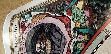
Bird's eye view of Phoenix, Maricopa Co., Arizona. Sketched by C.J. Dyer. W. Byrnes litho. Schmidt, Label & Litho. Co.
The city of Phoenix was founded in 1868 near the Salt River, and incorporated into a city in 1881. Eventually becoming the state's capital, it is now the 5th most populous city in the US. This beautiful bird's eye view map features insets of the city's early buildings. Complete reference list below.
The following booster statement was included on the map:
PHOENIX, The county seat of Maricopa County, is situated in the Salt River Valley, 23 miles north of Maricopa Station, on the Southern Pacific Railroad. The town is embowered in shade trees and shrubbery, has streams of living water through every street, is surrounded by orchards, gardens and vineyards, and is one of the handsomest in the West. The streets face the cardinal points, are broad and spacious and lined with trees. The County Courthouse, in the center of a square and surrounded by trees, is a handsome two-story brick, surmounted by a tower. The School House is a large and commodious brick structure, of two stories, almost hidden in a cottonwood grove. The Methodists, Baptists, and Catholics have tasteful places of worship. There are several large mercantile establishments, a steam flouring mill with daily capacity of 180 barrels, two ice factories and a planing mill. The Odd Fellows, Masons Workmen, Knights of Pythias, Good Templars and Chosen Friends have flourishing organizations. Two newspapers, the Herald and Gazetee have daily and weekly editions. The altitude is 1800 feet above the sea the climate is one of the healthiest in the world. Snow never falls and roses are in bloom in December. Phoenix is the center of an extensive and fertile valley almost 50 miles in length by 10 in width, and containing over 300,000 acres. Every variety of grain, grasses, fruits and vegetables give a prolific yield. For fruits, grape culture and wine making the soil and climate are especially adapted. Everything is grown by irrigation. Eight canals convey the water from the Salt river over the land. The Arizona canal is one of the largest works of this kind in the United States; it is over 40 miles in length, 80 feet wide on the bottom and 58 feet on the top, is 7 feet deep and has a capacity of 46,000 miners inches. It has reclaimed and made valuable over 100,000 acres of rich land. The office of the company is at Phoenix; the President is Hon. Clark Churchill and the Chief Engineer is Charles A. Marriner. The Territorial Insane Asylum is situated near the town, also the extensive and beautiful grounds of the Arizona Industrial exposition. The Normal school is situated nine miles up the river. A branch road from the Southern Pacific will be completed to Phoenix by January 1, 1886. The town is rapidly growing, and its charming situation will yet make it the leading city of Arizona. Population about 3,500.
Features numbered references to the following locations:
- County Court House.
- Baptist Church.
- Washington St. Methodist Church.
- Public School House.
- Centre St. Methodist Church.
- Salt River Valley Canal.
- Residence of J.T. Simms.
- Gazette Printing Office.
- Kales & Lewis' Bank.
- Valley Bank.
- Herald Printing Office.
- J.Y.T. Smith's Flour Mill.
- Public Plaza.
- Irvins Building.
- Phoenix Swimming Baths.
- Phoenix Hotel, Chas, Salari, Prop.
- Gregory House & Lumber Yard.
- Hotel Lamon.
- Catholic Church.
- Dutch Ditch.
- Maricopa Canal.
- Grand Central.
- Arizona Canal.
- Residence of H.H. McNeil.
- Residence of M.W. Kales.
- Property of E.B. Kirkland.
- Lount Bros.' Ice Factory.
- P. Minor's Lumber Yard.
- H.W. Ryder's Lumber Yard.