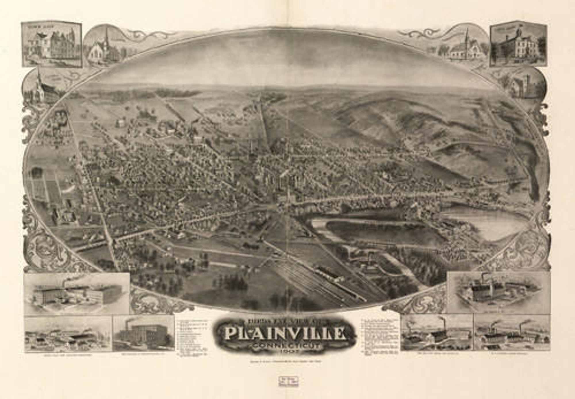
Historic Map - Plainville, CT - 1878
Description
Plainville, Connecticut 1878. Drawn & pub. by Messrs. O. H. Bailey & J. C. Hazen. C. H. Vogt.
An aero-view print reproduction of Plainville, CT, drawn and published by O. H. Bailey & J. C. Hazen in 1878. Named for its flat terrain, Plainville officially separated from the town of Farmington, where it had been known as the "Great Plain" and became a town in 1869, only nine years before the publication of this map. Due to its shallow soil, it had not been strongly selected as farm land by early settlers.
The construction of the Farmington Canal during the 1820s resulted in the establishment of a station called Bristol Basin, located just south of Main Street. Bristol Basin became a busy mercantile center and led to the establishment of Plainville as a town. While a great achievement, the Farmington Canal did not fare well, with porous and sandy soil, and harsh winter weather causing frequent closures. To keep the canal open while waiting for the east-west railroad to be completed, a track was built along the tow-path of the canal, completed in January 1848. A disastrous washout left the Bristol Basin empty, and it was never refilled. The Hartford, Providence and Fishkill Railroad, running east and west through Plainville was completed in 1852, which had also been included in the New York and New England Railroads routes.
The Plainville Manufacturing Company is featured in an inset illustration on the map. The company was founded in 1850 and was a major employer in Plainville, manufacturing a wide variety of knit underwear.
Complete reference list below.
Features numbered & lettered references to the following locations:
- Plainville Manufacturing Co.
- Episcopal Church
- Congregational Church
- Baptist Church
- Newtons Hall
- Morgan Hall
- Good Templers Hall
Materials
Archive Paper

Premium fine art paper that provides accurate color reproduction with high-contrast, high-resolution print output and maximum image permanence. A high-quality print ready for framing.
More
- Museum quality paper for high-quality fine art.
- Ultra smooth, neutral white matte finish.
- Heavy-weight 230 gsm, 9.5 mil thickness.
- Printed with pigment inks for longer print life and enhanced fade resistance.
- Pigment based Canon LUCIA inks provide smooth tones and rich colors in fine, precise detail.

Made In The USA

School Purchase Orders


