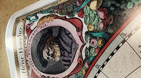
Auburn, Cal. / C.P. Cook., del. ; presented with the compliments of W.B. Lardner, real estate agent, att'y-at-law & notary public. The city of Auburn was founded in 1849, and by 1850 the town had grown to 1,500 people - mainly due to the California Gold Rush. This beautiful map provides a look back to the early beginnings of the city, and includes insets of the towns early structures. Complete reference list below.
The following booster statement was included on the map: Auburn, Placer County, Cal.
The county seat of Placer County, Cal., is situated in the foot-hill portion at an elevation of 1,360 feet, and is on the main overland route, the C.P.R.R., 36 miles from Sacramento, the Capital, and 126 miles from San Francisco. Auburn was settled in 1849, and has long been noted for its beauties of scenery and as a health resort. The doctors throughout the State recommend its climate for those troubled with asthma and pulmonary troubles. Its elevation and fresh resinous air make it peculiarly grateful to such. School facilities consist of public schools and the Sierra Normal College.
Churches are Congregational, Catholic, Methodist, and a Protestant Episcopal Mission. There are large hotels which entertain in first-class manner the local traveling and health-seeking public. Stages run daily to Placerville and Georgetown in El Dorado County, and Forest Hill and other towns in Placer County. It is a large freight shipping station to the neighboring mountain towns. The Wild rushing American River, in its canon 1,000 feet deep, is piped spring water to the lower part of town, but there will be finished in January, 1888, a most perfect system of water works for the town and surrounding hills. 3,800 feet of 13 inch pipe will carry Bear River ditch water to a hill having two reservoirs of 2,000,000 gallons capacity each, 345 feet above the Post Office ; thence a 13 inch pipe 3,600 feet to depot, with fall of 140 feet, thence in a 6 inch pipe 5,200 feet to lowest part of town, with 220 feet fall, or a total of 360 feet from reservoirs. This assures abundance of water for house, irrigation, fire, sewer and manufacturing purposes. All kinds of fruits and berries flourish here, deciduous as well as citrus. A few banana and rubber trees are growing in yards. It is the natural home of the orange, olive and vine. The Auburn Orange Growers' Association has 16 acres of growing orange trees, also a few lemons, in their grove near Auburn, which is the second larges in Northern California. An olive oil mill will be erected this season. The College Tract is a choice, centrallly located piece of rolling ground, subdivided into building lots. Streets and alleys are being graded, and water pipes will soon be laid to each lot. The population of Auburn is 2,000 and growing fast. In 1887 there were established new business houses as follows: A Second Bank, 2 Dry Goods Stores, 1 Grocery Store, 1 Drug Store, 1 Variety and News Depot, besides numerous residences; and 6 new Real Estate Agents have begun business in addition to the one office of 1886. A modern poet could truthfully sing - "Sweet Auburn ! loveliest village of the plain, Where health and plenty cheer the laboring swain, Where smiling spring its earliest visit paid, And parting summer's lingering blooms delayed."
Placer County, California.
Placer County in area is larger than the State of Rhode Island. It extends from near the Sacramento River on the west in a north-east direction to the State of Nevada and Lake Tahoe, about 160 miles. The width varies from 10 to 30 miles. The adjoining counties in the north are Yuba and Nevada ; on the south El Dorado and Sacramento ; on the west Sutter. In altitude above the ocean it reaches from 100 feet in the western and agricultural portion to the Sierra Nevada mountains, many of whose peaks are 10, 000 feet high. The elevations of the towns on the railroad are indicated on the map. For convenience it may be described in three sections, mountain, foot-hill and valley. In the mountains limbering and mining are the chief industries. Fruits of all kinds flourish in the middle or foothill portion, the western portion being in the famed Sacramento Valley. Health resorts are numerous. Miles of R.R., 117. Transportation facilities being from 12 to 36 hours nearer Chicago market than any other County in the State. The chief industries are lumbering, quarts and drift mining, fruit raising, granite cutting, pottery and terra cotta works, stock raising and general farming.
In 1886 Placer County received first prize for County exhibit at State Fair, and first prize at Sacramento Citrus Fair. The county ranks third in the State for the number of growing orange trees. Placer County has has no bonded. Taxes are low. Annual rainfall at elevation of Auburn is 30 inches, increasing further up the mountains. Irrigation system, with 500 miles of main and lateral ditches, water supply abundant. Value of raw land, from $10 to $100 per acre, according to location.
Its soil embraces timber, mining, orange, olive, grape, ordinary fruit and valley lands, and is granite and red slate in character. From Colfax to south-western portion may be considered in the thermal belt, most of which is suitable fro raising oranges, olives, and the raisin grape. Higher in the mountains the pear and apple reach perfection.
The lowest temperature in Riverside, Southern Cal., last year was 21 above zero. The lowest for Auburn and vicinity was 26. The temperature for the month of January, 1887, at Colfax, Placer Co. with an elevation of 2,422 feet averaged 36 degrees ; Riverside, five degrees of latitude further south -- over 360 miles -- averaged fro the same month 35.9 degrees. November 19th, 1887, a banana plant was in full bloom near Newcastle. Some of the best drift and quartz mines in the State are worked on the Forest Hill divide. For nearness to markets, both local and eastern, varied industries, temperate climate and beautiful scenery, cheap and productive soil with abundance of water, the future possibilities of Placer County are not surpassed in the whole State.
Features numbered references to the following locations:
1. Reservoir 2. Birdsall and Hamilton's Villa Sites. 3. Auburn House. 4. Borland Hotel. 5. C.P.R.R. Depot. 6. Arlington Hotel. 7. Sierra Nevada Mts. 8. Putnam House. 9. Congregational Ch. 10. Catholic Church. 11. Public School. 12. Methodist Church. 13. Sierra Normal Coll. 14. County Hospital. 15. Court House & Jail. 16. Orleans Hotel. 17. American Hotel. 18. Bear River Ditch. 19. Agard's Olive Orch'd.
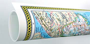
We use top-notch materials printed on demand using the Giclée printing method, so you get amazing detail and bright colors every time.
Archival Paper
Premium fine art paper that provides accurate color reproduction with high-contrast, high-resolution print output and maximum image permanence. A high-quality Giclée print ready for framing.
Museum quality paper for high-quality fine art.
Ultra smooth, neutral white matte finish.
Heavy-weight 230 gsm, 9.5 mil thickness.
Printed with pigment inks for longer print life and enhanced fade resistance.
Pigment based Canon LUCIA inks provide smooth tones and rich colors in fine, precise detail.
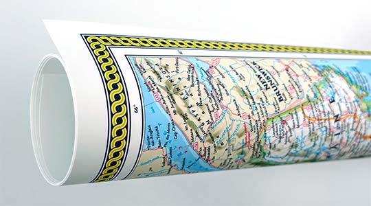
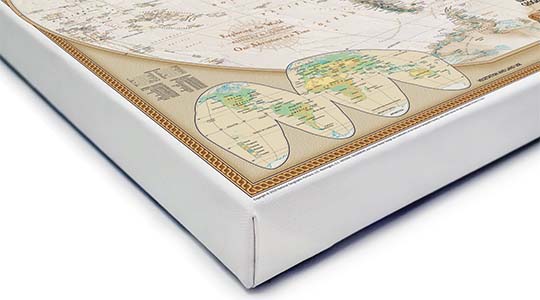
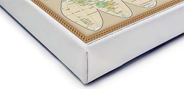
Canvas Gallery Wrap
A high quality canvas giclee print is hand stretched over a sturdy wood frame. Printed on demand and handcrafted in Seattle, WA. The canvas gallery wrap serves as a stunning piece of art ready to hang on your wall.
Premium 19 mil canvas material.
Pigment based Canon LUCIA inks provide smooth tones and rich colors in fine, precise detail.
High quality giclee fine art print with a lightfastness rating of over 100 years.
Durable canvas mounted to a 1.25" deep wood frame.
Ready to hang with included easy-to-use hanging kit.
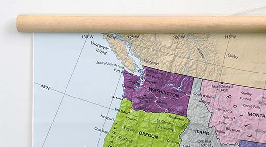
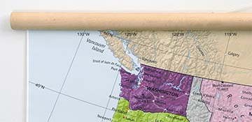
Canvas on Wood Rails
A canvas giclee print that is mounted to wood hanging rails placed along the top and bottom of the map. Rail mounted maps are ready to hang via the attached hanging cord. Solid wood rails have a natural finish.
Premium 19 mil canvas material.
Wood rails are 1 1/8" wide, round front.
USA sourced solid maple wood.
High quality giclee fine art print with a lightfastness rating of over 100 years.
Pigment based Canon LUCIA inks provide smooth tones and rich colors in fine, precise detail.
Luster Photo Paper
A premium semi-gloss photo paper with a subtle texture that produces a vivid, richly detailed print. This material results in an exquisitely detailed giclee print of substantially higher quality than a standard poster.
Printed on 10 mil premium luster photo paper resulting in a brilliant, colorful image with a vivid life-like quality.
Pigment based Canon LUCIA inks provide smooth tones and rich colors in fine, precise detail.
Inks have a lightfastness rating of over 100 years, guaranteeing minimal noticeable fading over a very long period of time.
Printed using very high resolution source files.
Giclee printing is superior to traditional lithography in a number of ways: colors are brighter, lasts longer, and is a higher resolution.
Framed Print
Our gallery quality frames are made of solid wood and feature optical-grade acrylic. Each framed map is printed on premium archival matte fine art paper.
Printed on thick, luxurious acid-free fine art paper & dry-mounted to foam board.
Pigment inks ensure a vivid print with amazing colors and excellent fade resistance.
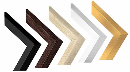
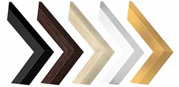
Solid wood frame in 5 finishes has a 7/8" face & 1.25" depth.
Kraft paper protective backing & hanging wire installed.
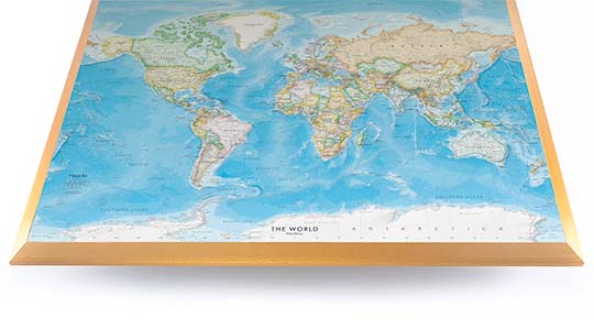
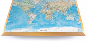
Plaque Mount
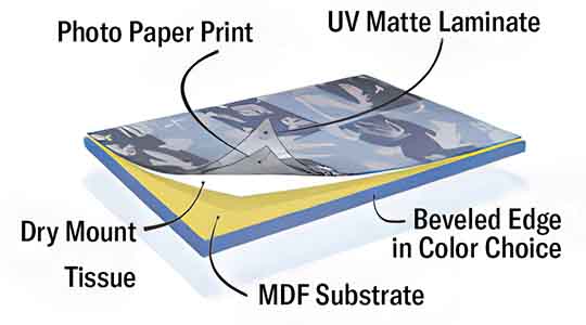
A museum grade display featuring high-resolution printing on premium photo paper, mounted on a durable wood plaque with a protective matte laminate. Surface can be cleaned with glass cleaner.
A premium photo print is dry-mounted to onto wood substrate (MDF).
Features a highly durable laminated surface that is scratch-resistant, water-resistant and fade-resistant.
Lamination is a non-glare matte finsh that can be wiped clean with a damp cloth or glass cleaner.
Mounted to 3/8" thick MDF wood panel with a 3/8" wide beveled edge available in premium foil color options.
Keyhole slot with velvet feet on the corners for easy wall mounting. Hanging hardware included.
Plaque Mounting Process
Gallery quality map prints made in the USA
We specialize in producing high-quality, detailed maps using advanced printing technologies and premium materials. Stringent quality control and ultra-high-resolution printing guarantee absolute clarity and precise detail at any size. Whether it's a smaller wall map print or a gigantic wallpaper map mural, no print will appear blurry or pixelated. You can expect every detail on the map to be sharp and clear.
Finely Crafted Cartographic Works of Art
Many of the maps we provide are created by our small team of cartographers under the name Academia Maps.
Museum Quality Materials
We source the best materials for our map prints and wallpaper maps. Premium archival inks guarantee rich vibrant colors with excellent fade resistance.
USA Print Production
We are a small business located in Seattle, WA that has been printing maps for over 15 years. Each map is printed on-demand using high-end fine art printers.
Shipping Costs
Free Ground Shipping within the contiguous United States and a flat rate of $20.00 to AK and HI.
Canada via UPS Standard is $40.00 USD.
Worldwide Shipping is available and shipping costs will be calculated at checkout.
Shipping Times
Most items are made to order and ship from our Seattle, WA facility. Typical production lead times are listed below. Shipping transit time is 2-5 business days depending on the delivery location. If you need your map by a certain deadline please contact us for expedited options.
Archival Paper, Laminated Maps, and Peel & Stick - 5-7 business days
Wood Rail Mounting - 3-4 weeks
Canvas Gallery Wraps & Framed Maps - 3-5 business days
Push Pin Maps - 3-5 business days
Spring Roller Maps - Varies, see product description
Wallpaper Map Murals - 7-10 business days
Returns
If you are unhappy with your order for any reason you can return it within 30 days of the delivery date. Customized items are non-returnable.
Yes, we can produce a majority of the map titles found on our website in a custom size. If you would like to request a custom size, take note of the map title and item#, then follow one of the links below to make your request. We will follow up with a link to checkout.
(for rolled or mounted prints)
(for larger peel & stick / wallpaper maps)
All of our maps are currently labeled as "Gulf of Mexico". Since our map products are printed to order, we can offer the alternate "Gulf of America" labeling by request.
If you would like your map to be labeled Gulf of America instead of Gulf of Mexico, simply request this in the comments section at checkout, and we will update the map.
We accept purchase orders from schools and government entities. You can e-mail a copy of your PO to [email protected].
View more information and download our W-9.
No problem, send a screenshot or PDF of your shopping cart to [email protected] and will promptly follow up with a quotation.
Our products are printed on demand and have the following production lead times:
Archival Paper, Laminated Maps, and Peel & Stick - 5-7 business days
Wood Rail Mounting - 3-4 weeks
Canvas Gallery Wraps & Framed Maps - 3-5 business days
Spring Roller Maps - Varies, see product description
Shipping transit time is 2-5 business days and will vary depending on your location. Most products ship from Seattle, WA.
Many of the maps found on our website can be customized, including adding a personalized title/legend or company logo, modifying the color scheme, change text labels, adding points of interest, and placing GIS data on the map.
If the order is shipping outside of Washington state, sales tax may not apply. We collect sales taxes per state and local laws. Sales tax is calculated at checkout based on the delivery address.
We can ship to nearly any country. The shipping cost is determined for Canada and most European countries at checkout. If you find that shipping is unavailable to your country when checking out then please contact us with a list of the products you would like to order as well as size and material options.
We can produce a custom map for any location in the world. Whether you are looking for a detailed city street map or high resolution satellite imagery of a remote area, we have you covered.
Because maps aren't just décor—they're personal stories, travel memories, and future adventures waiting to happen. SHOP BESTSELLING MAPS
🎁 Meaningful: Track travels, spark memories, plan new experiences.
🎄 Perfect for gifts: Unique, educational, and visually stunning.
🏠 Fits any home décor: Modern, vintage, minimalist & artistic styles available.
✏️ Personalizable: Add names, family titles, travel quotes (push-pin maps).
✈️ Great for travelers, students, families, teachers & offices.
Wall Maps Material Info
We use museum grade papers and canvas along with high quality solid wood mounting options.
Made in the USA
Archival Paper
Premium Giclée fine art print on thick acid-free paper with a matte finish. Features rich, vibrant colors with precise detail.
Luster Photo Paper
Giclée fine art print on semi-gloss photo paper. A richly detailed print with vivid colors.
Canvas on Wood Rails
High-quality giclée print on artist-grade canvas mounted to natural finish solid wood hanging rails placed along the top and bottom of the canvas. Hanging cord at top.
Canvas Gallery Wrap
High-quality giclée print on artist-grade canvas. Wrapped around a sturdy wooden frame, this print is perfect for adding depth and texture to any space.
Framed Map Print
Printed on high-grade fine art paper and mounted in a solid wood frame available in 5 finishes. The print is protected behind optical-grade clear acrylic.
Plaque Mount
A high resolution photo print dry-mounted to wood and sealed with a durable matte laminate. A sleek frameless look with a beveled edge that is available in multiple color finishes.
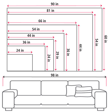
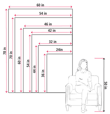
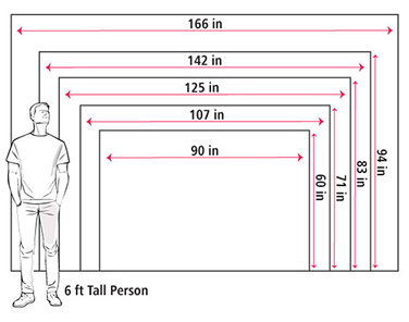
Size Guide
These mockups are to be used as a general visual aid to assist you in choosing a size. The measurements may not reflect the exact sizes of the product you are viewing. It is always best practice to measure your wall space prior to ordering.
Our wall maps and wallpaper map murals are handcrafted by our small team in Seattle, WA.
School Purchase Orders
We accept purchase orders from schools and other government institutions. Learn more here.
High Quality Materials
Maps are printed on premium fine art papers, canvas, and durable wallcovering materials using archival inks.
Stunning Cartography
Original and up-to-date maps designed by our cartographic team at Academia Maps include a range of high quality maps for geographic exploration, home decor, and classroom learning.