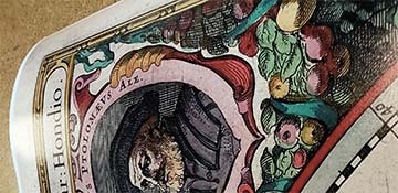
Sacramento. The city of Sacramento was founded in 1848 on the Pacific coast, and quickly grew due to the California Gold Rush. It was incorporated into a city in 1850, and later became the state's capital in 1854. This beautiful map provides a look back to the early beginnings of the city, and includes insets of the towns early structures. Complete reference list below.
The following booster statement was included on the map:
Sacramento, Cal. ___________
SACRAMENTO, the capital city of California, is situated at the confluence of the American and Sacramento rivers, ninety miles easterly from San Francisco, eighteen miles westerly from the lower foothills of the Sierra range, and nearly in the center of the State; and for a political seat could not be better located. The city has a population of 80,000. Its municipal area is in excess of four square miles. Fully two-thirds if this is compactly built. Its streets are broad, heavily shaded, and afford admirable drives. In its homes, Sacramentans take pardonable pride, since, for beauty of surrounding, floral wealth and choice foliage, their equals are few.
The city is admirably related by railroads to the trade and transportation interests if the coast. The California and Oregon Railroad leads hence to and through Oregon, the Central Pacific east to the transmontane regions, the California Pacific on the west side of the Sacramento river connects the city with San Francisco and its upper suburban towns and cities; the Western Pacific connects it with the San Joaquin valley, the Southern Pacific leading to the Gulf of Mexico, and by continuation from Lathrop makes a second connection with San Francisco, and by branch lines with the Santa Clara valley. The Sacramento Valley and Placerville line leads from the capital city to the El Dorado Sierras. Feeder to the great Central lines connect Sacramento with the leading counties of the State; both coast and interior. By navigation of the Sacramento river, the city has trade relations with the entire tier if river counties.
Sacramento is liberally endowed with churches. They represent nearly all denominations, and the church edifices are nearly all fine, and some are very imposing structures. There is maintained the best equipped school system, supplemented by several private educational institutions. One of these, the Sacramento School of Design, occupies the E. B. Crocker Art Gallery, a superb building presented to the city by Mrs. E. B. Crocker, and valued, with its collection of oil paintings, at about six hundred and fifty thousand dollars. The State capitol, situated in the heart of the city, is a classical structure, erected at a cost of upwards of three millions of dollars. The Catholic Cathedral, Agricultural Pavilion, Odd Fellows' Temple, Sacramento and Capital Grammar Schools, Courthouse and Hall of Records are among the notably large and fine structures. The Railroad Hospital, High School, Masonic Hall, Free Library, chief hotels, State Printing Office, Old Ladies Home, and several business structures are buildings that attract attention and are a source of local pride, The Central Pacific Railroads shops in this city are the largest mechanical works upon the coast, and give employment to two thousand skilled and unskilled workmen. There are many factors in the industry of the city.
The jobbing trade of Sacramento aggregates about sixty million dollars annually, and extends throughout all the Central and northern and mountain sections, and the adjacent States and Territories. Sacramento is the chief fruit shipping station of the State, sending forward in season far more fruit that any other point, and generally as much as most others combined. Its rail and river transportation facilities, nearness to the mountain range, contiguity to the great foothill region, centrality of location, and climatic desirability, all conspire to make it the most prominent fruit forwarding post of the State.
The county of Sacramento is largely devoted to fruit-raising and for grapes, berries and general fruits, its soil is not second - and in many respects first - in comparison with all other sections. Its river bottom lands are unquestionably the riches of the coast, making Sacramento pre-eminently the chief hop-raising territory of the United States. The largest hop-yard in the world is in this county, as also the second largest vineyard in the world. Of wheat, barley and alfalfa, the county yields abundantly and of the first quality. The business and property interests maintain a vigilant Board of Trade, an Improvement Association and an Immigration Society, all actively engaged in promoting local interests. Irrigation has not been needed in the county, nor employed, save in berry farms and gardens through agencies that lift water form bored wells, it being found in quantity and purity in a gravel strata underlying most of the county area.
The new comer will find a climate genial and bracing, free from enervating quality, and oranges and lemons ripening in the air will convince the most skeptical of the practicableness of raising them for market in this section. Semi-tropic plants flourish luxuriantly in all the Sacramento region, the palm, olive, date, lime, almond, orange and lemon finding the climate admirably adapted to their growth. In all deciduous fruits the Sacramento region holds the palm, peaches, pears, apples, apricots and all small fruits of the finest quality, are here grown in vast abundance. The raisins made in Sacramento county, being grown without irrigation, are sweeter and thinner skinned that the more famous Fresno brands. The fines pickled olives exhibited last year were grown at Florin, Sacramento county. The Sacramento section is emphatically agricultural; all cereal fruits, grasses and vegetables being raised with unparalleled success and of unsurpassed quality. The climate is semi-tropical. The heat of summer, owing to the dryness of the atmosphere, is not oppressive, and winter, as generally understood is unknown - as an evidence of which December and January ripens the orange, and February is the month of flowers especially, while vegetables are grown the year round, and berries are in market up to December 1st, and even later. Snow and ice and freezing temperatures are not factors in the climate. The health of Sacramento city is of high character, and she stands second as the healthiest city in the land. No other county has such varied resources that are more easily or profitably developed. The outlook for the city and its suburban country appears to be the brightest. Free from the speculative craze; values not suffering by inflation or decadence; immigration steadily coming in of the most desirable character; local capital being abundant, trade expanding, and the adornment pf the city and its suburbs constantly being made; manufacturers increasing, transportation facilities augmenting; society orderly, stable and of high moral tone, Sacramento presents herself as one of the most desirable and inviting localities of the Pacific coast. Features numbered references to the following locations:
1. S. P. Co.'s R.R. Shops. 2. S. P. Depot. 3. City Hall Water Works 4. S. P. Co.'s Foundry. 5. S. P. Co.'s Hospital. 6. Electric Light Works. 7. Hall of Records. 8. County Court House. 9. City Free Library. 10. Episcopal Church 11. Congregational Church. 12. Pioneer's Church. 13. Golden Eagle Hotel. 14. Capitol Hotel. 15. Masonic Temple. 16. 6th St. M. E. Church. 17. Presbyterian Church. 18. Armory Hall. 19. Metropolitan Theatre. 20. Record-Union Office. 21. Western Hotel. 22. Crocker Art Gallery. 23. Capital Grammar School. 24. High School. 25. First Baptist Church. 26. Clunie Opera House. 27. Odd Fellows Temple. 28. Turner Hall. 29. Catholic Cathedral. 30. German Lutheran Church. 31. City Plaza. 32. State Capitol. 33. State Exposition Building. 34. State Printing Office. 35. Grammar School 36. Sutter's Old Fort. 37. "Nob Hill" 38. Town of Enterprise. 39. City Cemetery. 40. "Nama Colony" A. Street Railways. B. Electric Railway.
We use top-notch materials printed on demand using the Giclée printing method, so you get amazing detail and bright colors every time.
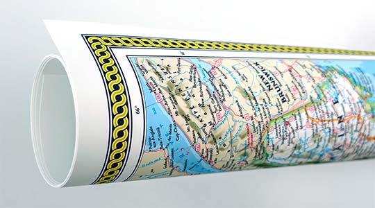
Archival Paper
Premium fine art paper that provides accurate color reproduction with high-contrast, high-resolution print output and maximum image permanence. A high-quality Giclée print ready for framing.
Museum quality paper for high-quality fine art.
Ultra smooth, neutral white matte finish.
Heavy-weight 230 gsm, 9.5 mil thickness.
Printed with pigment inks for longer print life and enhanced fade resistance.
Pigment based Canon LUCIA inks provide smooth tones and rich colors in fine, precise detail.
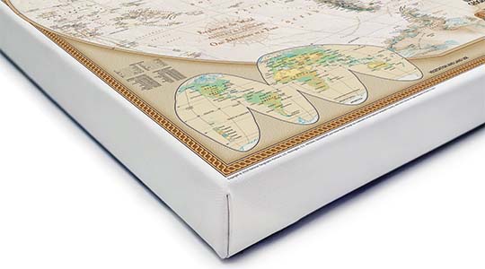
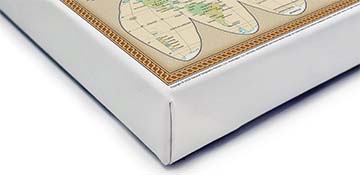
Canvas Gallery Wrap
A high quality canvas giclee print is hand stretched over a sturdy wood frame. Printed on demand and handcrafted in Seattle, WA. The canvas gallery wrap serves as a stunning piece of art ready to hang on your wall.
Premium 19 mil canvas material.
Pigment based Canon LUCIA inks provide smooth tones and rich colors in fine, precise detail.
High quality giclee fine art print with a lightfastness rating of over 100 years.
Durable canvas mounted to a 1.25" deep wood frame.
Ready to hang with included easy-to-use hanging kit.
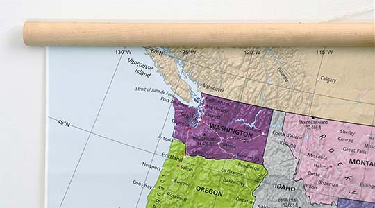
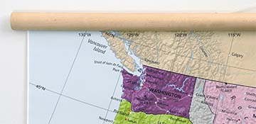
Canvas on Wood Rails
A canvas giclee print that is mounted to wood hanging rails placed along the top and bottom of the map. Rail mounted maps are ready to hang via the attached hanging cord. Solid wood rails have a natural finish.
Premium 19 mil canvas material.
Wood rails are 1 1/8" wide, round front.
USA sourced solid maple wood.
High quality giclee fine art print with a lightfastness rating of over 100 years.
Pigment based Canon LUCIA inks provide smooth tones and rich colors in fine, precise detail.
Luster Photo Paper
A premium semi-gloss photo paper with a subtle texture that produces a vivid, richly detailed print. This material results in an exquisitely detailed giclee print of substantially higher quality than a standard poster.
Printed on 10 mil premium luster photo paper resulting in a brilliant, colorful image with a vivid life-like quality.
Pigment based Canon LUCIA inks provide smooth tones and rich colors in fine, precise detail.
Inks have a lightfastness rating of over 100 years, guaranteeing minimal noticeable fading over a very long period of time.
Printed using very high resolution source files.
Giclee printing is superior to traditional lithography in a number of ways: colors are brighter, lasts longer, and is a higher resolution.
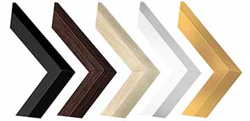
Framed Print
Our gallery quality frames are made of solid wood and feature optical-grade acrylic. Each framed map is printed on premium archival matte fine art paper.
Printed on thick, luxurious acid-free fine art paper & dry-mounted to foam board.
Pigment inks ensure a vivid print with amazing colors and excellent fade resistance.
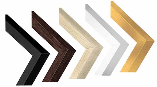
Solid wood frame in 5 finishes has a 7/8" face & 1.25" depth.
Kraft paper protective backing & hanging wire installed.
Plaque Mount
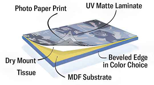
A museum grade display featuring high-resolution printing on premium photo paper, mounted on a durable wood plaque with a protective matte laminate. Surface can be cleaned with glass cleaner.
A premium photo print is dry-mounted to onto wood substrate (MDF).
Features a highly durable laminated surface that is scratch-resistant, water-resistant and fade-resistant.
Lamination is a non-glare matte finsh that can be wiped clean with a damp cloth or glass cleaner.
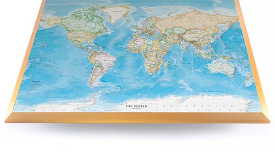
Mounted to 3/8" thick MDF wood panel with a 3/8" wide beveled edge available in premium foil color options.
Keyhole slot with velvet feet on the corners for easy wall mounting. Hanging hardware included.
Plaque Mounting Process
Gallery quality map prints made in the USA
We specialize in producing high-quality, detailed maps using advanced printing technologies and premium materials. Stringent quality control and ultra-high-resolution printing guarantee absolute clarity and precise detail at any size. Whether it's a smaller wall map print or a gigantic wallpaper map mural, no print will appear blurry or pixelated. You can expect every detail on the map to be sharp and clear.
Finely Crafted Cartographic Works of Art
Many of the maps we provide are created by our small team of cartographers under the name Academia Maps.
Museum Quality Materials
We source the best materials for our map prints and wallpaper maps. Premium archival inks guarantee rich vibrant colors with excellent fade resistance.
USA Print Production
We are a small business located in Seattle, WA that has been printing maps for over 15 years. Each map is printed on-demand using high-end fine art printers.
Shipping Costs
Free Ground Shipping within the contiguous United States and a flat rate of $20.00 to AK and HI.
Canada via UPS Standard is $40.00 USD.
Worldwide Shipping is available and shipping costs will be calculated at checkout.
Shipping Times
Most items are made to order and ship from our Seattle, WA facility. Typical production lead times are listed below. Shipping transit time is 2-5 business days depending on the delivery location. If you need your map by a certain deadline please contact us for expedited options.
Archival Paper, Laminated Maps, and Peel & Stick - 5-7 business days
Wood Rail Mounting - 3-4 weeks
Canvas Gallery Wraps & Framed Maps - 3-5 business days
Push Pin Maps - 3-5 business days
Spring Roller Maps - Varies, see product description
Wallpaper Map Murals - 7-10 business days
Returns
If you are unhappy with your order for any reason you can return it within 30 days of the delivery date. Customized items are non-returnable.
Yes, we can produce a majority of the map titles found on our website in a custom size. If you would like to request a custom size, take note of the map title and item#, then follow one of the links below to make your request. We will follow up with a link to checkout.
(for rolled or mounted prints)
(for larger peel & stick / wallpaper maps)
All of our maps are currently labeled as "Gulf of Mexico". Since our map products are printed to order, we can offer the alternate "Gulf of America" labeling by request.
If you would like your map to be labeled Gulf of America instead of Gulf of Mexico, simply request this in the comments section at checkout, and we will update the map.
We accept purchase orders from schools and government entities. You can e-mail a copy of your PO to [email protected].
View more information and download our W-9.
No problem, send a screenshot or PDF of your shopping cart to [email protected] and will promptly follow up with a quotation.
Our products are printed on demand and have the following production lead times:
Archival Paper, Laminated Maps, and Peel & Stick - 5-7 business days
Wood Rail Mounting - 3-4 weeks
Canvas Gallery Wraps & Framed Maps - 3-5 business days
Spring Roller Maps - Varies, see product description
Shipping transit time is 2-5 business days and will vary depending on your location. Most products ship from Seattle, WA.
Many of the maps found on our website can be customized, including adding a personalized title/legend or company logo, modifying the color scheme, change text labels, adding points of interest, and placing GIS data on the map.
If the order is shipping outside of Washington state, sales tax may not apply. We collect sales taxes per state and local laws. Sales tax is calculated at checkout based on the delivery address.
We can ship to nearly any country. The shipping cost is determined for Canada and most European countries at checkout. If you find that shipping is unavailable to your country when checking out then please contact us with a list of the products you would like to order as well as size and material options.
We can produce a custom map for any location in the world. Whether you are looking for a detailed city street map or high resolution satellite imagery of a remote area, we have you covered.
Because maps aren't just décor—they're personal stories, travel memories, and future adventures waiting to happen. SHOP BESTSELLING MAPS
🎁 Meaningful: Track travels, spark memories, plan new experiences.
🎄 Perfect for gifts: Unique, educational, and visually stunning.
🏠 Fits any home décor: Modern, vintage, minimalist & artistic styles available.
✏️ Personalizable: Add names, family titles, travel quotes (push-pin maps).
✈️ Great for travelers, students, families, teachers & offices.
Wall Maps Material Info
We use museum grade papers and canvas along with high quality solid wood mounting options.
Made in the USA
Archival Paper
Premium Giclée fine art print on thick acid-free paper with a matte finish. Features rich, vibrant colors with precise detail.
Luster Photo Paper
Giclée fine art print on semi-gloss photo paper. A richly detailed print with vivid colors.
Canvas on Wood Rails
High-quality giclée print on artist-grade canvas mounted to natural finish solid wood hanging rails placed along the top and bottom of the canvas. Hanging cord at top.
Canvas Gallery Wrap
High-quality giclée print on artist-grade canvas. Wrapped around a sturdy wooden frame, this print is perfect for adding depth and texture to any space.
Framed Map Print
Printed on high-grade fine art paper and mounted in a solid wood frame available in 5 finishes. The print is protected behind optical-grade clear acrylic.
Plaque Mount
A high resolution photo print dry-mounted to wood and sealed with a durable matte laminate. A sleek frameless look with a beveled edge that is available in multiple color finishes.
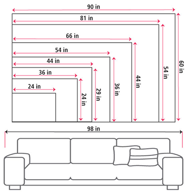
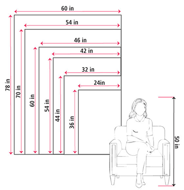
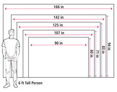
Size Guide
These mockups are to be used as a general visual aid to assist you in choosing a size. The measurements may not reflect the exact sizes of the product you are viewing. It is always best practice to measure your wall space prior to ordering.
Our wall maps and wallpaper map murals are handcrafted by our small team in Seattle, WA.
School Purchase Orders
We accept purchase orders from schools and other government institutions. Learn more here.
High Quality Materials
Maps are printed on premium fine art papers, canvas, and durable wallcovering materials using archival inks.
Stunning Cartography
Original and up-to-date maps designed by our cartographic team at Academia Maps include a range of high quality maps for geographic exploration, home decor, and classroom learning.