

Pennsylvania Political/Physical Map from Compart
Starting at $46.00


This vibrantly colored wall map of Pennsylvania features state county boundaries clearly illustrated using shaded outlines in contrasting colors. A wide array of information is presented in a clear and concise manner using attractive easy-to-read fonts with various features on the map clearly differentiated.
A comprehensive city and county index makes it easy to locate major cities on the map. A great reference map for use in the home, a business, or teaching Pennsylvania state geography.
Key Features:
This Pennsylvania state wall map is laminated and can be marked on with a dry or wet erase marker. Choose from three sizes in a variety of mounting options including: non-laminated print, laminated print, repositionable peel and stick fabric print, or wooden rail mounting.
Premium fine art paper that provides accurate color reproduction with high-contrast, high-resolution print output and maximum image permanence. A high-quality print ready for framing.
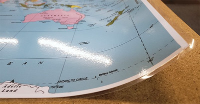
A fully laminated paper print. Durable and ready to hang on the wall using push-pins, double sided tape, or poster hanging rails. A great inexpensive map option that features a wet or dry-erase markable surface.
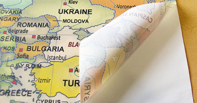
A versatile peel & stick fabric material with repositionable self-adhesive backing. A polyester canvas material that can be used multiple times without damaging walls or leaving a residue.
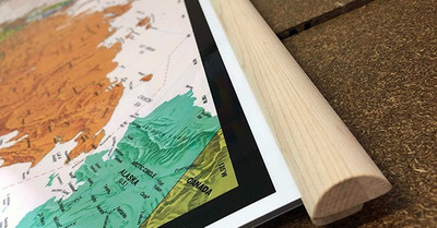
A laminated paper print is mounted to wooden hanging rails placed along the top and bottom of the map. Ready to hang on the wall using the attached hanging cord. Wood rails feature a natural finish.
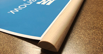
A canvas giclee print is mounted to wooden hanging rails placed along the top and bottom of the map. Ready to hang on the wall using the attached hanging cord. Wood rails feature a natural finish.
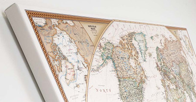
A high quality canvas giclee print is hand stretched over a sturdy wood frame. Printed on demand and handcrafted in Seattle, WA. The canvas gallery wrap serves as a stunning piece of art ready to hang on your wall.


