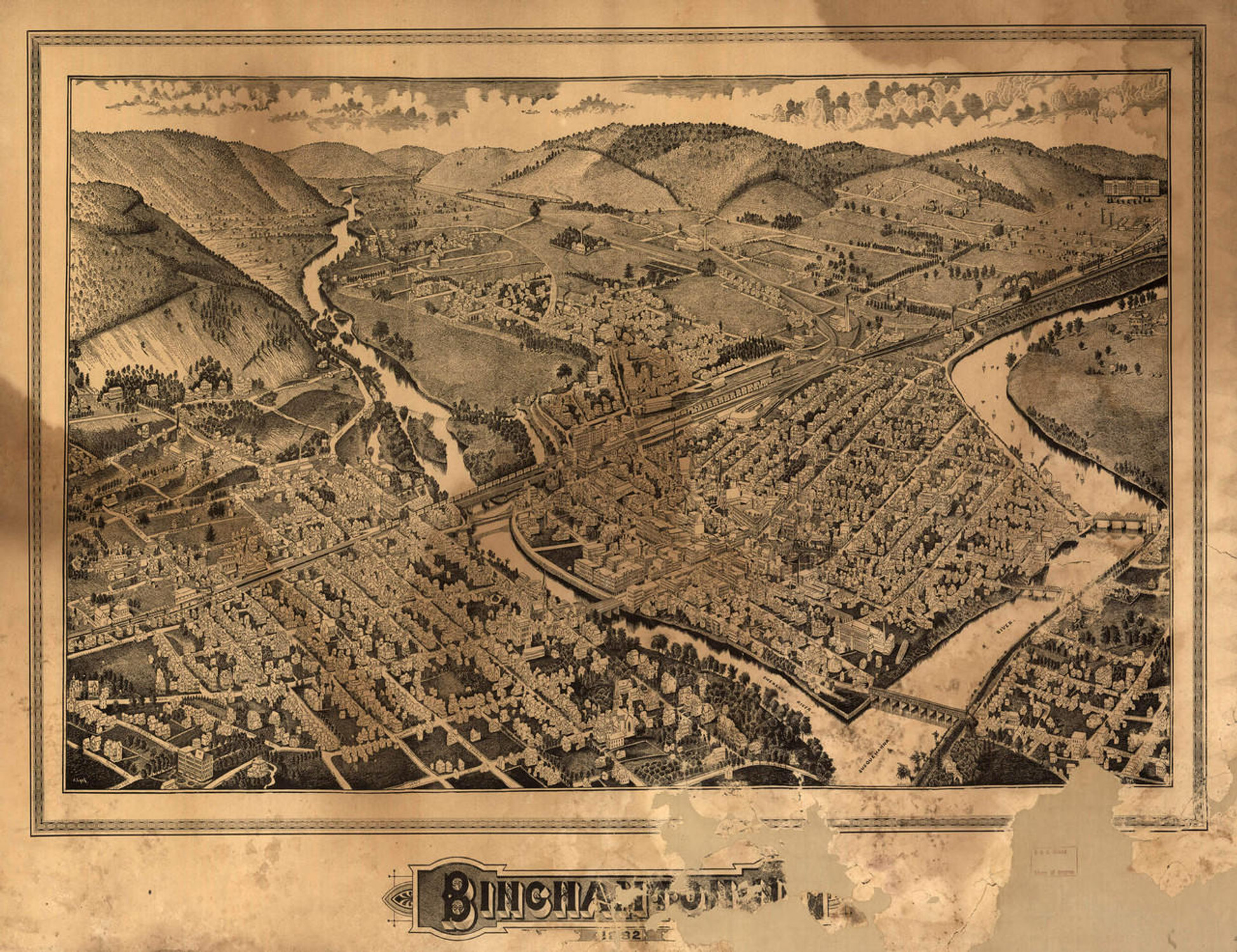
Historic Map - Schenectady, NY - 1882
Description
Schenectady, N.Y. / Burleigh del. ; Lyth sc.
This reproduction bird's-eye view map of Schenectady, New York was published in 1882 by Lucien R. Burleigh. Schenectady, county seat for Schenectady County, is located near the confluence of the Mohawk and Hudson Rivers. European settlement began here in 1661 as part of the Dutch colony New Netherland. Land was purchased from the Mohawk Nation and the first settlement was led by Arent van Curler, from Nijkerk in the Netherlands. The Dutch established Fort Orange, which was located where Albany is now. The Stockade area of Schenectady was established as a walled fur-trading and industrial center. During the American Revolution the Stockade was used to supply troops with provisions and arms. George Washington made several visits to Schenectady during this era. Wharves and warehouses were constructed along the Binne Kill to accommodate the many cargo vessels using the Mohawk River. Being along the main route used to settle the mid-west, Schenectady was referred to as "Gateway to the West".
After a devastating fire in 1819 burned much of the commercial area along Washington Avenue, and with the 1825 opening of the nearby Erie Canal, the business district of Schenectady was relocated one-half mile east, so as to be closer to the canal. The Mohawk and Hudson Railroad began serving the area in 1831. Union College, which had been established here in 1795, erected the popular 16-sided Nott Memorial on their beautiful grounds in 1875. The map portrays Schenectady five years before Thomas Edison brought his Edison Machine Works to town.
This aero-view map from 1882 shows buildings, clearly labeled streets and railroad route.
Materials
Archive Paper

Premium fine art paper that provides accurate color reproduction with high-contrast, high-resolution print output and maximum image permanence. A high-quality print ready for framing.
More
- Museum quality paper for high-quality fine art.
- Ultra smooth, neutral white matte finish.
- Heavy-weight 230 gsm, 9.5 mil thickness.
- Printed with pigment inks for longer print life and enhanced fade resistance.
- Pigment based Canon LUCIA inks provide smooth tones and rich colors in fine, precise detail.

Made In The USA

School Purchase Orders


