Middle East & Surrounding Countries on Spring Roller from Kappa
Description
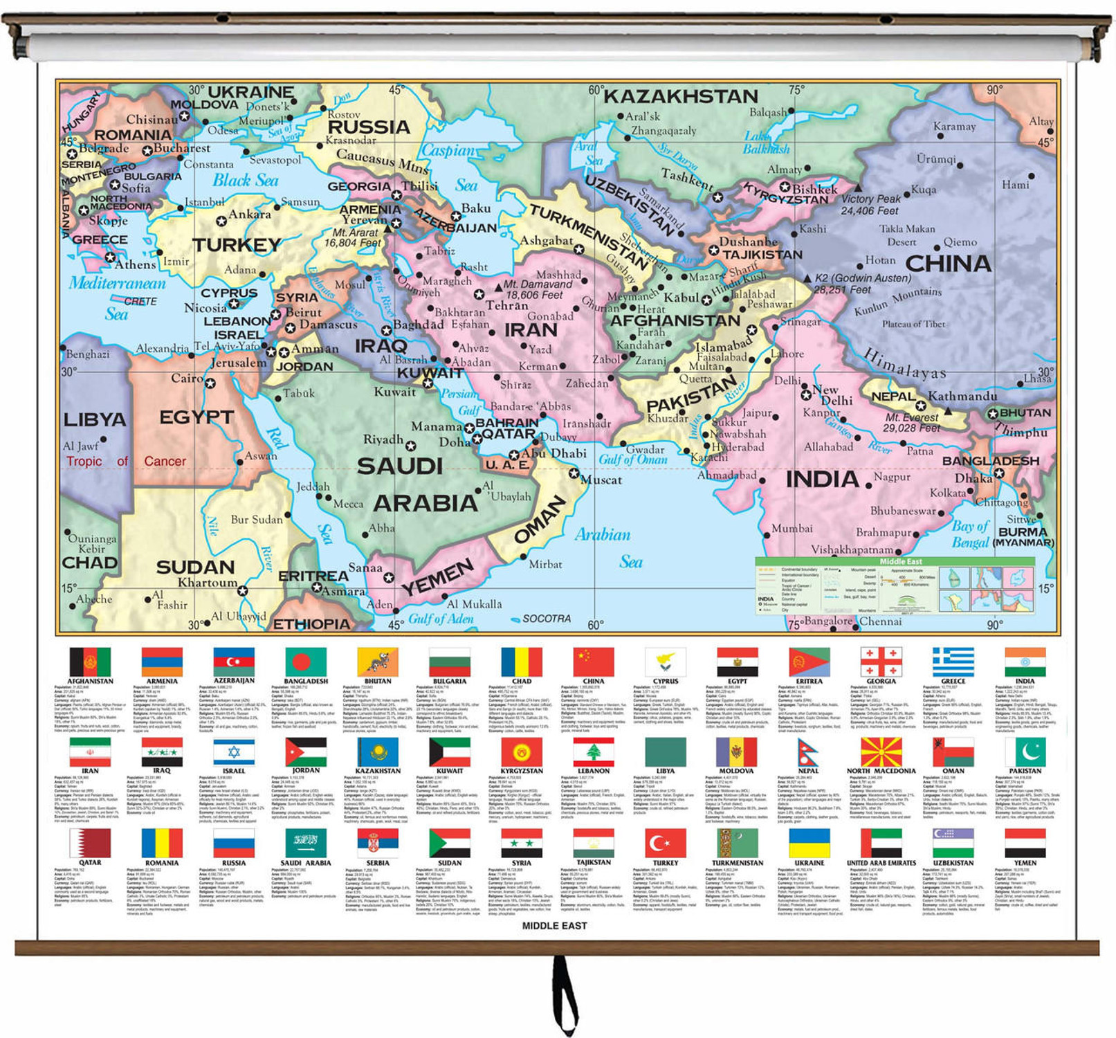
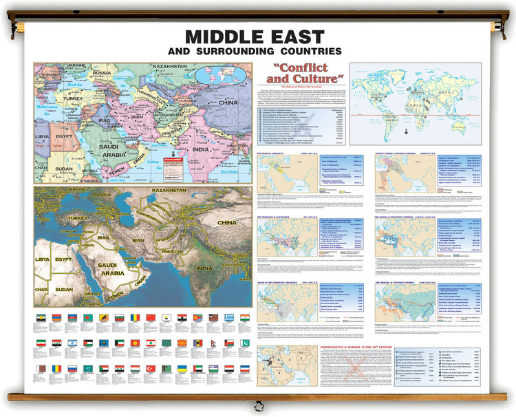
An informative map of the Middle East and surrounding countries. Features a political map with countries in bright contrasting colors as well as a physical satellite image map depicting detailed topographic relief. Political map labels major cities, capitals, rivers and bodies of water. Flags with demographic data are displayed for each country in the region.
Middle East History Map Insets Discuss:
Dimensions: 54" x 43"
Middle East History Map Insets Discuss:
- History of Modern Day Terrorism
- The Fertile Crescent - 3500 - 1531 B.C.
- Ancient Middle Eastern Empires - 2000 - 627 B.C.
- The Persians & Alexander - 557 - 323 B.C.
- The Roman & Byzantine Empires - 510 B.C. - 1455 A.D.
- Islam & Christian Crusades - 570 - 1192 A.D.
- The Mongol & Ottoman Empires 1196 - 1922
- Independence & Turmoil in the 20th Century
Dimensions: 54" x 43"

Made In The USA

School Purchase Orders


