Multi-Map Spring Roller Combo Sets
Educational map sets that allow you to create your own custom spring roller combination by choosing the indvidual maps, our Custom Multi-Map Combination Map Sets are mounted to a single heavy-duty spring roller and are a great way to save space in the classroom. World maps, continent maps, United States and Canada as well as history maps are available as part of the pull-down map combinations, or are sold individually mounted. Classroom map sets are available to meet curriculum requirements for teaching grades 2 through 12. Create your own customized educational map set bundles. Select from 2 up to 8 maps to be mounted on a single spring roller.

US & World Spring Roller Combo Maps
Custom 2-8 Map Spring Roller Combo Sets
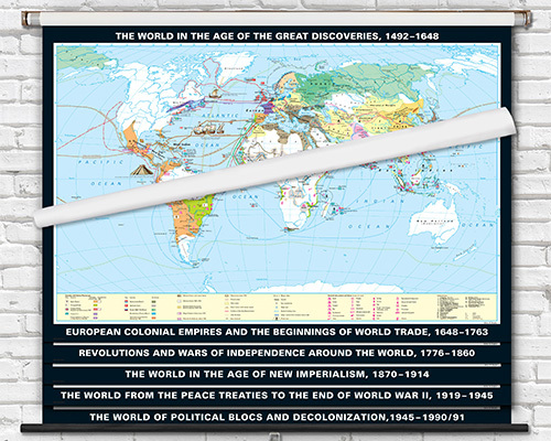
World & US History Map Sets
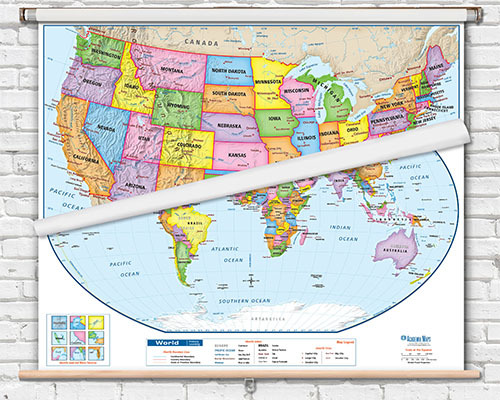
World / USA / State Map Spring Roller Combo Sets
Custom Spring Roller Map Sets
Multi-map combo sets typically include 3, up to 8 maps on a single bracket system. Common configurations pair a world map, US map, and continent maps together. Maps are mounted to a single roller to save wall space and hardware costs.
All maps are attached to the roller at a single point, so they all pull down together. To reveal maps behind the top one, you flip the bottom edge of the maps you want to hide behind the roller. We have a diagram and short video explaining this here
Yes. Combo sets offer significant savings compared to purchasing the same maps individually on separate rollers. You also save installation time and wall space since all maps share a single bracket mount point.
A combo set takes up essentially the same wall width as a single map since all the rollers stack within the same bracket housing. The bracket itself extends only a few inches from the wall, and around 8 inches beyond the map width. This is one of the most space-efficient solutions for classrooms that need multiple reference maps.
Some combo configurations are available as pre-assembled standard sets, while custom combo sets can be configured to your specifications. Contact the team to discuss building a custom set with the specific maps you need for your curriculum.
It may be possible but would require sending in for assessment and repairs. Contact our team to discuss
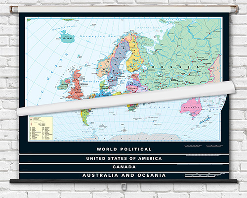
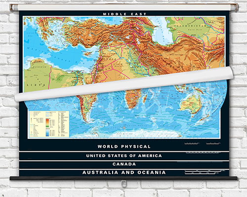
The most popular classroom combo includes a World and US political map. US/World/State map combo sets are the second most popular. Some sets add physical maps alongside political maps for comparative lessons.
Maps within a combo set are typically the same width to fit the shared bracket system. Standard widths align across the set so maps display consistently. The bracket system is designed for specific map dimensions that are matched at the time of assembly.
Yes. Combo sets are available with laminated maps that support dry-erase marker use. This allows interactive teaching on any map in the set—annotate, erase, and switch to the next map for a different lesson topic.
Yes. Multi-map combo sets include the bracket system and mounting hardware needed for installation. The bracket attaches to the wall or ceiling and holds all the roller maps in the set. Basic tools (drill, screwdriver, level) are needed for installation.