Classroom Pull-Down Maps by Grade Level
Discover our extensive selection of classroom spring roller maps, organized into convenient categories by grade level to support tailored learning for elementary, middle, and high school. These durable, laminated maps mounted to a pull-down spring roller for easy use and are compatible with dry-erase markers for interactive lessons. Perfect for classroom education and home school, each map is designed to align with grade-specific geography and history curricula. Enhance your classroom with high-quality maps that make learning engaging and hands-on.
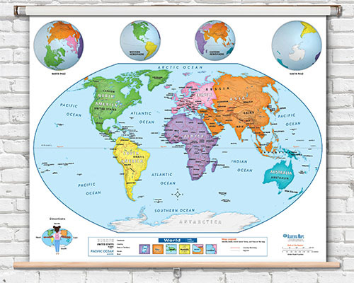
Pre-K to 1st Grade Classroom Maps
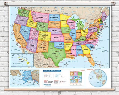
Elementary Classroom Maps

Middle School Classroom Maps
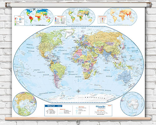
High School and College Maps
Maps for younger students use simplified labeling, larger fonts, brighter colors, and fewer geographic details to avoid overwhelm. Elementary-level maps add more cities, physical features, and geographic vocabulary progressively. The goal is to match the map's complexity to the student's reading level and curriculum standards.
Most educators introduce simplified world and US maps in Pre-K through 1st grade, then transition to maps with more detail—secondary cities, physical features, and geographic vocabulary—from 2nd grade onward. By middle school, students can work with highly detailed reference maps showing complex political and physical information.
Yes. The Classroom Maps by Grade Level collection includes maps designed specifically for Pre-K to 1st grade with simplified content, large clear labels, vibrant colors, and age-appropriate geographic detail that introduces young learners to basic map skills.
High school maps include comprehensive political detail with secondary cities, detailed physical features (mountain ranges, river systems, ocean currents), latitude/longitude grids, and precise geographic labeling. These reference-grade maps support advanced geography, AP courses, and college-prep curriculum.
While maps are primarily standalone visual references, many are designed to align with common geography and social studies curriculum standards. The World Maps Online team can help recommend maps that match your grade-level curriculum requirements. Contact us for guidance on the best map selection for your classroom.
With teacher guidance, younger students can benefit from more detailed maps for specific focused activities. However, maps designed for older students can overwhelm younger learners when used for independent study. Using grade-appropriate maps ensures students can engage with the content at their developmental level.
Yes. Maps for younger students feature noticeably larger fonts for country names, state labels, and geographic features. As grade level increases, font sizes decrease to accommodate the additional detail and labeling density that older students need for more advanced geographic study.
Spring roller pull-down maps are available across all grade level ranges from Pre-K through high school and college. Options include world maps, US maps, and continent maps at each complexity level. See the Spring Roller Pull-Down Maps collection for the full range.
Yes. Grade-level maps are available in laminated finishes for dry-erase marker compatibility. This allows teachers to use the same map interactively across lessons, marking and erasing as needed. Lamination also adds durability for daily classroom handling.
Select the map that matches the majority of your students' reading level, then differentiate instruction using supplemental materials. Having both a simplified map and a more detailed map available allows you to meet students where they are. The team can help you choose appropriate maps for mixed-ability classrooms.