Satellite Imagery Wall Maps
Our Satellite Imagery Wall Maps showcase visually stunning aerial imagery of the world, United States, continents, countries, cities, and regions, bringing the beauty of a view from space onto your wall space. Available in mounting options such as archival paper prints, photo paper giclée prints, wood poster hanging rails, framed canvas gallery wraps, solid wood framed maps and peel-and-stick wall decals, these maps are perfect for homes, offices, and educational settings. Each satellite image map highlights natural landscapes, urban areas, and geographic features with remarkable detail and clarity.
These maps are printed on demand at our Seattle shop using an ultra high quality printing process known as Giclee which results in a high resolution print featuring vibrant colors and a vivid life-like quality not found in any standard four color offset poster map prints. This highly specialized printing method is typically used by galleries to reproduce fine art pieces.
Every print results in an eloquent piece of art suitable for displaying in even the most prestigious of museums or art galleries. Exquisitely detailed giclee prints are available in a range of satellite image maps of the Earth. Satellite imagery maps are available in versions with no labels or with place name labels for countries, cities, islands, and seas.
Explore our collection or request an optional satellite image map of any location to create a custom satellite imagery map print that suits your needs.

World Satellite Image Maps

United States Satellite Image Maps
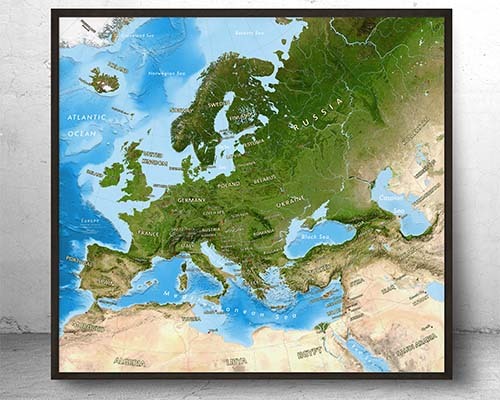
Satellite Image Maps of Continents

Countries, Regions, Cities Satellite Wall Maps

Custom Satellite Imagery Maps
A satellite imagery wall map displays Earth as seen from space using high-resolution aerial and orbital photography. Instead of drawn borders and color-coded countries, you see actual landforms, ocean colors, vegetation patterns, urban areas, and terrain exactly as they appear from above. The result is a stunningly realistic and detailed view of our planet.
A regular map uses drawn boundaries, labels, and color coding to represent geographic information. A satellite map shows actual photographic imagery of Earth from space, real coastlines, green forests, brown deserts, blue oceans, and white ice caps. Some satellite maps include overlaid labels and borders for reference.
Yes. Satellite imagery maps create a unique, sophisticated visual impact in professional spaces. The photographic quality and natural color palette make them excellent conversation pieces for offices, conference rooms, and lobbies, especially for companies in aviation, environmental, technology, and international industries.
Yes. The Satellite Imagery Wall Maps collection includes world, US, continent, country, region, and city-level satellite maps. Custom satellite imagery maps of specific areas can also be ordered.
Standard satellite imagery maps show the landscape as photographed from space without labels. However, some options include overlaid road networks, city names, and borders for reference. Product descriptions indicate whether labels and boundaries are included alongside the satellite imagery.
The source imagery is extremely high resolution, and printing uses museum-quality giclée techniques with pigment-based inks. You can see individual mountain ranges, river systems, coastline detail, and even major urban areas. Larger print sizes reveal even more visible detail in the landscape.
Satellite imagery maps are available in archival paper, photo paper giclée, wood poster hanging rails, canvas gallery wraps, solid wood framed, and peel-and-stick wall decals. Photo paper giclée and canvas finishes are especially popular for satellite imagery because they enhance the photographic depth and color.
Nighttime Earth imagery showing illuminated cities and infrastructure is one of the most visually striking satellite map options. These maps reveal population density and urban development patterns through the glow of city lights against the dark landscape.
Yes. Custom satellite imagery maps can be created covering specific regions, cities, or areas of interest. This allows you to display the aerial view of your hometown, a favorite travel destination, or a commercially relevant geographic area as a unique wall display.
For a space-themed room, consider a full-Earth satellite image showing the planet as seen from orbit—these pair beautifully with space and galaxy decor. Nighttime satellite maps and detailed moon maps are also popular choices. For dedicated space wallpaper, see the Other Wall Murals collection for galaxy and space imagery.