Regional Wall Maps
We offer a wide range of Regional Wall Maps that provide detailed and focused coverage of specific areas including continents, countries, Canada, the America’s, as well as a selection of city street maps. These maps feature precise geographic detail and political features. Ideal for classrooms, offices, and homes, these maps are designed with vibrant colors and clear labels to make learning and reference easy. Made using high quality materials here in our Seattle, WA shop in a variety of finishing options that include paper poster prints, laminated wall maps, canvas wood rail mounting, peel & stick wall decals, and framed canvas wraps. Explore our collection to find the perfect regional map that fits your educational or decorative needs.

America's Wall Maps

Canada Wall Maps
Continent Wall Maps
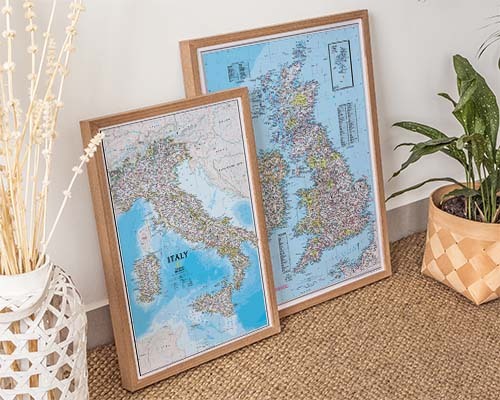
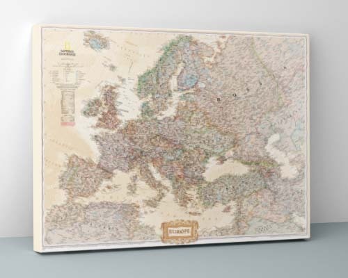
Country Wall Maps
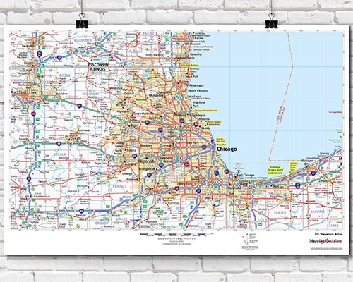
City and County Maps

National Parks & Recreation Maps
The Regional Wall Maps collection includes the Americas, Canada, individual continents (Europe, Asia, Africa, South America, Australia), individual countries, and specialty maps like National Parks and recreation areas. Both political and physical styles are available for most regions.
Yes. National parks and recreation maps display the locations of national parks, monuments, forests, and recreation areas across the United States. These are popular for travel planning and as decorative pieces for outdoor enthusiasts. Both framed and unframed options are available.
Yes. Physical-style continent maps use color gradients and terrain shading to show mountain ranges, river systems, deserts, ocean depth, and vegetation zones. These complement political maps that show country borders and are especially useful for geography education and reference.
Political continent maps emphasize country borders, capitals, and major cities using distinct colors for each nation. Physical maps depict natural geographic features like elevation, terrain, water bodies, and vegetation through color gradients and shading. Together they provide a complete geographic picture.
Yes. Canada wall maps clearly display all provinces and territories with distinct labeling, provincial capitals, major cities, and geographic features. Multiple styles are available including political, physical, and laminated classroom formats.
A regional map at least 48" wide ensures good visibility in a standard classroom. Laminated versions are recommended for interactive use with dry-erase markers. For dedicated classroom products, also see the Classroom Maps collection with spring roller options.
Regional maps are available in the same premium finishes as the full wall map collection: archival paper, laminated (dry-erase compatible), canvas gallery wrap, wood rail-mounted, peel-and-stick, and framed. The best finish depends on your intended use—interactive, decorative, or educational.
Yes. Americas maps include options that display both North and South America, as well as maps focused specifically on North and Central America. These show country borders, capitals, major cities, and geographic features across the region.
Yes. Individual country maps are available in large formats suitable for office display. Popular options include detailed maps of countries across Europe, Asia, Africa, and the Americas. Multiple finishes including laminated, canvas, and framed options make them suitable for any professional environment.
Yes. All maps are printed on demand with the most current cartographic data available from the publisher. This ensures you receive a freshly printed map with accurate borders and place names rather than outdated stock.