1899 Plattsburgh, N.Y. C. Fausel, artist. L. R. Burleigh, lith. This reproduction panoramic map of Plattsburgh, New York was drawn by Christian Fausel and published by L. R. Burleigh Litho. in 1899. Plattsburgh is the county seat for Clinton County and is located near the Adirondack Mountains where the Saranac River meets the western shore of Lake Champlain. Samuel de Champlain explored this area in 1609 and it became a fur trading community. Zephaniah Platt, a lawyer and politician, founded Plattsburgh in 1785 on land granted to him by former colonial governor, The Hon. George Clinton. Platt moved to Plattsburgh ten years later and continued his law practice becoming a regent of the State University and an originator of the Erie Canal. Plattsburgh was known as "La Ville Sur le Lac" and had been the locale of the Revolutionary War's "Battle of Valcour Island" and the War of 1812's "Battle of Plattsburgh". This map shows Plattsburgh three years before it reached its city status and one year after the New York State Normal School building was completed.
The map from 1899 shows buildings, clearly labeled streets, railroad routes and features the steamer "Vermont" in the foreground.
Features numbered references to the following locations:
1. Presbyterian Church 2. Methodist Church 3. Catholic Church 4. French Catholic Church 5. Episcopal Church 6. Baptist Church 7. Synagogue 8. Rev. Hall's Church 9. U. S. Military Post 10. Site of Fort Moreau 11. N. Y. State Normal School 12. U. S. Custom House and Post Office 13. D. & H. Depot 14. Fouquet House 15. Witherill House 16. Cumberland House 17. Commercial Hotel 18. American Hotel 19. Clinton Hotel 20. U. S. Hotel, near D. & H. Depot 21. Bord's Hotel 22. Plattsburgh Light, Heat and Power Co. 23. Plattsburgh Traction Co. Stables 24. Wilcox & Son's Houses, Coal Dock and Wood Yards 25. Office of Chateauguay Ore and Iron Co. 26. F. M. Purdy Sash and Blind Factory 27. Plattsburgh Paper Mill and Bag Factory 28. C. H. Foote & Co., Wholesale Grocers 29. Plattsburgh Foundry and Machine Shop 30. W. H. Travis' Cash Meat Market 31. R. H. Hanna's Cafe and Lunch Wagons 32. T. J. D'Arcy's Cafe and Restaurant 33. E. G. Moore & Co., Jobbers of Boots, Shoes, Rubbers and Gloves 34. Baker Bros. Lumber Co. 35. H. Scheier, Cigar Manufacturer 36. J. Scheier, Cigar Manufacturer. Dealer in Cigars and Liquors 37. Honsinger & Jerry, Carriage Repository 38. W. P. Meyer & Co., Hardware 39. Henry, Wood & Marshall, Hardware 40. A. H. Marshall's Residence 41. Davis Block, Provisions, Grain and Feed 42. C. P. Carpenter, Groceries, Grist Mill and Wood Yards 43. Frank Z. Jabaut's Ice House and Wood Yards 44. W. H. Goft's Store and Wood Yard 45. Joe Ouimette's Brick Yards 46. H. A. Wood, Clothier 47. A. McHathie, Dry Goods 48. A. Sharron, Dry Goods 49. G. F. Hutchinson, Importer and Wholesale Liquor Dealer 50. J. B. Longton's Bakery 51. J. C. Gee, Blacksmith Shop 52. Weed Building
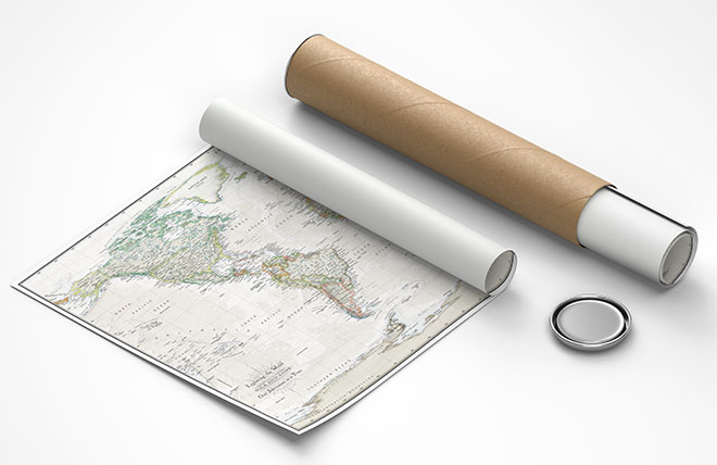
We use top-notch materials printed on demand using the Giclée printing method, so you get amazing detail and bright colors every time.
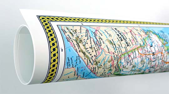
Archival Paper
Premium fine art paper that provides accurate color reproduction with high-contrast, high-resolution print output and maximum image permanence. A high-quality Giclée print ready for framing.
Museum quality paper for high-quality fine art.
Ultra smooth, neutral white matte finish.
Heavy-weight 230 gsm, 9.5 mil thickness.
Printed with pigment inks for longer print life and enhanced fade resistance.
Pigment based Canon LUCIA inks provide smooth tones and rich colors in fine, precise detail.
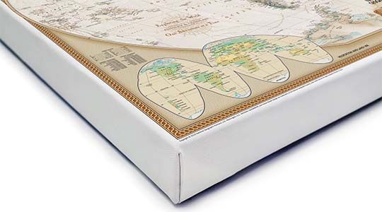
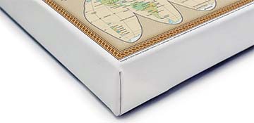
Canvas Gallery Wrap
A high quality canvas giclee print is hand stretched over a sturdy wood frame. Printed on demand and handcrafted in Seattle, WA. The canvas gallery wrap serves as a stunning piece of art ready to hang on your wall.
Premium 19 mil canvas material.
Pigment based Canon LUCIA inks provide smooth tones and rich colors in fine, precise detail.
High quality giclee fine art print with a lightfastness rating of over 100 years.
Durable canvas mounted to a 1.25" deep wood frame.
Ready to hang with included easy-to-use hanging kit.
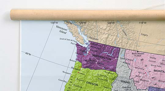
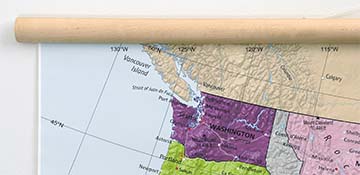
Canvas on Wood Rails
A canvas giclee print that is mounted to wood hanging rails placed along the top and bottom of the map. Rail mounted maps are ready to hang via the attached hanging cord. Solid wood rails have a natural finish.
Premium 19 mil canvas material.
Wood rails are 1 1/8" wide, round front.
USA sourced solid maple wood.
High quality giclee fine art print with a lightfastness rating of over 100 years.
Pigment based Canon LUCIA inks provide smooth tones and rich colors in fine, precise detail.
Luster Photo Paper
A premium semi-gloss photo paper with a subtle texture that produces a vivid, richly detailed print. This material results in an exquisitely detailed giclee print of substantially higher quality than a standard poster.
Printed on 10 mil premium luster photo paper resulting in a brilliant, colorful image with a vivid life-like quality.
Pigment based Canon LUCIA inks provide smooth tones and rich colors in fine, precise detail.
Inks have a lightfastness rating of over 100 years, guaranteeing minimal noticeable fading over a very long period of time.
Printed using very high resolution source files.
Giclee printing is superior to traditional lithography in a number of ways: colors are brighter, lasts longer, and is a higher resolution.
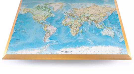
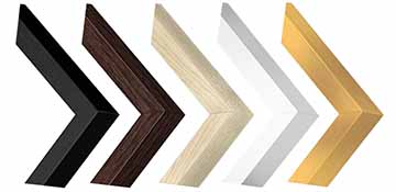
Framed Print
Our gallery quality frames are made of solid wood and feature optical-grade acrylic. Each framed map is printed on premium archival matte fine art paper.
Printed on thick, luxurious acid-free fine art paper & dry-mounted to foam board.
Pigment inks ensure a vivid print with amazing colors and excellent fade resistance.
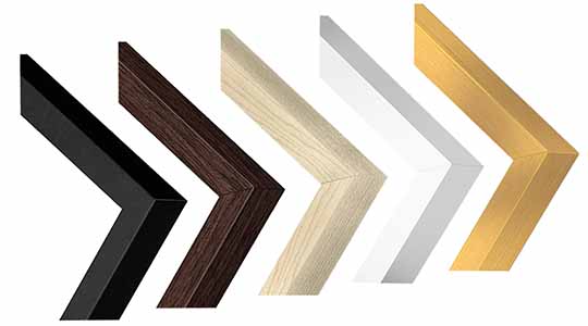
Solid wood frame in 5 finishes has a 7/8" face & 1.25" depth.
Kraft paper protective backing & hanging wire installed.
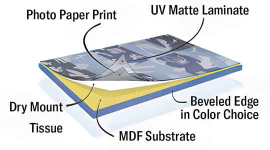
Plaque Mount
A museum grade display featuring high-resolution printing on premium photo paper, mounted on a durable wood plaque with a protective matte laminate. Surface can be cleaned with glass cleaner.
A premium photo print is dry-mounted to onto wood substrate (MDF).
Features a highly durable laminated surface that is scratch-resistant, water-resistant and fade-resistant.
Lamination is a non-glare matte finsh that can be wiped clean with a damp cloth or glass cleaner.
Mounted to 3/8" thick MDF wood panel with a 3/8" wide beveled edge available in premium foil color options.
Keyhole slot with velvet feet on the corners for easy wall mounting. Hanging hardware included.
Plaque Mounting Process
Gallery quality map prints made in the USA
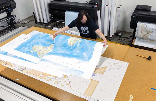
We specialize in producing high-quality, detailed maps using advanced printing technologies and premium materials. Stringent quality control and ultra-high-resolution printing guarantee absolute clarity and precise detail at any size. Whether it's a smaller wall map print or a gigantic wallpaper map mural, no print will appear blurry or pixelated. You can expect every detail on the map to be sharp and clear.
Finely Crafted Cartographic Works of Art
Many of the maps we provide are created by our small team of cartographers under the name Academia Maps.
Museum Quality Materials
We source the best materials for our map prints and wallpaper maps. Premium archival inks guarantee rich vibrant colors with excellent fade resistance.
USA Print Production
We are a small business located in Seattle, WA that has been printing maps for over 15 years. Each map is printed on-demand using high-end fine art printers.
Shipping Costs
Free Ground Shipping within the contiguous United States and a flat rate of $20.00 to AK and HI.
Canada via UPS Standard is $40.00 USD.
Worldwide Shipping is available and shipping costs will be calculated at checkout.
Shipping Times
Most items are made to order and ship from our Seattle, WA facility. Typical production lead times are listed below. Shipping transit time is 2-5 business days depending on the delivery location. If you need your map by a certain deadline please contact us for expedited options.
Archival Paper, Laminated Maps, and Peel & Stick - 5-7 business days
Wood Rail Mounting - 3-4 weeks
Canvas Gallery Wraps & Framed Maps - 3-5 business days
Push Pin Maps - 3-5 business days
Spring Roller Maps - Varies, see product description
Wallpaper Map Murals - 7-10 business days
Returns
If you are unhappy with your order for any reason you can return it within 30 days of the delivery date. Customized items are non-returnable.
Yes, we can produce a majority of the map titles found on our website in a custom size. If you would like to request a custom size, take note of the map title and item#, then follow one of the links below to make your request. We will follow up with a link to checkout.
(for rolled or mounted prints)
(for larger peel & stick / wallpaper maps)
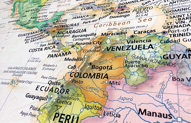
All of our maps are currently labeled as "Gulf of Mexico". Since our map products are printed to order, we can offer the alternate "Gulf of America" labeling by request.
If you would like your map to be labeled Gulf of America instead of Gulf of Mexico, simply request this in the comments section at checkout, and we will update the map.
We accept purchase orders from schools and government entities. You can e-mail a copy of your PO to [email protected].
View more information and download our W-9.
No problem, send a screenshot or PDF of your shopping cart to [email protected] and will promptly follow up with a quotation.
Our products are printed on demand and have the following production lead times:
Archival Paper, Laminated Maps, and Peel & Stick - 5-7 business days
Wood Rail Mounting - 3-4 weeks
Canvas Gallery Wraps & Framed Maps - 3-5 business days
Spring Roller Maps - Varies, see product description
Shipping transit time is 2-5 business days and will vary depending on your location. Most products ship from Seattle, WA.
Many of the maps found on our website can be customized, including adding a personalized title/legend or company logo, modifying the color scheme, change text labels, adding points of interest, and placing GIS data on the map.
If the order is shipping outside of Washington state, sales tax may not apply. We collect sales taxes per state and local laws. Sales tax is calculated at checkout based on the delivery address.
We can ship to nearly any country. The shipping cost is determined for Canada and most European countries at checkout. If you find that shipping is unavailable to your country when checking out then please contact us with a list of the products you would like to order as well as size and material options.
We can produce a custom map for any location in the world. Whether you are looking for a detailed city street map or high resolution satellite imagery of a remote area, we have you covered.
Because maps aren't just décor—they're personal stories, travel memories, and future adventures waiting to happen. SHOP BESTSELLING MAPS
🎁 Meaningful: Track travels, spark memories, plan new experiences.
🎄 Perfect for gifts: Unique, educational, and visually stunning.
🏠 Fits any home décor: Modern, vintage, minimalist & artistic styles available.
✏️ Personalizable: Add names, family titles, travel quotes (push-pin maps).
✈️ Great for travelers, students, families, teachers & offices.
Wall Maps Material Info
We use museum grade papers and canvas along with high quality solid wood mounting options.
Made in the USA
Archival Paper
Premium Giclée fine art print on thick acid-free paper with a matte finish. Features rich, vibrant colors with precise detail.
Luster Photo Paper
Giclée fine art print on semi-gloss photo paper. A richly detailed print with vivid colors.
Canvas on Wood Rails
High-quality giclée print on artist-grade canvas mounted to natural finish solid wood hanging rails placed along the top and bottom of the canvas. Hanging cord at top.
Canvas Gallery Wrap
High-quality giclée print on artist-grade canvas. Wrapped around a sturdy wooden frame, this print is perfect for adding depth and texture to any space.
Framed Map Print
Printed on high-grade fine art paper and mounted in a solid wood frame available in 5 finishes. The print is protected behind optical-grade clear acrylic.
Plaque Mount
A high resolution photo print dry-mounted to wood and sealed with a durable matte laminate. A sleek frameless look with a beveled edge that is available in multiple color finishes.
Size Guide
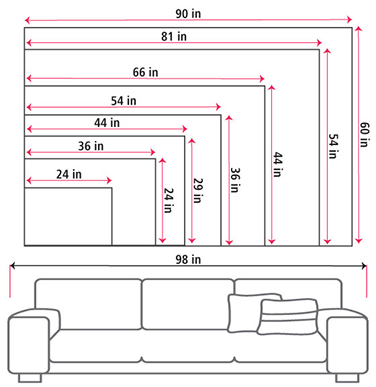
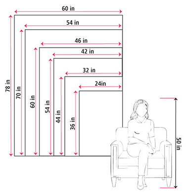
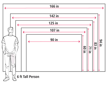
These mockups are to be used as a general visual aid to assist you in choosing a size. The measurements may not reflect the exact sizes of the product you are viewing. It is always best practice to measure your wall space prior to ordering.
Our wall maps and wallpaper map murals are handcrafted by our small team in Seattle, WA.
School Purchase Orders
We accept purchase orders from schools and other government institutions. Learn more here.
High Quality Materials
Maps are printed on premium fine art papers, canvas, and durable wallcovering materials using archival inks.
Stunning Cartography
Original and up-to-date maps designed by our cartographic team at Academia Maps include a range of high quality maps for geographic exploration, home decor, and classroom learning.