Aeroplane view of business district Amarillo, Texas. Drawn by E. E. Motter. Copyright by G. C. Sturdivant. Reproduction map of the Amarillo, TX, drawn and published in 1912.
Inset illustrations of the following buildings appear on the map:
Amarillo Gas Plant First Baptist Church Central Presbyterian Church First Methodist Church High School St. Charles Apartments
Complete reference list below.
Features the following "booster" statement:
"AMARILLO, the geographical and trade center of 25,000 square miles of the Texas Panhandle and a still larger area of Eastern New Mexico, and Western Oklahoma, had 9,957 population inside the corporate limits by the 1910 census. The actual population of Amarillo in 1912 is easily 12,000 and there has never been a cessation in her growth. Amarillo has three transcontinental railway systems, with vast shops, offices and terminal facilities of the Santa Fe and with division offices and shops for the Fort Worth & Denver (Hill Lines) and Rock Island. Amarillo has a Federal Court, weather bureau, Court of Civil Appeals. Amarillo's school, church and college property aggregates over a million dollars in value. Amarillo's growth is substantial and modern both in her buildings and in her industrial, commercial, social and civic enterprises. Congress has authorized an appropriation of $250,000 for the erection of a Federal building on a site valued at $10,000 which has already been deeded to the government. By reason of her mountain altitude, 3700 feet above sea level, Amarillo enjoys a life-giving atmosphere which attracts many visitors and many residents from less favored climes. Fifteen miles south of the city lies the beautiful Palo Duro Canyon, which has already become a nature's playground of national fame."
The following table shows the constant and remarkable growth of the total receipts of the Amarillo Post Office for a period of 9 years:
Year 1903..........................................$10,911.94 Year 1904..........................................$12,545.57 Year 1905..........................................$12,859.92 Year 1906..........................................$17,502.08 Year 1907..........................................$25,376.70 Year 1908..........................................$33,525.04 Year 1909..........................................$42,627.78 Year 1910..........................................$49,786.64 Year 1911..........................................$47,932.96
The following is a list of Amarillo's manufacturing enterprises:
3 Artificial Stone manufacturers. 2 Bottling Works. 1 Brick and tile factory. 1 Broom factory. 1 Cabinet shop. 2 Candy factories. 1 Carriage and wagon factory. 1 Cigar factory. 1 Candy wagon factory. 2 Flour and meal mills. 3 Cornice manufacturers. 2 Creameries. 2 Electric sign factories. 4 Chop and feed mills. 1 Fireproof metal window factory. 1 Furniture and mattress factory. 1 Gas plant. 3 Grain elevators. 1 Harness and Saddlery manufacturer. 3 Ice Cream factories. 2 Ice factories. 3 Steam Laundries. 2 Marble works. 3 Planing mills. 1 Sash and door factory. 3 Tank factories. 1 Vulcanizing plant. 1 Water, Light & Power Plant.
There are in Amarillo the following wholesale and jobbing houses: 2 Automobile supply houses. 3 Wholesale Cigar dealers. 3 Wholesale Coal dealers. 1 Wholesale Coke dealer. 1 Wholesale Drug Company. 2 Wholesale Electrical supply houses. 5 Wholesale Feed, Hay & Grain concerns. 1 Wholesale Fruit and Produce company. 4 Wholesale Grocers. 2 Wholesale Hardware houses. 1 Wholesale Paints, Oil, & Painters' supplies house. 3 Wholesale Gasoline and oil establishments. 2 Wholesale plumbing concerns. 2 Wholesale well machinery and supply houses.
Here are the accurate government figures showing the percentage of population gain of the fastest growing cities in the United States during the past decade:
AMARILLO, TEXAS...590 per cent Oklahoma City, Okla...540 per cent N. Yakima, Wash....346 per cent Virginia, Minn....254 per cent Salem, Ore...231 per cent Los Angeles, Cal...211 per cent Monessen, Penna...437 per cent Aberdeen, Wash...265 per cent Birmingham, Ala...265 per cent Everett, Wash...215 per cent Billings, Mont....210 per cent
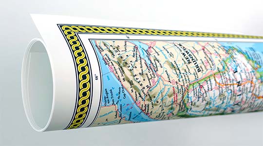
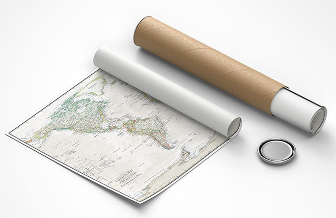
We use top-notch materials printed on demand using the Giclée printing method, so you get amazing detail and bright colors every time.
Archival Paper
Premium fine art paper that provides accurate color reproduction with high-contrast, high-resolution print output and maximum image permanence. A high-quality Giclée print ready for framing.
Museum quality paper for high-quality fine art.
Ultra smooth, neutral white matte finish.
Heavy-weight 230 gsm, 9.5 mil thickness.
Printed with pigment inks for longer print life and enhanced fade resistance.
Pigment based Canon LUCIA inks provide smooth tones and rich colors in fine, precise detail.
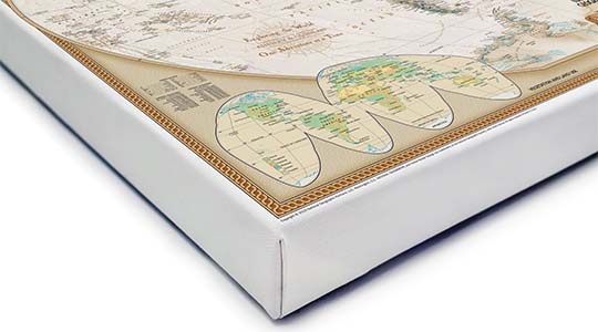
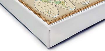
Canvas Gallery Wrap
A high quality canvas giclee print is hand stretched over a sturdy wood frame. Printed on demand and handcrafted in Seattle, WA. The canvas gallery wrap serves as a stunning piece of art ready to hang on your wall.
Premium 19 mil canvas material.
Pigment based Canon LUCIA inks provide smooth tones and rich colors in fine, precise detail.
High quality giclee fine art print with a lightfastness rating of over 100 years.
Durable canvas mounted to a 1.25" deep wood frame.
Ready to hang with included easy-to-use hanging kit.
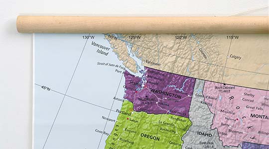
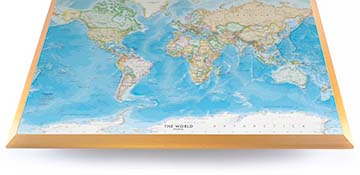
Canvas on Wood Rails
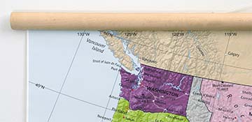
A canvas giclee print that is mounted to wood hanging rails placed along the top and bottom of the map. Rail mounted maps are ready to hang via the attached hanging cord. Solid wood rails have a natural finish.
Premium 19 mil canvas material.
Wood rails are 1 1/8" wide, round front.
USA sourced solid maple wood.
High quality giclee fine art print with a lightfastness rating of over 100 years.
Pigment based Canon LUCIA inks provide smooth tones and rich colors in fine, precise detail.
Luster Photo Paper
A premium semi-gloss photo paper with a subtle texture that produces a vivid, richly detailed print. This material results in an exquisitely detailed giclee print of substantially higher quality than a standard poster.
Printed on 10 mil premium luster photo paper resulting in a brilliant, colorful image with a vivid life-like quality.
Pigment based Canon LUCIA inks provide smooth tones and rich colors in fine, precise detail.
Inks have a lightfastness rating of over 100 years, guaranteeing minimal noticeable fading over a very long period of time.
Printed using very high resolution source files.
Giclee printing is superior to traditional lithography in a number of ways: colors are brighter, lasts longer, and is a higher resolution.
Framed Print
Our gallery quality frames are made of solid wood and feature optical-grade acrylic. Each framed map is printed on premium archival matte fine art paper.
Printed on thick, luxurious acid-free fine art paper & dry-mounted to foam board.
Pigment inks ensure a vivid print with amazing colors and excellent fade resistance.
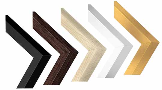
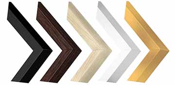
Solid wood frame in 5 finishes has a 7/8" face & 1.25" depth.
Kraft paper protective backing & hanging wire installed.
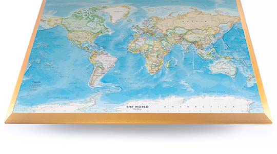
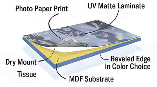
Plaque Mount
A museum grade display featuring high-resolution printing on premium photo paper, mounted on a durable wood plaque with a protective matte laminate. Surface can be cleaned with glass cleaner.
A premium photo print is dry-mounted to onto wood substrate (MDF).
Features a highly durable laminated surface that is scratch-resistant, water-resistant and fade-resistant.
Lamination is a non-glare matte finsh that can be wiped clean with a damp cloth or glass cleaner.
Mounted to 3/8" thick MDF wood panel with a 3/8" wide beveled edge available in premium foil color options.
Keyhole slot with velvet feet on the corners for easy wall mounting. Hanging hardware included.
Plaque Mounting Process
Gallery quality map prints made in the USA
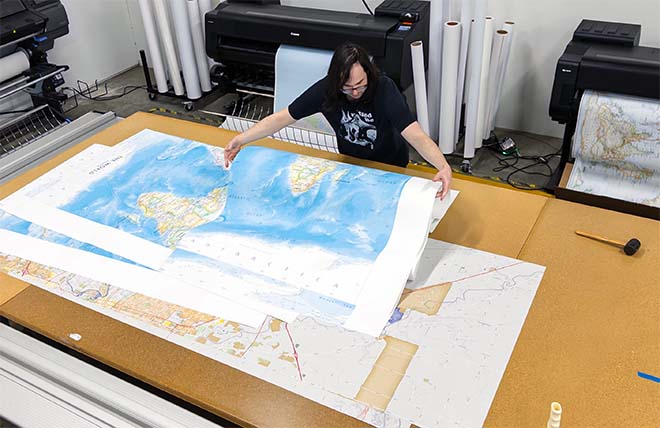
We specialize in producing high-quality, detailed maps using advanced printing technologies and premium materials. Stringent quality control and ultra-high-resolution printing guarantee absolute clarity and precise detail at any size. Whether it's a smaller wall map print or a gigantic wallpaper map mural, no print will appear blurry or pixelated. You can expect every detail on the map to be sharp and clear.
Finely Crafted Cartographic Works of Art
Many of the maps we provide are created by our small team of cartographers under the name Academia Maps.
Museum Quality Materials
We source the best materials for our map prints and wallpaper maps. Premium archival inks guarantee rich vibrant colors with excellent fade resistance.
USA Print Production
We are a small business located in Seattle, WA that has been printing maps for over 15 years. Each map is printed on-demand using high-end fine art printers.
Shipping Costs
Free Ground Shipping within the contiguous United States and a flat rate of $20.00 to AK and HI.
Canada via UPS Standard is $40.00 USD.
Worldwide Shipping is available and shipping costs will be calculated at checkout.
Shipping Times
Most items are made to order and ship from our Seattle, WA facility. Typical production lead times are listed below. Shipping transit time is 2-5 business days depending on the delivery location. If you need your map by a certain deadline please contact us for expedited options.
Archival Paper, Laminated Maps, and Peel & Stick - 5-7 business days
Wood Rail Mounting - 3-4 weeks
Canvas Gallery Wraps & Framed Maps - 3-5 business days
Push Pin Maps - 3-5 business days
Spring Roller Maps - Varies, see product description
Wallpaper Map Murals - 7-10 business days
Returns
If you are unhappy with your order for any reason you can return it within 30 days of the delivery date. Customized items are non-returnable.
Yes, we can produce a majority of the map titles found on our website in a custom size. If you would like to request a custom size, take note of the map title and item#, then follow one of the links below to make your request. We will follow up with a link to checkout.
(for rolled or mounted prints)
(for larger peel & stick / wallpaper maps)
All of our maps are currently labeled as "Gulf of Mexico". Since our map products are printed to order, we can offer the alternate "Gulf of America" labeling by request.
If you would like your map to be labeled Gulf of America instead of Gulf of Mexico, simply request this in the comments section at checkout, and we will update the map.
We accept purchase orders from schools and government entities. You can e-mail a copy of your PO to [email protected].
View more information and download our W-9.
No problem, send a screenshot or PDF of your shopping cart to [email protected] and will promptly follow up with a quotation.
Our products are printed on demand and have the following production lead times:
Archival Paper, Laminated Maps, and Peel & Stick - 5-7 business days
Wood Rail Mounting - 3-4 weeks
Canvas Gallery Wraps & Framed Maps - 3-5 business days
Spring Roller Maps - Varies, see product description
Shipping transit time is 2-5 business days and will vary depending on your location. Most products ship from Seattle, WA.
Many of the maps found on our website can be customized, including adding a personalized title/legend or company logo, modifying the color scheme, change text labels, adding points of interest, and placing GIS data on the map.
If the order is shipping outside of Washington state, sales tax may not apply. We collect sales taxes per state and local laws. Sales tax is calculated at checkout based on the delivery address.
We can ship to nearly any country. The shipping cost is determined for Canada and most European countries at checkout. If you find that shipping is unavailable to your country when checking out then please contact us with a list of the products you would like to order as well as size and material options.
We can produce a custom map for any location in the world. Whether you are looking for a detailed city street map or high resolution satellite imagery of a remote area, we have you covered.
Because maps aren't just décor—they're personal stories, travel memories, and future adventures waiting to happen. SHOP BESTSELLING MAPS
🎁 Meaningful: Track travels, spark memories, plan new experiences.
🎄 Perfect for gifts: Unique, educational, and visually stunning.
🏠 Fits any home décor: Modern, vintage, minimalist & artistic styles available.
✏️ Personalizable: Add names, family titles, travel quotes (push-pin maps).
✈️ Great for travelers, students, families, teachers & offices.
Wall Maps Material Info
We use museum grade papers and canvas along with high quality solid wood mounting options.
Made in the USA
Archival Paper
Premium Giclée fine art print on thick acid-free paper with a matte finish. Features rich, vibrant colors with precise detail.
Luster Photo Paper
Giclée fine art print on semi-gloss photo paper. A richly detailed print with vivid colors.
Canvas on Wood Rails
High-quality giclée print on artist-grade canvas mounted to natural finish solid wood hanging rails placed along the top and bottom of the canvas. Hanging cord at top.
Canvas Gallery Wrap
High-quality giclée print on artist-grade canvas. Wrapped around a sturdy wooden frame, this print is perfect for adding depth and texture to any space.
Framed Map Print
Printed on high-grade fine art paper and mounted in a solid wood frame available in 5 finishes. The print is protected behind optical-grade clear acrylic.
Plaque Mount
A high resolution photo print dry-mounted to wood and sealed with a durable matte laminate. A sleek frameless look with a beveled edge that is available in multiple color finishes.
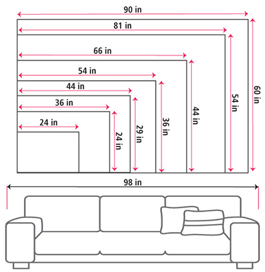
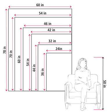
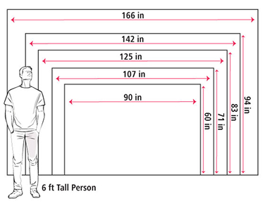
Size Guide
These mockups are to be used as a general visual aid to assist you in choosing a size. The measurements may not reflect the exact sizes of the product you are viewing. It is always best practice to measure your wall space prior to ordering.
Our wall maps and wallpaper map murals are handcrafted by our small team in Seattle, WA.
School Purchase Orders
We accept purchase orders from schools and other government institutions. Learn more here.
High Quality Materials
Maps are printed on premium fine art papers, canvas, and durable wallcovering materials using archival inks.
Stunning Cartography
Original and up-to-date maps designed by our cartographic team at Academia Maps include a range of high quality maps for geographic exploration, home decor, and classroom learning.