Americae Sive Qvartae Orbis Partis Nova Et Exactissima Descriptio / Avtore Diego Gvtiero Philippi Regis Hisp. etc. Cosmographo ; Hiero. Cock excvde 1562 ; Hieronymus Cock Excude Cum Gratia Et Priuilegio 1562 This beautiful map of the Americas was originally published in 1550 by famed Spanish cartographer Diego Gutiérrez, as a collaboration with printer Hieronymus Cock. This map was the first recorded appearance of California as a place name, as well as the first to refer to Appalachia (Apalchen). Featuring beautifully drawn depictions of volcano's, mermaids, monkeys, and an assortment of sea creatures, this unique map will be a welcome addition for any map enthusiast.
The late fifteenth-century landfall by Christopher Columbus on the island of Guanahani, in the Bahamas, forced open the gates to a whole new world for the Spanish and other European explorers. America, as it came to be called, became the destination for numerous expeditions and adventures from 1492 onward. Through papal bulls in 1493 and the famous Treaty of Tordesillas between Spain and Portugal in 1494, the two Iberian powers laid claim to the entire Western Hemisphere, although to them the newly found lands were extensions of Asia, or islands off its coasts.
During the next seventy years, a veritable avalanche of individual and state-supported efforts ensued to discover, explore, and understand the fullness of America, although initially the efforts were concentrated along its extensive coastlines. Exploratory forays continued well into the eighteenth century until every segment of America, from Canada to Tierra del Fuego, was visited and studied.
In sixteenth-century Europe, authoritative knowledge of the geography of America was based upon the observations of primarily Spanish and Portuguese-sponsored explorers and navigators, as interpreted and plotted by official cosmographers and cartographers of the crowns of Spain's new overseas empire. As Europe's vision of trade and land acquisition shifted from the Mediterranean Sea to the Atlantic Ocean, the information that this institution acquired about its new territories was vital to Spain's world power status. Comprehensive changes in long-held geographical concepts were produced as practical observation countered time-honored ideas about the shape of the world and the areas that comprised it.
In 1562 Diego Gutiérrez, a Spanish cartographer from the respected Casa de la Contratacin, and Hieronymus Cock, a noted engraver from Antwerp, collaborated in the preparation of a spectacular and ornate map of what was then referred to as the fourth part of the world, America. It was the largest engraved map of America to that time. Substantial mystery surrounds this map more than four hundred years after its creation. Confusion over its authorship, the location of its printing, and the reasons even for its preparation remains. The fact that only two known copies of this printed map are extant, one located in the Library of Congress (Washington, D.C.) and the other preserved in the British Library (London) no doubt contributes to our lack of knowledge about this valuable and authoritative depiction of Spanish dominion in its new world, America.
Entitled Americae sive quartae orbis partis nova et exactissima descriptio. (Auctore Diego Gutiero Philippi Regis Hisp. etc. Cosmographo. Hiero Cock Excude. 1562, the map depicts the eastern coast of North America, all of Central and South America, and portions of the western coasts of Europe and Africa. While only a longitude scale appears, it is clear that the map covers an area bounded between 0 and 115 longitude west of Greenwich, and 57 north and 70 south latitude. While a latitude scale does not appear, the Equator and the Tropics of Cancer and Capricorn are clearly shown and measurements between these fixed latitudes can assist in determining distances for the entire map. Six engraved sheets are neatly joined to form a single map which measures 93 by 86 centimeters. Because this map ends abruptly on the east and the west and the ornamental border on the Library of Congress copy appears only at the top and the bottom of the map, one might believe that a world map was planned, of which only the American part was completed. However, this map contains a unique title identifying America as the fourth part of the world. It seems logical that only a map of the Western Hemisphere was intended and rendered. It is apparent that one of the intentions in preparing the map was to define clearly Spain's America for the other European powers who might have designs on the region.
Giants of Patagonia
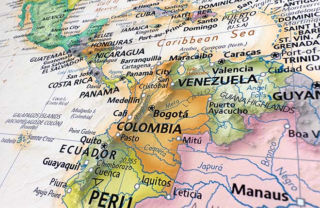
The map provides a richly illustrated view of an America filled with images and names that had been popularized in Europe following Columbus's 1492 voyage of discovery. Images of parrots, monkeys, mermaids, fearsome sea creatures, cannibals, Patagonian giants, and an erupting volcano in central Mexico complement the numerous settlements, rivers, mountains, and capes named. According to Ruth Putnam, in California: The Name (Berkeley, 1917), the Gutiérrez map contains one of the earliest references to California, for on it " C. California" is located on the southern tip of Baja California. The map correctly recognizes the presence of the Amazon River system, other rivers of South America, Lake Titicaca, the location of Potos and Mexico City, Florida and the greater southeastern part of the United States, and myriad coastal features of South, Central, North, and Caribbean America. It was to be the largest printed Spanish map of America to appear before the late eighteenth century.
There are three coats of arms on the Gutiérrez map: in the lower right, in the Atlantic Ocean east of Argentina is the coat of arms of the crown of Portugal, and Portuguese interests in India are noted in the Eastern Atlantic "La Flota De Portugal Que Va Par Calicute". In the southeastern and southwestern parts of what is now the United States are two coats of arms: the one on the left is that of the Spanish Habsburg Empire; to its right is that of the French crown. Gutiérrez's Americae is an official map, recognizing both Philip II, King of Spain from 1556 to 1598, and his half-sister Margarita de Parma, Regent of the Netherlands from 1559 to 1562.
The following inscription (in Latin on the map) gives evidence, seventy years after Columbus's historic voyage, of the popular belief that Americus Vespucius discovered America in 1497: "This fourth part of the world remained unknown to all geographers until the year 1497, at which time it was discovered by Americus Vespucius serving the King of Castile, whereupon it also obtained a name from the discoverer.
Early reference to California
The map has been used as evidence in two South American boundary disputes. It was reproduced in part in Frontires entre le Brsil et la Guyane Franaise. Mmoire prsent par les tats Unis de Brsil. Atlas (Paris, 1899) and Juicio de lmites entre el Per y Bolivia. Prueba peruana presentada al gobierno de la Repblica Argentina por Vctor M. Maurtua. Atlas (Barcelona, 1906). A tracing of it was made in the nineteenth century by Johann Georg Kohl for his hand-copied collection of maps in European libraries and archives for the study of the discovery, exploration, and mapping of North America, now in the Geography and Map Division, Library of Congress.
The Library of Congress's copy of the Gutiérrez map was formerly in the collection of the Duke of Gotha in Germany. Sold at a 1932 auction in Munich, it was subsequently acquired by an American book dealer who sold it to Lessing J. Rosenwald, the well-known collector of illustrated books. The Gutiérrez map was among the items received when Mr. Rosenwald gave a portion of his collection to the Library of Congress in 1949.
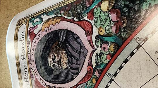
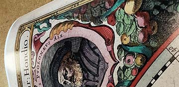
Detail of the fine engraving of Hieronymus
Diego Gutiérrez was a cosmographer at the Casa de la Contratacin, in its office of Pilot Major. His father, also named Diego Gutiérrez, was the head of a Sevillean family map- and instrument-making business from the early part of the sixteenth century until his death in 1554. The elder Diego Gutiérrez, also a map maker of note, became associated with the work of theCasa de la Contratacin and catered to the navigational information needs of navigators and pilots engaged in that extraordinary time of exploration and travel to America, practically at its inception in the early part of the sixteenth century.
The mapmaker Diego Gutiérrez had been named cosmographer in the Casa de la Contratacin by a royal appointment on October 22, 1554, following the death of his father Diego in January 1554. He received a salary of 6,000 maravedis because of his known ability to make navigational charts and other nautical instruments. On the famous 1562 map of America he is identified as the "Auctore Diego Gutiero Philippi Regis Hisp. Etc." That is, "Diego Gutiérrez, cosmographer at the time of the reign of Philip II of Spain." He served as a cosmographer in the Casa de la Contratacin from 1554 to at least 1569, according to documents in the Archivo General de Indias in Seville. He was among a number of cartographers in the Casa de la Contratacin known as cosmographers, including Alonso de Chaves (Pilot Major), Francisco Falero, Jernimo de Chaves, Sancho Gutiérrez (Diego's brother), and Alonso de Santa Cruz. Diego Gutirrez was distinguished from the rest as "oficial de hacer cartas de marear" ["an official who makes sea charts"]). Diego's brother, Sancho Gutiérrez, became a cosmographer in the Casa on May 18, 1553.
The engraver of the map, Hieronymus Cock, was a Flemish artist of recognized talent who worked in Antwerp. He has been considered one of the most important engravers and printmakers in Europe in the sixteenth century. In the second half of the sixteenth century, Antwerp became the major center for the production of prints and books in the Low Countries. Cock was the son of Jan Wellens or Willems, alias Cock, and had a brother, Mathias Cock; they were both noted painters. Born at Antwerp in 1510, Cock was admitted to the Guild of St. Luke as a master painter in 1545 and later engaged in engraving and print selling. Between 1546 and 1548 he studied in Rome, where he was influenced by the work of the noted artists and printmakers Antonio Salamanca and Antonio Lafrery. In Antwerp in 1548 Cock established the shop Aux Quatre Vents [To the The Four Winds]. Between 1548 and the time of his death in 1570 he carried on a very successful business, popularizing art through his engravings of the finest works of the Dutch masters.
In 1550 Cock prepared his first engraving of ruins of Ancient Rome, followed by twenty-four plates of the ruins in May 1554. He engraved various works in honor of Charles V, Holy Roman Emperor and King of Spain, including the "Pompa funebris" in 1559, depicting the funeral cortege organized in Brussels in 1558 by Philip II in honor of his father. Cock in 1555 engraved portraits of Philip II and Maria and Maximillian II of Austria. He engraved a portrait of Charles V in 1556 and produced the Divi Caroli V imp. opt. max. victoriae, in 1563, a series of twelve engravings illustrating the triumphs of that emperor. Cock engraved several maps, including those of Leiden (1550), Piedmont (1551), Sicily (1553), Turkey and Persia by Castaldo (1555), Siena (1555), Ostia (1557), an Antwerp bird's-eye view (1557), Siege de Saint-Quentin (1557), Ypres (1562), Hableneuf (1563), Malta (1565), Bourgogne by Ferdinand de Launoy (1562), and the Holy Land by Petru Laicksteen (1562) in addition to the 1562 America map. He engraved several of the maps for Abraham Ortelius's Theatrum Orbis Terrarum, published in 1570 by the Plantin Press in Antwerp and is cited in Ortelius's Catalogus Auctorum Tabularum Geographicarum. His engravings also appeared in Jacob van Deventer's Nederlansche Steden, Braun and Hogenberg's Civitates Orbis Terrarum, and Sebastian Mnster's Cosmographia. In order to invest his business with an official status and obtain privileges, Cock had as his patron the powerful Antoine Perrenot, Cardinal de Granvelle (1517-1586), to whom some of Cock's prints are dedicated. His widow carried on the business after his death in 1570.
Facts concerning the distribution of the 1562 map of America or the number of copies prepared are not known.
Coats of arms of Spain and France
It would seem that a substantial number of copies of the map must have been printed since it was intended to define authoritatively boundaries of Spain's sphere of influence in America while, simultaneously, recognizing the French and Portuguese presence. It is ironic that in the 1560s, following the issuance of the map, Spain was forced to reinforce its presence along the northern Atlantic coast in North America. In 1562 France began to colonize sites in what are now South Carolina and Florida, threatening Spain's exclusive control in the area.
It is possible that the map was produced, at the request of official Spain, through Antoine Perrenot de Granvelle who was the Spanish negotiator of the 1559 Treaty of Cateau Cambrsis. As was mentioned earlier, Granvelle was the patron of much of Cock's printing in Antwerp. That treaty between France and Spain, and a separate one by the same name between France and England brought to a close nearly thirty years of constant warfare in Western Europe. And the recognition of Philip II on the map, to whom Gutirrez was cosmographer, indicated that the map itself probably was prepared after 1556, when Charles V abdicated the throne in favor of Philip II and retired to the Monastery of Yuste in Extremadura. Charles died on September 21, 1558.
Fleets fighting for dominance in the South Atlantic
The April 3, 1559 Treaty of Cateau Cambrsis between Spain and France is a key event in the map's preparation. That treaty and another signed on April 2, 1559 between France and England are known collectively as the Peace of Cateau Cambrsis. Those treaties contained the most comprehensive agreements drawn up before the Peace of Westphalia in the seventeenth century, thus effectively establishing legal and political status quo for Western Europe for ninety years. Concluded with the treaty was a French-Spanish agreement, namely the marriage of Elizabeth of Valois, daughter of Henry II, King of France, to Philip II in the summer of 1559. The marriage alliance between the two kingdoms is possibly an explanation for the very close positioning of the coats of arms of Spain and France on the Gutiérrez map.
An apparent oral agreement between French and Spanish negotiators at Cateau Cambrsis concluded that the geographical parameters of the treaty were not to extend to non-European areas, for example, in America, where the French claimed the right to trade, which Spain denied.
One of the noteworthy omissions in the Gutiérrez map of America is the absence of the famous line of demarcation. This hypothetical vertical line in the Atlantic Ocean served as the division between Spanish and Portuguese possessions in America. West of the line were Spain's areas of influence. In the Gutiérrez map the most prominent line of demarcation is not a vertical line but rather a parallel or horizontal line, representing the Tropic of Cancer at 23 30' N. One would have expected instead the parallel of Cape Bojador at 26 N, which passes south of the Canaries, and was used by Pope Martin V in the fifteenth century to grant exclusive privileges to the Portuguese southwards down the African coast, and by Pope Nicholas V in Romanus Pontifex (1455) and in all subsequent bulls on the subject of spheres of influence. But the latitudinal line mentioned in the 1559 Treaty of Cateau Cambrsis and prominently shown on the Gutiérrez map was that of the Tropic of Cancer.
But why was the famous vertical line of demarcation, that line separating Europe from America, not referred to in the treaty of Cateau Cambrsis and on the map? Diplomatic documents after the 1559 treaty state simply that Spain's sphere of influence is south of the Tropic of Cancer and west of the prime meridian. But not knowing what prime meridian creates a problem with ascertaining the location of the line of demarcation. Was it to be the line given in the Papal Bull of 1493 or that in the Treaty of Tordesillas of 1494; and for that matter which island in the Atlantic Ocean was to be used as the eastern terminus from which the distance to the line of demarcation was to be determined? There was no agreement upon which privilege was to be accepted, and even individual treaties remained unclear when references were made to the easternmost starting point, whether west of the meridian of Ferro or Pico in the Azores or one of the Cape Verde Islands.
Portugal's coat of arms
In the sixteenth century, no one could determine longitudes across the oceans with more than a rough approximation of accuracy. From the outset of the diplomatic history of the Americas, it was concluded by diplomats, as well as distinguished Spanish jurists and theologians, that the Pope in Rome had no right to give away what did not belong to him, and that the only valid claim that Spain could assert to any part of America was to those areas it effectively occupied. In their sixteenth- and seventeenth-century relations with Spain, other European powers, with the exception of Portugal, recognized only one line, and that was the Tropic of Cancer. And Spain had chosen to use that line without regard for papal donations, for practical reasons. Navigators could easily ascertain the location of the Tropic of Cancer. What made it particularly useful was that Cancer ran through the Straits of Florida with the safest channel well on its Cuban, or southern, side. So no ship could enter West Indian or Caribbean waters, not even the Gulf of Mexico, without crossing the Tropic of Cancer. Spain was vitally interested in preserving the monopoly of its American trade and the safety of its silver and gold fleets. Until 1559 the only serious threat to its monopoly was France, and no sooner did French interlopers and corsairs begin to be a nuisance than measures began to be taken to pursue and eliminate them anywhere below the Tropic of Cancer. The normal relation between Spain and France, especially before 1559, had been war.
The long snaking path of the Amazon River
Above the Tropic of Cancer, Spain's interests and ambitions were more limited. It at times lay claim, through expeditions and colonization attempts, to that area and its offshore islands on the grounds of Pope Alexander's 1493 bull. But its primary concern was to safeguard its treasure fleets and prevent the establishment of potentially hostile bases.
With the map and the treaty of Cateau Cambrsis, Spain and France acknowledged areas of possession in America. At the time of the map the ill-fated French settlement of Nicolas de Villegaignon in Portugal's Brazil, following France's 1555 establishment of its "La France Antarctique" in Guanabara Bay, was under continuous attack by the Portuguese until it was removed in 1567. South of the Tropic of Cancer. Spain had firm control in its America. But from the Florida Keys northward Spain had not effectively placed its flag. In the 1560's in present-day South Carolina and Florida, the most ambitious effort to test Spanish resolve occurred. In 1562 a new French colony was established in Florida under Jean Ribaut and Ren de Laudonnire only to be destroyed by the Spanish in 1565 with the subsequent establishment of the first permanent settlement in what is now the United States, Saint Augustine, as a protective station for the Spanish gold fleet returning from America to Spain.
Gutiérrez's magnificent
Animals of Africa
1562 map of America was not intended to be a scientifically or navigationally exacting document, although it was of large scale and remained the largest map of America for a century. It was, rather, a ceremonial map, a diplomatic map, as identified by the coats of arms proclaiming possession. Through the map, Spain proclaimed to the nations of Western Europe its American territory, clearly outlining its sphere of control, not by degrees, but with the appearance of a very broad line for the Tropic of Cancer clearly drawn on the map.
The map of America has rarely gained the recognition and the study that it deserves. Perhaps its uniqueness, with only two known copies extant, has contributed to its relative obscurity in cartographic literature. Or, it is possible that the controversy over who actually made the map, whether the father or less well-known son, has confused researchers. But, for whatever reason that limited information is known about this large map of America, it is hoped that this facsimile of the map in the Library of Congress's Geography and Map Division can generate interest in further research on Diego Gutiérrez and his 1562 map of America. Perhaps then this magnificent map can enter its proper rank among the cartographic treasures of the early years of European exploration of America.
Dr. John R. Hebert Chief Geography and Map Division Library of Congress Washington, D.C. Text provided by the Library of Congress "American Memory" archives.
We use top-notch materials printed on demand using the Giclée printing method, so you get amazing detail and bright colors every time.
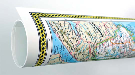
Archival Paper
Premium fine art paper that provides accurate color reproduction with high-contrast, high-resolution print output and maximum image permanence. A high-quality Giclée print ready for framing.
Museum quality paper for high-quality fine art.
Ultra smooth, neutral white matte finish.
Heavy-weight 230 gsm, 9.5 mil thickness.
Printed with pigment inks for longer print life and enhanced fade resistance.
Pigment based Canon LUCIA inks provide smooth tones and rich colors in fine, precise detail.
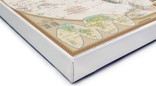
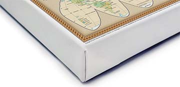
Canvas Gallery Wrap
A high quality canvas giclee print is hand stretched over a sturdy wood frame. Printed on demand and handcrafted in Seattle, WA. The canvas gallery wrap serves as a stunning piece of art ready to hang on your wall.
Premium 19 mil canvas material.
Pigment based Canon LUCIA inks provide smooth tones and rich colors in fine, precise detail.
High quality giclee fine art print with a lightfastness rating of over 100 years.
Durable canvas mounted to a 1.25" deep wood frame.
Ready to hang with included easy-to-use hanging kit.
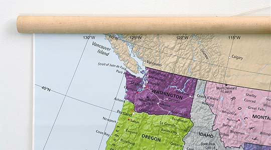
Canvas on Wood Rails
A canvas giclee print that is mounted to wood hanging rails placed along the top and bottom of the map. Rail mounted maps are ready to hang via the attached hanging cord. Solid wood rails have a natural finish.
Premium 19 mil canvas material.
Wood rails are 1 1/8" wide, round front.
USA sourced solid maple wood.
High quality giclee fine art print with a lightfastness rating of over 100 years.
Pigment based Canon LUCIA inks provide smooth tones and rich colors in fine, precise detail.
Luster Photo Paper
A premium semi-gloss photo paper with a subtle texture that produces a vivid, richly detailed print. This material results in an exquisitely detailed giclee print of substantially higher quality than a standard poster.
Printed on 10 mil premium luster photo paper resulting in a brilliant, colorful image with a vivid life-like quality.
Pigment based Canon LUCIA inks provide smooth tones and rich colors in fine, precise detail.
Inks have a lightfastness rating of over 100 years, guaranteeing minimal noticeable fading over a very long period of time.
Printed using very high resolution source files.
Giclee printing is superior to traditional lithography in a number of ways: colors are brighter, lasts longer, and is a higher resolution.
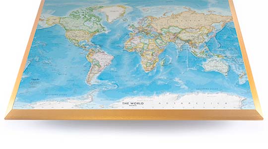
Framed Print
Our gallery quality frames are made of solid wood and feature optical-grade acrylic. Each framed map is printed on premium archival matte fine art paper.
Printed on thick, luxurious acid-free fine art paper & dry-mounted to foam board.
Pigment inks ensure a vivid print with amazing colors and excellent fade resistance.
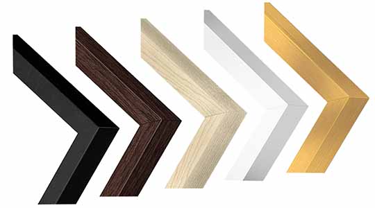
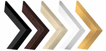
Solid wood frame in 5 finishes has a 7/8" face & 1.25" depth.
Kraft paper protective backing & hanging wire installed.
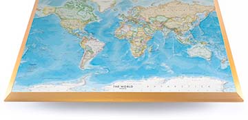
Plaque Mount
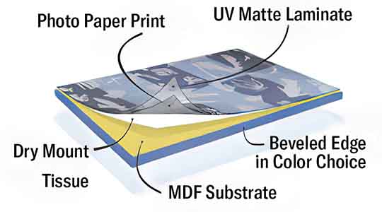
A museum grade display featuring high-resolution printing on premium photo paper, mounted on a durable wood plaque with a protective matte laminate. Surface can be cleaned with glass cleaner.
A premium photo print is dry-mounted to onto wood substrate (MDF).
Features a highly durable laminated surface that is scratch-resistant, water-resistant and fade-resistant.
Lamination is a non-glare matte finsh that can be wiped clean with a damp cloth or glass cleaner.
Mounted to 3/8" thick MDF wood panel with a 3/8" wide beveled edge available in premium foil color options.
Keyhole slot with velvet feet on the corners for easy wall mounting. Hanging hardware included.
Plaque Mounting Process
Gallery quality map prints made in the USA
We specialize in producing high-quality, detailed maps using advanced printing technologies and premium materials. Stringent quality control and ultra-high-resolution printing guarantee absolute clarity and precise detail at any size. Whether it's a smaller wall map print or a gigantic wallpaper map mural, no print will appear blurry or pixelated. You can expect every detail on the map to be sharp and clear.
Finely Crafted Cartographic Works of Art
Many of the maps we provide are created by our small team of cartographers under the name Academia Maps.
Museum Quality Materials
We source the best materials for our map prints and wallpaper maps. Premium archival inks guarantee rich vibrant colors with excellent fade resistance.
USA Print Production
We are a small business located in Seattle, WA that has been printing maps for over 15 years. Each map is printed on-demand using high-end fine art printers.
Shipping Costs
Free Ground Shipping within the contiguous United States and a flat rate of $20.00 to AK and HI.
Canada via UPS Standard is $40.00 USD.
Worldwide Shipping is available and shipping costs will be calculated at checkout.
Shipping Times
Most items are made to order and ship from our Seattle, WA facility. Typical production lead times are listed below. Shipping transit time is 2-5 business days depending on the delivery location. If you need your map by a certain deadline please contact us for expedited options.
Archival Paper, Laminated Maps, and Peel & Stick - 5-7 business days
Wood Rail Mounting - 3-4 weeks
Canvas Gallery Wraps & Framed Maps - 3-5 business days
Push Pin Maps - 3-5 business days
Spring Roller Maps - Varies, see product description
Wallpaper Map Murals - 7-10 business days
Returns
If you are unhappy with your order for any reason you can return it within 30 days of the delivery date. Customized items are non-returnable.
Yes, we can produce a majority of the map titles found on our website in a custom size. If you would like to request a custom size, take note of the map title and item#, then follow one of the links below to make your request. We will follow up with a link to checkout.
(for rolled or mounted prints)
(for larger peel & stick / wallpaper maps)
All of our maps are currently labeled as "Gulf of Mexico". Since our map products are printed to order, we can offer the alternate "Gulf of America" labeling by request.
If you would like your map to be labeled Gulf of America instead of Gulf of Mexico, simply request this in the comments section at checkout, and we will update the map.
We accept purchase orders from schools and government entities. You can e-mail a copy of your PO to contact@worldmapsonline.com.
View more information and download our W-9.
No problem, send a screenshot or PDF of your shopping cart to contact@worldmapsonline.com and will promptly follow up with a quotation.
Our products are printed on demand and have the following production lead times:
Archival Paper, Laminated Maps, and Peel & Stick - 5-7 business days
Wood Rail Mounting - 3-4 weeks
Canvas Gallery Wraps & Framed Maps - 3-5 business days
Spring Roller Maps - Varies, see product description
Shipping transit time is 2-5 business days and will vary depending on your location. Most products ship from Seattle, WA.
Many of the maps found on our website can be customized, including adding a personalized title/legend or company logo, modifying the color scheme, change text labels, adding points of interest, and placing GIS data on the map.
If the order is shipping outside of Washington state, sales tax may not apply. We collect sales taxes per state and local laws. Sales tax is calculated at checkout based on the delivery address.
We can ship to nearly any country. The shipping cost is determined for Canada and most European countries at checkout. If you find that shipping is unavailable to your country when checking out then please contact us with a list of the products you would like to order as well as size and material options.
We can produce a custom map for any location in the world. Whether you are looking for a detailed city street map or high resolution satellite imagery of a remote area, we have you covered.
Because maps aren't just décor—they're personal stories, travel memories, and future adventures waiting to happen. SHOP BESTSELLING MAPS
🎁 Meaningful: Track travels, spark memories, plan new experiences.
🎄 Perfect for gifts: Unique, educational, and visually stunning.
🏠 Fits any home décor: Modern, vintage, minimalist & artistic styles available.
✏️ Personalizable: Add names, family titles, travel quotes (push-pin maps).
✈️ Great for travelers, students, families, teachers & offices.
Wall Maps Material Info
We use museum grade papers and canvas along with high quality solid wood mounting options.
Made in the USA
Archival Paper
Premium Giclée fine art print on thick acid-free paper with a matte finish. Features rich, vibrant colors with precise detail.
Luster Photo Paper
Giclée fine art print on semi-gloss photo paper. A richly detailed print with vivid colors.
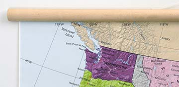
Canvas on Wood Rails
High-quality giclée print on artist-grade canvas mounted to natural finish solid wood hanging rails placed along the top and bottom of the canvas. Hanging cord at top.
Canvas Gallery Wrap
High-quality giclée print on artist-grade canvas. Wrapped around a sturdy wooden frame, this print is perfect for adding depth and texture to any space.
Framed Map Print
Printed on high-grade fine art paper and mounted in a solid wood frame available in 5 finishes. The print is protected behind optical-grade clear acrylic.
Plaque Mount
A high resolution photo print dry-mounted to wood and sealed with a durable matte laminate. A sleek frameless look with a beveled edge that is available in multiple color finishes.
Size Guide
These mockups are to be used as a general visual aid to assist you in choosing a size. The measurements may not reflect the exact sizes of the product you are viewing. It is always best practice to measure your wall space prior to ordering.
Our wall maps and wallpaper map murals are handcrafted by our small team in Seattle, WA.
School Purchase Orders
We accept purchase orders from schools and other government institutions. Learn more here.
High Quality Materials
Maps are printed on premium fine art papers, canvas, and durable wallcovering materials using archival inks.
Stunning Cartography
Original and up-to-date maps designed by our cartographic team at Academia Maps include a range of high quality maps for geographic exploration, home decor, and classroom learning.