3D Raised Relief Maps
Discover geography in a more detailed, dimensional way with our collection of raised relief wall maps. Unlike traditional flat maps, raised relief maps use molded, three-dimensional terrain to show mountain ranges, valleys, basins, plateaus, rivers, coastlines, and other major physical features. These 3D maps make it easier to understand how landscapes are formed, how regions connect, and how elevation changes across the Earth’s surface.
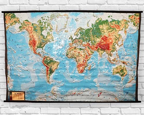
World 3D Raised Relief Maps
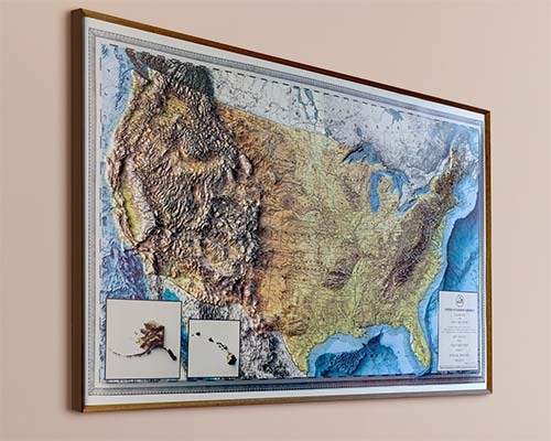
United States 3D Raised Relief Maps
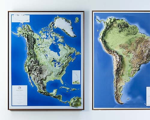
Continent 3D Raised Relief Maps
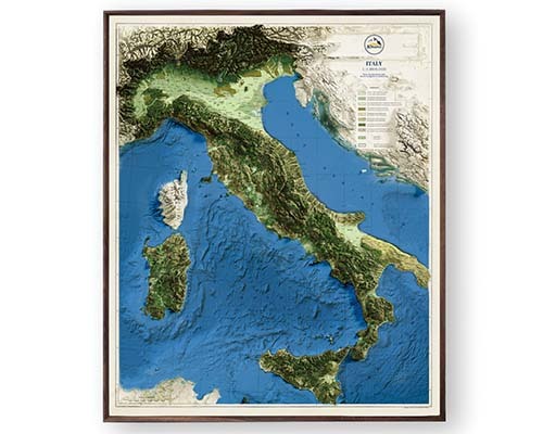
Country 3D Raised Relief Maps
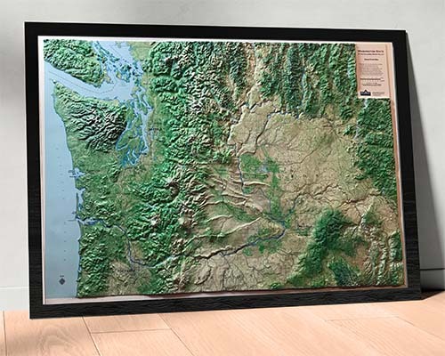
State 3D Raised Relief Maps
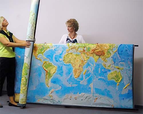
Large 3D Raised Relief Maps
A 3D raised relief map is ideal for anyone who wants more than a standard reference wall map. The raised terrain provides an immediate sense of scale and topography, helping viewers see the relationship between elevation, landforms, cities, borders, waterways, and natural regions. Teachers use relief maps to bring geography lessons to life. Travelers and hikers use them to visualize destinations and terrain. Map collectors, historians, and outdoor enthusiasts appreciate them as beautiful, functional displays.
A raised relief map is a three-dimensional wall map where the terrain is physically molded to show mountains, valleys, plateaus, and ocean floors in tactile detail. You can run your fingers across the surface and feel the elevation changes. This makes geographic features tangible rather than abstract, creating both a powerful educational tool and dramatic wall art.
Yes. The terrain on a raised relief map is physically elevated. You can feel mountain ranges, river valleys, and coastal features by touch. The Rocky Mountains, Himalayas, and Andes are prominently raised, while lowlands and ocean floors are recessed. This tactile quality makes them exceptional for both education and visual impact.
Raised relief maps are one of the most effective geographic teaching tools available. Students can see and feel terrain features that are invisible on flat maps, making concepts like elevation, continental divides, and ocean floor topography concrete and memorable. They are especially valuable for visual and kinesthetic learners.
Raised relief maps are available in a range of sizes from desk-size reference maps to large wall-format displays. World, US, state, continent, and country options are available. The 3D Raised Relief Maps collection offers detailed sizing information for each product.
Absolutely. A raised relief map makes a striking conversation piece in a home office. The three-dimensional terrain catches light beautifully, creating visual depth that flat prints cannot match. It serves as both a functional geographic reference and a distinctive piece of wall art.
States and regions with dramatic terrain variation are especially impressive in raised relief. Mountain states like Colorado, California, and Washington showcase dramatic elevation differences. However, even flatter regions reveal surprising geographic detail in relief form, showing river valleys, subtle ridges, and coastal features.
Raised relief maps are designed for wall display or desktop use, so currently do not come with any mounting hardware.
Raised relief maps have molded terrain surface that is durable and maintains its shape over time. While they should not be subjected to heavy impact, they hold up well under normal classroom conditions including regular student interaction.
Raised relief maps are one of the most well-received gift choices for geography teachers, travel enthusiasts, and anyone who appreciates maps. The tactile, three-dimensional quality sets them apart from any other type of map and creates a genuine surprise factor that flat prints cannot achieve.
A regular physical map uses printed color gradients and shading to represent terrain on a flat surface. A raised relief map physically molds the surface so mountains are elevated and valleys are recessed, creating a true three-dimensional representation you can see and touch. Both show the same geographic information, but relief maps make it tangible.