

World Topography & Bathymetry Satellite Image Wall Map
Starting at $34.00


A stunningly detailed satellite image map of the world displaying both topography and bathymetry (ocean floor relief). Created by utilizing the latest techniques for turning satellite data into digital images, this is one of the most detailed and accurate satellite image maps of the world available.
*Features*
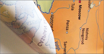
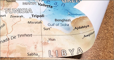
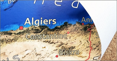
Enjoy being able to make out tens of thousands of the Earth's natural features with this exquisite map mural of the planet Earth on your wall. Easily point out large physical features like the Grand Canyon and Rocky Mountains, or relatively small Ayer's Rock in Australia, ocean floor tectonic plate boundaries are also clearly visible.
The map is derived from a composite of satellite imagery with a spatial resolution of 500 meters. A multitude of data sources were combined to produce this unique view of the Earth including: land imagery sourced from NASA's Landsat 8 captured between 2018 & 2020 and ocean bathymetric information from NOAA and GEBCO (General Bathymetric Chart of the Oceans). Antarctica data is compiled from the RAMP (Radarsat Antarctic Mapping Project Elevation Model) AMM-1 SAR image mosaic and RAMP digital elevation model, both version 2. Shaded-relief is based on NASA SRTM elevation data.
Also available in a version with country borders and place name labels.
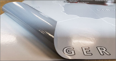
A thin canvas material that is removable & reusable multiple times without losing adhesive strength. Great for rental houses & apartments as it can be removed without damaging paint or leaving residue. Popular with renters.
Standard PVC-free wallpaper material featuring water activated adhesive. The wallcovering material is odorless & non-toxic. GREENGUARD Children & Schools Certified and FSC Certified. Printed with eco-friendly latex inks.
A durable commercial grade wallpaper that is ideal for high traffic public spaces. Surface is scrub and scratch resistant. Odorless & non-toxic GREENGUARD Gold Certified.
Durable removable vinyl wallcovering with dry-erase marker compatible lamination. Suitable for indoor and outdoor installations.
We can create a custom size mural. Fill out the form below or e-mail your request. We will follow up with pricing, a proof for review, and a link to place an order. Custom orders typically ship within 4-5 business days.
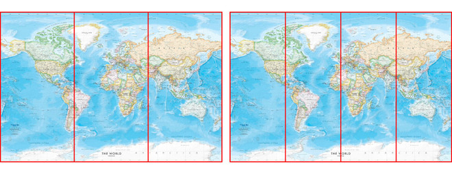
Our map wall murals are installed just like regular wallpaper, in multiple panels for ease of installation.
Peel & Stick Fabric Removable Wallpaper is an easy to install DIY option ideal for rental properties or temporary installs as it can be removed leaving no damage to paint or walls. Simply peel, place, and stick!
PEEL & STICK FABRIC INSTRUCTIONSPVC-free Wallpaper is a wet-strength pre-pasted wallpaper material. Paste can be activated by soaking panels or using a paste activator spray.
PVC-FREE WALLPAPER INSTRUCTIONSDurable Type II Wallpaper is a commerical grade wallcovering material with a textile scrim backing. This material does require a wallpaper adhesive for installation.
DURABLE TYPE-II WALLPAPER INSTRUCTIONSLaminated Vinyl Peel & Stick is an ultra-conformable calendared adhesive-backed vinyl with UV gloss laminate. Durable enough for outdoor installs including vehicle wraps. Professional installation is recommended.
LAMINATED VINYL INSTRUCTIONSMaps can be modifided with a custom color scheme to better fit your decor, a personalized title, or even adding custom points of interest. We also offer a full range of custom cartographic services. Contact us now with your custom request.
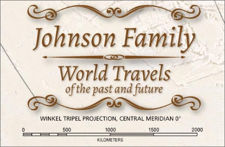
Personalize a map with a title such as your family name or add a custom designed map legend. Many decorative cartouche styles and fonts area available.
Maps can be modifided with a custom color scheme to better fit your decor. We can help you come up with a design that is completly unique to you.
We can add a logo for your organization, school, or business. Infographics and supplemental information can also be added to the map for a custom exhibit display.
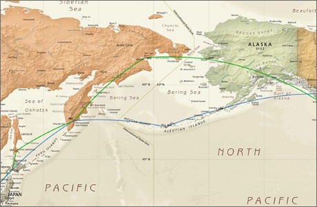
Mark specific locations on the map or add custom travel routes. We can take your point, line, or polygon GIS data and add it to one of our existing maps.
We offer a full range of custom cartographic services including custom area street maps, educational reference maps, maps for exhibitions, and even custom board game maps.
Contact us to learn more about our custom mapping services.


