Map and view of St. Louis, Mo. Drawn, engraved & printed by J.M. Kershaw.
Reproduction map of the city known as St. Louis, MO, engraved and printed by J. M. Kershaw. The steamboat era began in St. Louis in 1817. Steamboat technology enabled goods to be traded more efficiently than ever before. The boats were very dependable, unlike the hand-propelled barges and keel boats that had been used, as they could navigate as easily upriver, against the current, as downriver. Rapids north of St. Louis made it the northernmost input for many of the large boats.
St. Louis was named "Gateway to the West", and by the 1830s, as many as 150 steamboats could be seen at the St. Louis levee at one time. Work began on the Courthouse building in 1839. After 1840, immigrants poured into the area from Europe as well as from the south during Reconstruction, seeking better opportunities. St. Louis grew in population from 20,000 in 1840, to 77,860 in 1850. In 1843, the city began running Omnibuses to transport its number of new residents. By 1850, St. Louis became the largest U. S. city west of Pittsburgh.
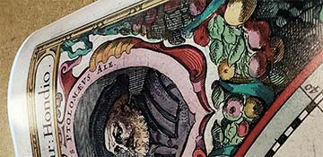
The map features clearly labeled street names. It features a pleasant scene of St. Louis from across the Missouri River, and border illustrations of St. Zaviers Church, Christs Church, Liberty Engine House, St. Louis Engine House, Oddfellows Hall, 2nd Presbyterian Church, Baptist Church, Gas Works, Missouri Engine House, Post Office, Medical Dept. St. Louis University, State Tobacco Ware House, Unitarian Church, The Old Market House and Levee, Theatre, McDowals Medical College, Centenary Church, Public School, Union Engine House, Shot Tower and Bank of Missouri.