Bird’s-eye View of Eastport, Washington County, Maine, 1879, Published by J. J. Stoner.
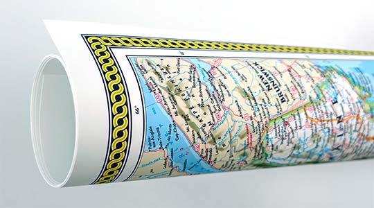
Reproduction print of historic Eastport, Maine as it appeared in 1879. A town deserving of its name, Eastport is the most eastern port in the United States. This map shows lively maritime activity in the harbor with a variety of masted vessels and steamboats depicted. The numbered references are clearly labeled on the map. Significant rust stains are apparant in the middle of the map.
Incorporated in 1798, the town was known as Moose Island when James Cochrane, a fisherman from Newburyport, Massachusetts arrived, becoming the first settler in 1772.
Fort Sullivan was built to protect American interests in 1809; however the British captured the fort in 1814, claiming that Eastport was on the British side of the border that had been established in 1783. Eastport was returned to the United States in 1818, with the final settlement reached through the Webster-Ashburton Treaty of 1842, assuring its position as the United States’ easternmost port.
The Greenback Party emerged in the 1870’s starting as a political movement opposed to the National Banking System and evolved into a party that supported an income tax and worker’s rights.
An interesting glimpse into local politics at the time this map was published is revealed in this brief article published in the “Daily Kennebec Journal” on September 22, 1879:
“Greenback Bulldozing at Eastport”
“The most conspicuous case of bulldozing in the late election which has come to our notice occurred in the town of Eastport. There are three fish factories in that town, at which quite a large number of men are employed. On the morning of election the proprietor or manager of one of these factories, made the announcement to his men to go and vote as they pleased, but if any man voted the republican ticket he need not come back to that factory expecting employment. Another one stood at the polls, and as his men came up he gave to each a greenback ticket, and watched to see that it was put into the ballot-box. When the time came to go to the polls the men from the three factories were formed in procession and, with fife and drum playing and two banners flying, marched to the place of meeting. Upon one of the banners was the inscription, “State Rights”, upon the other, “Greenbacks”. There were some sixty persons in the procession, all of whom marched to the polls and voted the greenback ticket. The town meeting was the most turbulent that has been known in Eastport for years, all on account of the bulldozing performances of the communistic greenbackers. We have not seen any account of this affair in any democratic paper in the State, although they have a great deal to say about bribery and bulldozing by the republicans. Neither have we seen anything in their pretended and fictitious reports of bulldozing by republicans that comes up to the enormity of the naked facts in this Eastport case, which we learn from reliable persons who were eye-witnesses of the same.” Features numbered & lettered references to the following locations:
• Memorial Hall. • High School. • Grammar School. • Trescott Hall. • Fort Sullivan. • U. S. Custom House, P. O. & Signal Office. • Fire Engine House. • Gas Works. • International S. S. Co’s Wharf. • Todd’s Head Battery. • Passamaquoddy House, A. Pike & Co., Proprietors. • Island House, E. S. Kenney Proprietor. • Paine Bro.’s Wharf. • Central Wharf, S. L. Wadsworth Commission Mer. • Union Wharf. • J. C. Young Smoke House. • Young & Stimpson Fish Wharf. • Market Wharf. • Kelly Bro.’s Fish, Dealers, Whalen’s Wharf. • Leavitt’s Wharf. • I. C. Blakey’s Wharf. • Martin & Sellman’s Wharf. • Michener’s • Odell’s. • Milliken’s Wharf. • D. G. Furbush & Son Fish Wharf. • Wolfe & Reessing Fish Wharf. • Pike & Faben Fish Wharf. • P. M. Kane Fish Wharf. • H. Blanchard Steam Mill. • Peabody & Cumming’s Wharf. • J. S. Buck Fish Wharf. • Bass Fish Wharf. • O’Grady’s Fish Wharf. • Custom House Wharf. • C. H. Dyer Wharf. • French’s Wharf. • Carrying Place
CHURCHES: • Baptist. • North Baptist. • Congregational. • Episcopal. • Methodist. • Roman Catholic. • Unitarian. • Cemetery.
We use top-notch materials printed on demand using the Giclée printing method, so you get amazing detail and bright colors every time.
Archival Paper
Premium fine art paper that provides accurate color reproduction with high-contrast, high-resolution print output and maximum image permanence. A high-quality Giclée print ready for framing.
Museum quality paper for high-quality fine art.
Ultra smooth, neutral white matte finish.
Heavy-weight 230 gsm, 9.5 mil thickness.
Printed with pigment inks for longer print life and enhanced fade resistance.
Pigment based Canon LUCIA inks provide smooth tones and rich colors in fine, precise detail.
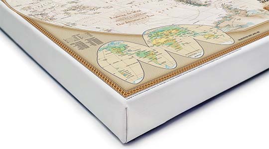
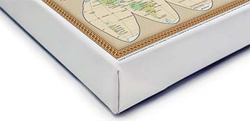
Canvas Gallery Wrap
A high quality canvas giclee print is hand stretched over a sturdy wood frame. Printed on demand and handcrafted in Seattle, WA. The canvas gallery wrap serves as a stunning piece of art ready to hang on your wall.
Premium 19 mil canvas material.
Pigment based Canon LUCIA inks provide smooth tones and rich colors in fine, precise detail.
High quality giclee fine art print with a lightfastness rating of over 100 years.
Durable canvas mounted to a 1.25" deep wood frame.
Ready to hang with included easy-to-use hanging kit.
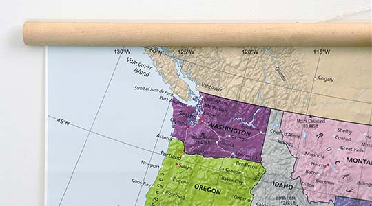
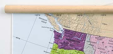
Canvas on Wood Rails
A canvas giclee print that is mounted to wood hanging rails placed along the top and bottom of the map. Rail mounted maps are ready to hang via the attached hanging cord. Solid wood rails have a natural finish.
Premium 19 mil canvas material.
Wood rails are 1 1/8" wide, round front.
USA sourced solid maple wood.
High quality giclee fine art print with a lightfastness rating of over 100 years.
Pigment based Canon LUCIA inks provide smooth tones and rich colors in fine, precise detail.
Luster Photo Paper
A premium semi-gloss photo paper with a subtle texture that produces a vivid, richly detailed print. This material results in an exquisitely detailed giclee print of substantially higher quality than a standard poster.
Printed on 10 mil premium luster photo paper resulting in a brilliant, colorful image with a vivid life-like quality.
Pigment based Canon LUCIA inks provide smooth tones and rich colors in fine, precise detail.
Inks have a lightfastness rating of over 100 years, guaranteeing minimal noticeable fading over a very long period of time.
Printed using very high resolution source files.
Giclee printing is superior to traditional lithography in a number of ways: colors are brighter, lasts longer, and is a higher resolution.
Framed Print
Our gallery quality frames are made of solid wood and feature optical-grade acrylic. Each framed map is printed on premium archival matte fine art paper.
Printed on thick, luxurious acid-free fine art paper & dry-mounted to foam board.
Pigment inks ensure a vivid print with amazing colors and excellent fade resistance.
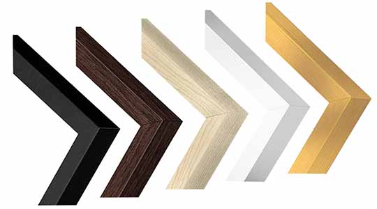
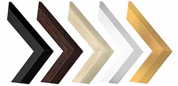
Solid wood frame in 5 finishes has a 7/8" face & 1.25" depth.
Kraft paper protective backing & hanging wire installed.
Plaque Mount
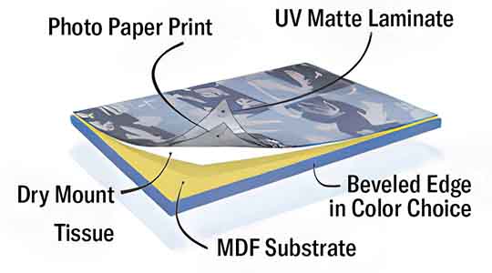
A museum grade display featuring high-resolution printing on premium photo paper, mounted on a durable wood plaque with a protective matte laminate. Surface can be cleaned with glass cleaner.
A premium photo print is dry-mounted to onto wood substrate (MDF).
Features a highly durable laminated surface that is scratch-resistant, water-resistant and fade-resistant.
Lamination is a non-glare matte finsh that can be wiped clean with a damp cloth or glass cleaner.
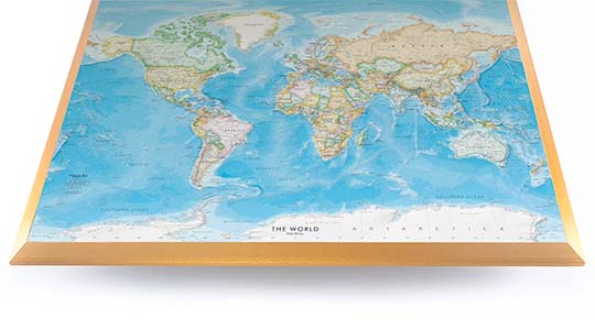
Mounted to 3/8" thick MDF wood panel with a 3/8" wide beveled edge available in premium foil color options.
Keyhole slot with velvet feet on the corners for easy wall mounting. Hanging hardware included.
Plaque Mounting Process
Gallery quality map prints made in the USA
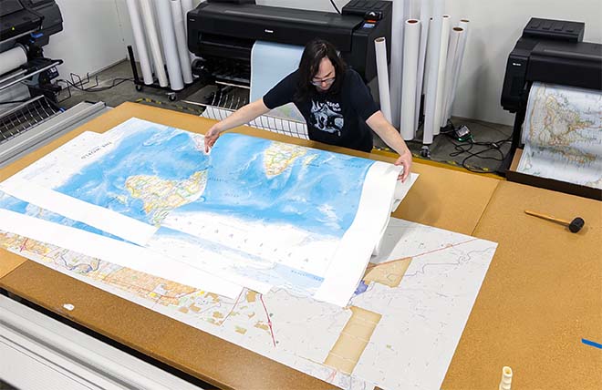
We specialize in producing high-quality, detailed maps using advanced printing technologies and premium materials. Stringent quality control and ultra-high-resolution printing guarantee absolute clarity and precise detail at any size. Whether it's a smaller wall map print or a gigantic wallpaper map mural, no print will appear blurry or pixelated. You can expect every detail on the map to be sharp and clear.
Finely Crafted Cartographic Works of Art
Many of the maps we provide are created by our small team of cartographers under the name Academia Maps.
Museum Quality Materials
We source the best materials for our map prints and wallpaper maps. Premium archival inks guarantee rich vibrant colors with excellent fade resistance.
USA Print Production
We are a small business located in Seattle, WA that has been printing maps for over 15 years. Each map is printed on-demand using high-end fine art printers.
Shipping Costs
Free Ground Shipping within the contiguous United States and a flat rate of $20.00 to AK and HI.
Canada via UPS Standard is $40.00 USD.
Worldwide Shipping is available and shipping costs will be calculated at checkout.
Shipping Times
Most items are made to order and ship from our Seattle, WA facility. Typical production lead times are listed below. Shipping transit time is 2-5 business days depending on the delivery location. If you need your map by a certain deadline please contact us for expedited options.
Archival Paper, Laminated Maps, and Peel & Stick - 5-7 business days
Wood Rail Mounting - 3-4 weeks
Canvas Gallery Wraps & Framed Maps - 3-5 business days
Push Pin Maps - 3-5 business days
Spring Roller Maps - Varies, see product description
Wallpaper Map Murals - 7-10 business days
Returns
If you are unhappy with your order for any reason you can return it within 30 days of the delivery date. Customized items are non-returnable.
Yes, we can produce a majority of the map titles found on our website in a custom size. If you would like to request a custom size, take note of the map title and item#, then follow one of the links below to make your request. We will follow up with a link to checkout.
(for rolled or mounted prints)
(for larger peel & stick / wallpaper maps)
All of our maps are currently labeled as "Gulf of Mexico". Since our map products are printed to order, we can offer the alternate "Gulf of America" labeling by request.
If you would like your map to be labeled Gulf of America instead of Gulf of Mexico, simply request this in the comments section at checkout, and we will update the map.
We accept purchase orders from schools and government entities. You can e-mail a copy of your PO to [email protected].
View more information and download our W-9.
No problem, send a screenshot or PDF of your shopping cart to [email protected] and will promptly follow up with a quotation.
Our products are printed on demand and have the following production lead times:
Archival Paper, Laminated Maps, and Peel & Stick - 5-7 business days
Wood Rail Mounting - 3-4 weeks
Canvas Gallery Wraps & Framed Maps - 3-5 business days
Spring Roller Maps - Varies, see product description
Shipping transit time is 2-5 business days and will vary depending on your location. Most products ship from Seattle, WA.
Many of the maps found on our website can be customized, including adding a personalized title/legend or company logo, modifying the color scheme, change text labels, adding points of interest, and placing GIS data on the map.
If the order is shipping outside of Washington state, sales tax may not apply. We collect sales taxes per state and local laws. Sales tax is calculated at checkout based on the delivery address.
We can ship to nearly any country. The shipping cost is determined for Canada and most European countries at checkout. If you find that shipping is unavailable to your country when checking out then please contact us with a list of the products you would like to order as well as size and material options.
We can produce a custom map for any location in the world. Whether you are looking for a detailed city street map or high resolution satellite imagery of a remote area, we have you covered.
Because maps aren't just décor—they're personal stories, travel memories, and future adventures waiting to happen. SHOP BESTSELLING MAPS
🎁 Meaningful: Track travels, spark memories, plan new experiences.
🎄 Perfect for gifts: Unique, educational, and visually stunning.
🏠 Fits any home décor: Modern, vintage, minimalist & artistic styles available.
✏️ Personalizable: Add names, family titles, travel quotes (push-pin maps).
✈️ Great for travelers, students, families, teachers & offices.
Wall Maps Material Info
We use museum grade papers and canvas along with high quality solid wood mounting options.
Made in the USA
Archival Paper
Premium Giclée fine art print on thick acid-free paper with a matte finish. Features rich, vibrant colors with precise detail.
Luster Photo Paper
Giclée fine art print on semi-gloss photo paper. A richly detailed print with vivid colors.
Canvas on Wood Rails
High-quality giclée print on artist-grade canvas mounted to natural finish solid wood hanging rails placed along the top and bottom of the canvas. Hanging cord at top.
Canvas Gallery Wrap
High-quality giclée print on artist-grade canvas. Wrapped around a sturdy wooden frame, this print is perfect for adding depth and texture to any space.
Framed Map Print
Printed on high-grade fine art paper and mounted in a solid wood frame available in 5 finishes. The print is protected behind optical-grade clear acrylic.
Plaque Mount
A high resolution photo print dry-mounted to wood and sealed with a durable matte laminate. A sleek frameless look with a beveled edge that is available in multiple color finishes.
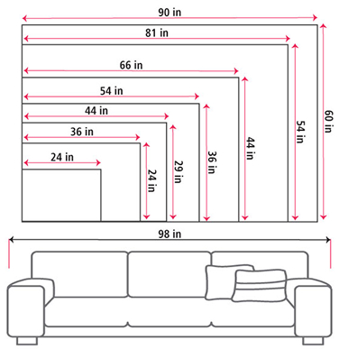
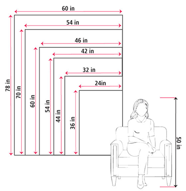
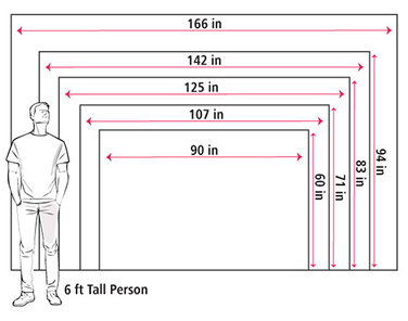
Size Guide
These mockups are to be used as a general visual aid to assist you in choosing a size. The measurements may not reflect the exact sizes of the product you are viewing. It is always best practice to measure your wall space prior to ordering.
Our wall maps and wallpaper map murals are handcrafted by our small team in Seattle, WA.
School Purchase Orders
We accept purchase orders from schools and other government institutions. Learn more here.
High Quality Materials
Maps are printed on premium fine art papers, canvas, and durable wallcovering materials using archival inks.
Stunning Cartography
Original and up-to-date maps designed by our cartographic team at Academia Maps include a range of high quality maps for geographic exploration, home decor, and classroom learning.