St. Louis, MO - 1904 Vintage Map Print (George W. Melville)
Item:1W-MO-SL-1904-S-P
MSRP:
Was:
Now:
$45.00
(You save)
UPC:
Free U.S.
Shipping
30-Day
Guarantee
Made in
the USA
Museum
Quality
Description
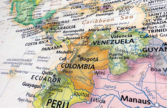
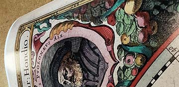
Panorama of the World's Fair, St. Louis, 1904. Louisiana Purchase Exposition Celebrating the Centennial of the purchase of the Louisiana Territory. Reproduction map of the town known as St. Louis, MO, celebrating the centennial of the Louisiana Purchase in 1904, drawn by George W. Melville.
Booster information below the title on the map reads as follows:
"In the production of this panorama of the fair, effort has been made by careful detail to portray the architectural beauties of all the buildings; and by general arrangement and color, convey to the observer in a comprehensive picture the vastness and "tout ensemble" of the exposition. Forest Park, where the World's Fair is located, previous to the erection of the buildings, was a succession of wooded hills and dales. Millions of dollars were expended in leveling and grading, to prepare the site for the main exhibit palaces, shown in the center of the picture; at either end of the grounds the country still rises to an elevation of seventy-five feet. The view is looking towards the south; the great palaces of Electricity, Varied Industries, Transportation and Machinery are shown on the right of the Court of Honor; on the left are Education, Manufacturers, Mines and Metallurgy and Liberal Arts. Surrounding these eight palaces of exhibits are ornamental parade plazas, sunken gardens, and the mile and one-half lagoon system, which encircles the Electricity and Educational buildings. Left of the Liberal Arts building rises the U. S. Government building, and further back the Missouri building and Plateau of State buildings, which reaches to the extreme south-east corner of the grounds. From this point, following the line of horizon to the right, one sees the grand Festival Hall, in the center of the picture, which, with the terrace of states, the beautiful cascades and gardens, form the central feature of the exposition. Directly behind this are the Palace of Art and Statuary Halls. Conspicuous among the Foreign Pavilions is that of Germany, located on Art Hill at the left of the Terrace of States, the Texas State building, in the form of a star, being a near neighbor. To the right of the Terrace, down in the depression, is Jerusalem; close by are the National Gardens of Japan, and Morocco; across the boulevard, the Fraternal Temple, plus California and Illinois State buildings; down to the right, the Observator (Ferris) Wheel, backed by the great Agricultural Palace and Philippine Reservation; lower in the picture, at the extreme right, are the Indian School and Villages, Map of the U. S. in growing crops, Athletic and Aeronautic fields, the Administration buildings of the Fair and the Pavilions of Foreign Nations. In the immediate foreground is shown the Pike or Midway, a street a mile long lined on either side with amusing and instructive world wonders. The World's Fair Grounds cover an area of about two square miles, being one and three-quarters miles long and one mile wide, containing 1,240 acres. The total cost of the Exposition, about $50,000,000." Complete reference list below.
Features references to the following locations:
EXHIBIT PALACES:
Palaces of Art and Statuary Palaces of Agriculture, twenty acres Palace of Education and Social Economy, eight acres Palace of Electricity, eight acres Palace of Forestry, Fish and Game, four acres Palace of Horticulture, seven acres Palace of Liberal Arts, nine acres Palace of Machinery, ten acres Palace of Manufacturers, fourteen acres Palace of Mines and Metallurgy, nine acres Palace of Transportation, fifteen acres U. S. Government Building, four acres Palace of Varied Industries, fourteen acres
STATE BUILDINGS:
Arizona Arkansas California Colorado Connecticut Idaho Illinois Indiana Indian Territory Iowa Kansas Kentucky
STATE BUILDINGS CONTINUED:
Louisiana (The Cabildo) Maine Massachusetts Michigan Minnesota Mississippi Missouri Montana New Hampshire New Jersey (Washington's Headquarters at Morristown) New York Nevada Ohio Oklahoma Oregon Pennsylvania Rhode Island South Dakota Tennessee Texas Utah Vermont Washington West Virginia Wisconsin
SPECIAL BUILDINGS:
Administration Buildings Alaska Closure Collonade of States Day Nursery Desciples of Christ Festival Hall Forest Park Hotel Grand View Fraternal Hotel General Grant's Cabin Hall of Congress House of Hoo Hoo Indian School Inside Inn (2,500 rooms) Lindell Entrance Live Stock Pavilion (thirty-seven acres and arena for live stock exhibits) Metal Pavilion Model City Buildings New York to North Pole Press Building Police Station Power House Restaurant Pavilions Refrigeration Plant Robert Burns' Cottage Temple of Fraternity T. P. A. Building U. S. Bird Exhibit U. S. Fisheries
PIKE OR MIDWAY LOCATIONS:
German Tyrolean Alps Irish Internation Exhibit Under and Over the Sea Old Seville Hunting in Ozarks Hackenback's Animals Fair Japan Old St. Louis Creation Siberian Railroad Deep Sea Divers Chinese Village Constantinople Magic Whirlpool Cliff Dwellers Scenic Railroad Naval Exhibit Galveston Flood Hales Fire Fighters Battle Abbey 49 Mining Camp Cairo Natatorium Palais du Costume Paris, Ancient and Modern Moving Pictures Glass Weavers Hereafter Moorish Palace Asia
FOREIGN PAVILLIONS:
Austria Belgium Brazil Canada China Cuba Ceylon France (Grand Trianon Palace, Versailles Gardens) Germany (Charlottenburg Palace) Great Britain (Orangery at Kensington Palace) India Japan "Gardens" Mexico Morocco Nicaragua Siam Sweden
SPECIAL ATTRICTIONS:
Aernautic Field, Air Ship Competition Athletic Field, for Olympian Games Aquatic Gardens Cascades and Gardens Competitive Forestry Exhibit (U. S. and Germany) Floral Clock, 100 feet diameter
SPECIAL ATTRACTIONS CONTINUED:
Intramural Railway Loop Indian Villages of U. S., thirty acres Irrigated Farm Life Saving Station on Lake Louisiana Purchase Monument Music Pagodas Map of U. S. in growing Crops, six acres Observation (Ferris) Wheel, 264 feet high Rose Garden, six acres Sunken Garden Philippine Reservation, forty acres Laguna de Bayie Bridge of Spain Wall around Manila Cathedral of Manila Government Buildings in Manila Villages of Philippine Natives (Water, Tree and Land Dwellers) Jerusalem Wall Around City Moslem Quarter, Dome of the Rock Jewish Quarter: Citidal and Wailing Wall Christian Quarter: Modern Buildings and Church of the Holy Sepulchre Gate of Damascus Gate of Jaffa Gate of the Moors
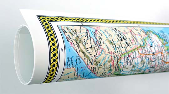
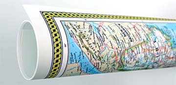
We use top-notch materials printed on demand using the Giclée printing method, so you get amazing detail and bright colors every time.
Archival Paper
Premium fine art paper that provides accurate color reproduction with high-contrast, high-resolution print output and maximum image permanence. A high-quality Giclée print ready for framing.
Museum quality paper for high-quality fine art.
Ultra smooth, neutral white matte finish.
Heavy-weight 230 gsm, 9.5 mil thickness.
Printed with pigment inks for longer print life and enhanced fade resistance.
Pigment based Canon LUCIA inks provide smooth tones and rich colors in fine, precise detail.
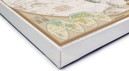
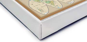
Canvas Gallery Wrap
A high quality canvas giclee print is hand stretched over a sturdy wood frame. Printed on demand and handcrafted in Seattle, WA. The canvas gallery wrap serves as a stunning piece of art ready to hang on your wall.
Premium 19 mil canvas material.
Pigment based Canon LUCIA inks provide smooth tones and rich colors in fine, precise detail.
High quality giclee fine art print with a lightfastness rating of over 100 years.
Durable canvas mounted to a 1.25" deep wood frame.
Ready to hang with included easy-to-use hanging kit.
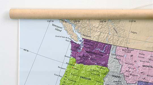
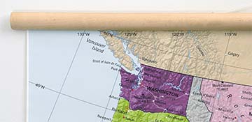
Canvas on Wood Rails
A canvas giclee print that is mounted to wood hanging rails placed along the top and bottom of the map. Rail mounted maps are ready to hang via the attached hanging cord. Solid wood rails have a natural finish.
Premium 19 mil canvas material.
Wood rails are 1 1/8" wide, round front.
USA sourced solid maple wood.
High quality giclee fine art print with a lightfastness rating of over 100 years.
Pigment based Canon LUCIA inks provide smooth tones and rich colors in fine, precise detail.
Luster Photo Paper
A premium semi-gloss photo paper with a subtle texture that produces a vivid, richly detailed print. This material results in an exquisitely detailed giclee print of substantially higher quality than a standard poster.
Printed on 10 mil premium luster photo paper resulting in a brilliant, colorful image with a vivid life-like quality.
Pigment based Canon LUCIA inks provide smooth tones and rich colors in fine, precise detail.
Inks have a lightfastness rating of over 100 years, guaranteeing minimal noticeable fading over a very long period of time.
Printed using very high resolution source files.
Giclee printing is superior to traditional lithography in a number of ways: colors are brighter, lasts longer, and is a higher resolution.
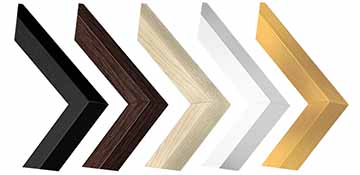
Framed Print
Our gallery quality frames are made of solid wood and feature optical-grade acrylic. Each framed map is printed on premium archival matte fine art paper.
Printed on thick, luxurious acid-free fine art paper & dry-mounted to foam board.
Pigment inks ensure a vivid print with amazing colors and excellent fade resistance.
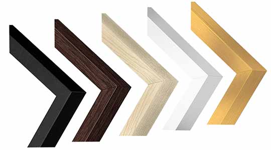
Solid wood frame in 5 finishes has a 7/8" face & 1.25" depth.
Kraft paper protective backing & hanging wire installed.
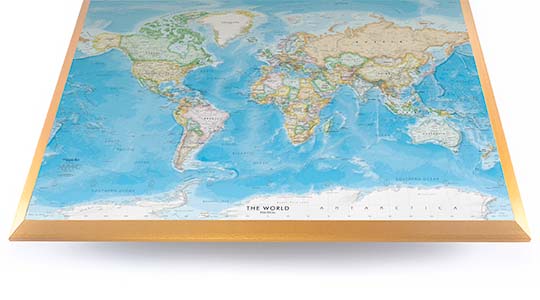
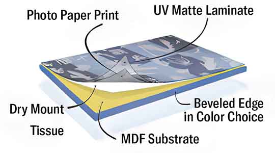
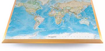
Plaque Mount
A museum grade display featuring high-resolution printing on premium photo paper, mounted on a durable wood plaque with a protective matte laminate. Surface can be cleaned with glass cleaner.
A premium photo print is dry-mounted to onto wood substrate (MDF).
Features a highly durable laminated surface that is scratch-resistant, water-resistant and fade-resistant.
Lamination is a non-glare matte finsh that can be wiped clean with a damp cloth or glass cleaner.
Mounted to 3/8" thick MDF wood panel with a 3/8" wide beveled edge available in premium foil color options.
Keyhole slot with velvet feet on the corners for easy wall mounting. Hanging hardware included.
Plaque Mounting Process
Gallery quality map prints made in the USA
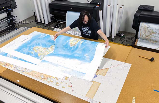
We specialize in producing high-quality, detailed maps using advanced printing technologies and premium materials. Stringent quality control and ultra-high-resolution printing guarantee absolute clarity and precise detail at any size. Whether it's a smaller wall map print or a gigantic wallpaper map mural, no print will appear blurry or pixelated. You can expect every detail on the map to be sharp and clear.
Finely Crafted Cartographic Works of Art
Many of the maps we provide are created by our small team of cartographers under the name Academia Maps.
Museum Quality Materials
We source the best materials for our map prints and wallpaper maps. Premium archival inks guarantee rich vibrant colors with excellent fade resistance.
USA Print Production
We are a small business located in Seattle, WA that has been printing maps for over 15 years. Each map is printed on-demand using high-end fine art printers.
Shipping Costs
Free Ground Shipping within the contiguous United States and a flat rate of $20.00 to AK and HI.
Canada via UPS Standard is $40.00 USD.
Worldwide Shipping is available and shipping costs will be calculated at checkout.
Shipping Times
Most items are made to order and ship from our Seattle, WA facility. Typical production lead times are listed below. Shipping transit time is 2-5 business days depending on the delivery location. If you need your map by a certain deadline please contact us for expedited options.
Archival Paper, Laminated Maps, and Peel & Stick - 5-7 business days
Wood Rail Mounting - 3-4 weeks
Canvas Gallery Wraps & Framed Maps - 3-5 business days
Push Pin Maps - 3-5 business days
Spring Roller Maps - Varies, see product description
Wallpaper Map Murals - 7-10 business days
Returns
If you are unhappy with your order for any reason you can return it within 30 days of the delivery date. Customized items are non-returnable.
Yes, we can produce a majority of the map titles found on our website in a custom size. If you would like to request a custom size, take note of the map title and item#, then follow one of the links below to make your request. We will follow up with a link to checkout.
(for rolled or mounted prints)
(for larger peel & stick / wallpaper maps)
All of our maps are currently labeled as "Gulf of Mexico". Since our map products are printed to order, we can offer the alternate "Gulf of America" labeling by request.
If you would like your map to be labeled Gulf of America instead of Gulf of Mexico, simply request this in the comments section at checkout, and we will update the map.
We accept purchase orders from schools and government entities. You can e-mail a copy of your PO to contact@worldmapsonline.com.
View more information and download our W-9.
No problem, send a screenshot or PDF of your shopping cart to contact@worldmapsonline.com and will promptly follow up with a quotation.
Our products are printed on demand and have the following production lead times:
Archival Paper, Laminated Maps, and Peel & Stick - 5-7 business days
Wood Rail Mounting - 3-4 weeks
Canvas Gallery Wraps & Framed Maps - 3-5 business days
Spring Roller Maps - Varies, see product description
Shipping transit time is 2-5 business days and will vary depending on your location. Most products ship from Seattle, WA.
Many of the maps found on our website can be customized, including adding a personalized title/legend or company logo, modifying the color scheme, change text labels, adding points of interest, and placing GIS data on the map.
If the order is shipping outside of Washington state, sales tax may not apply. We collect sales taxes per state and local laws. Sales tax is calculated at checkout based on the delivery address.
We can ship to nearly any country. The shipping cost is determined for Canada and most European countries at checkout. If you find that shipping is unavailable to your country when checking out then please contact us with a list of the products you would like to order as well as size and material options.
We can produce a custom map for any location in the world. Whether you are looking for a detailed city street map or high resolution satellite imagery of a remote area, we have you covered.
Because maps aren't just décor—they're personal stories, travel memories, and future adventures waiting to happen. SHOP BESTSELLING MAPS
🎁 Meaningful: Track travels, spark memories, plan new experiences.
🎄 Perfect for gifts: Unique, educational, and visually stunning.
🏠 Fits any home décor: Modern, vintage, minimalist & artistic styles available.
✏️ Personalizable: Add names, family titles, travel quotes (push-pin maps).
✈️ Great for travelers, students, families, teachers & offices.
Wall Maps Material Info
We use museum grade papers and canvas along with high quality solid wood mounting options.
Made in the USA
Archival Paper
Premium Giclée fine art print on thick acid-free paper with a matte finish. Features rich, vibrant colors with precise detail.
Luster Photo Paper
Giclée fine art print on semi-gloss photo paper. A richly detailed print with vivid colors.
Canvas on Wood Rails
High-quality giclée print on artist-grade canvas mounted to natural finish solid wood hanging rails placed along the top and bottom of the canvas. Hanging cord at top.
Canvas Gallery Wrap
High-quality giclée print on artist-grade canvas. Wrapped around a sturdy wooden frame, this print is perfect for adding depth and texture to any space.
Framed Map Print
Printed on high-grade fine art paper and mounted in a solid wood frame available in 5 finishes. The print is protected behind optical-grade clear acrylic.
Plaque Mount
A high resolution photo print dry-mounted to wood and sealed with a durable matte laminate. A sleek frameless look with a beveled edge that is available in multiple color finishes.
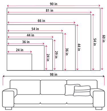
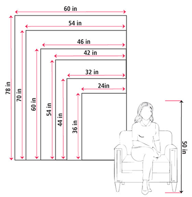
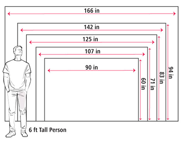
Size Guide
These mockups are to be used as a general visual aid to assist you in choosing a size. The measurements may not reflect the exact sizes of the product you are viewing. It is always best practice to measure your wall space prior to ordering.
Our wall maps and wallpaper map murals are handcrafted by our small team in Seattle, WA.
School Purchase Orders
We accept purchase orders from schools and other government institutions. Learn more here.
High Quality Materials
Maps are printed on premium fine art papers, canvas, and durable wallcovering materials using archival inks.
Stunning Cartography
Original and up-to-date maps designed by our cartographic team at Academia Maps include a range of high quality maps for geographic exploration, home decor, and classroom learning.