Continents / Countries Historical Maps
Discover our stunning collection of vintage and historical reproduction map prints of individual continents, countries, and international cities. These high-quality prints bring history to life, showcasing the artistry and cartography of bygone eras. Perfect for collectors, educators, and history enthusiasts, these maps add timeless elegance to any decor in the home, office, or classroom. Explore the world’s heritage with these beautifully crafted reproductions.
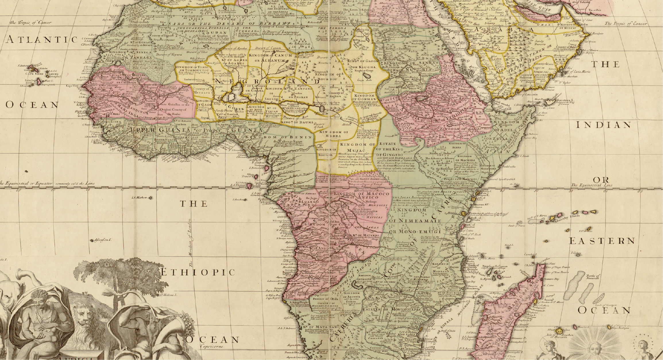
Africa Historical Maps
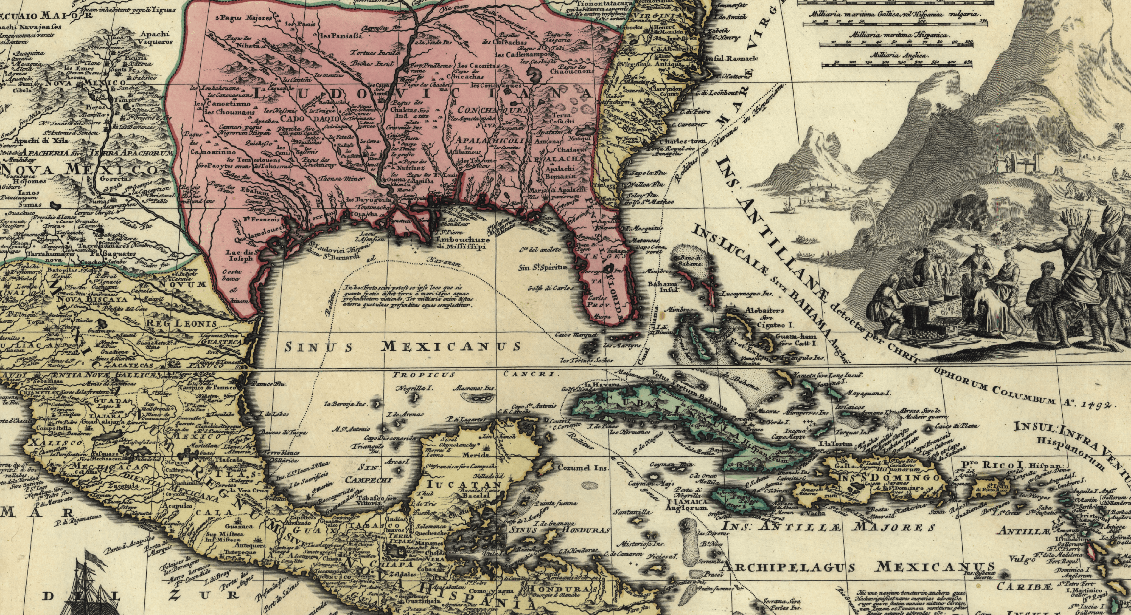
Americas Historical Maps
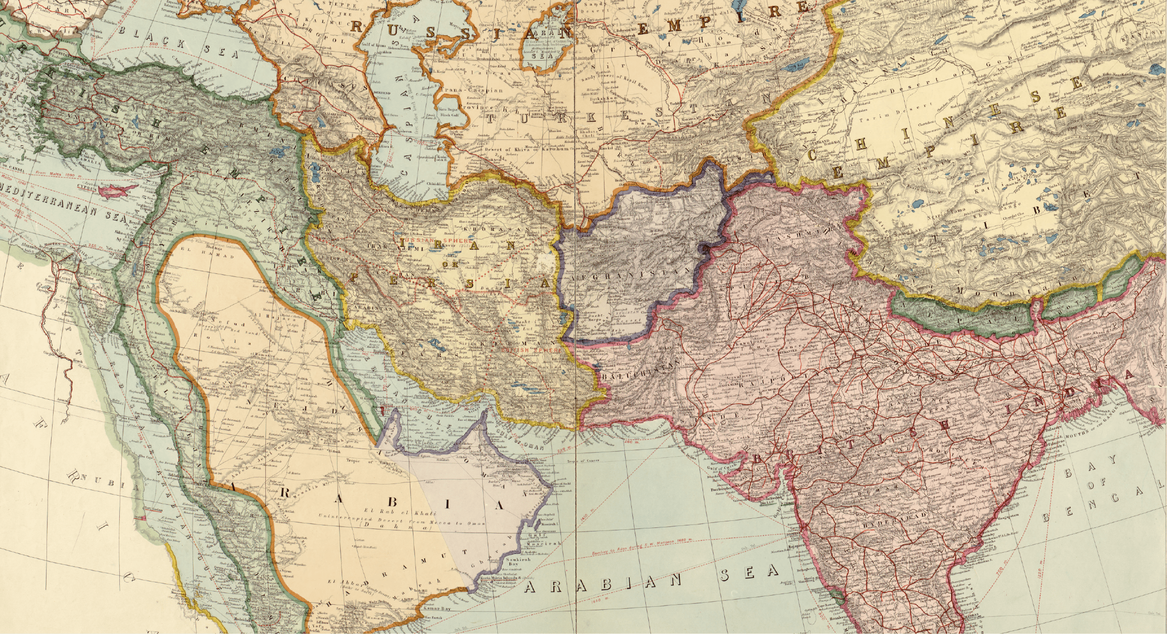
Asia Historical Maps
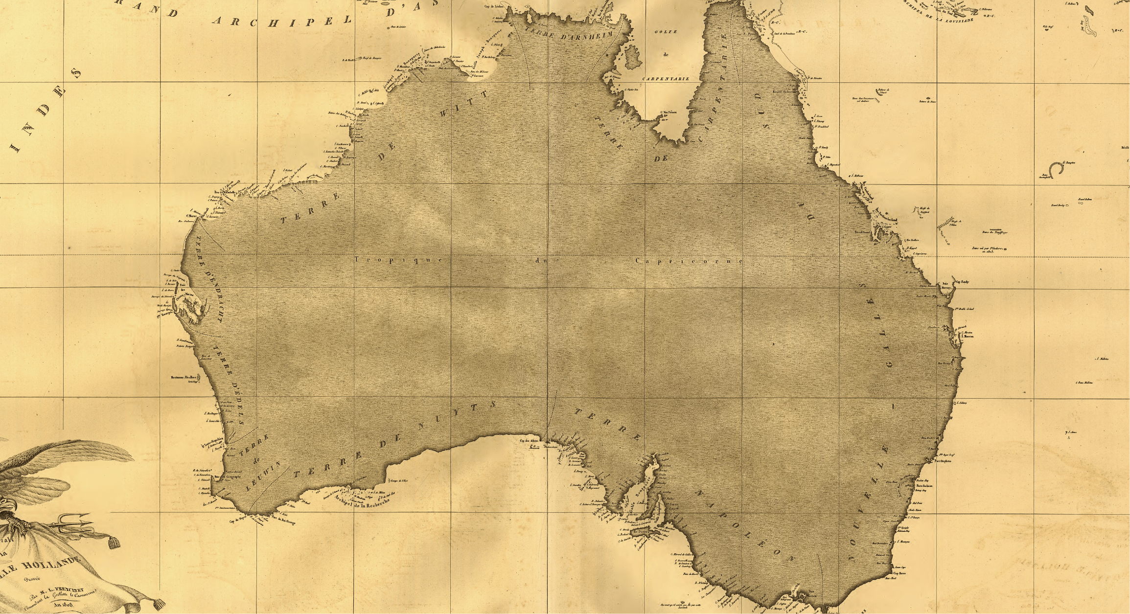
Australia Historical Maps
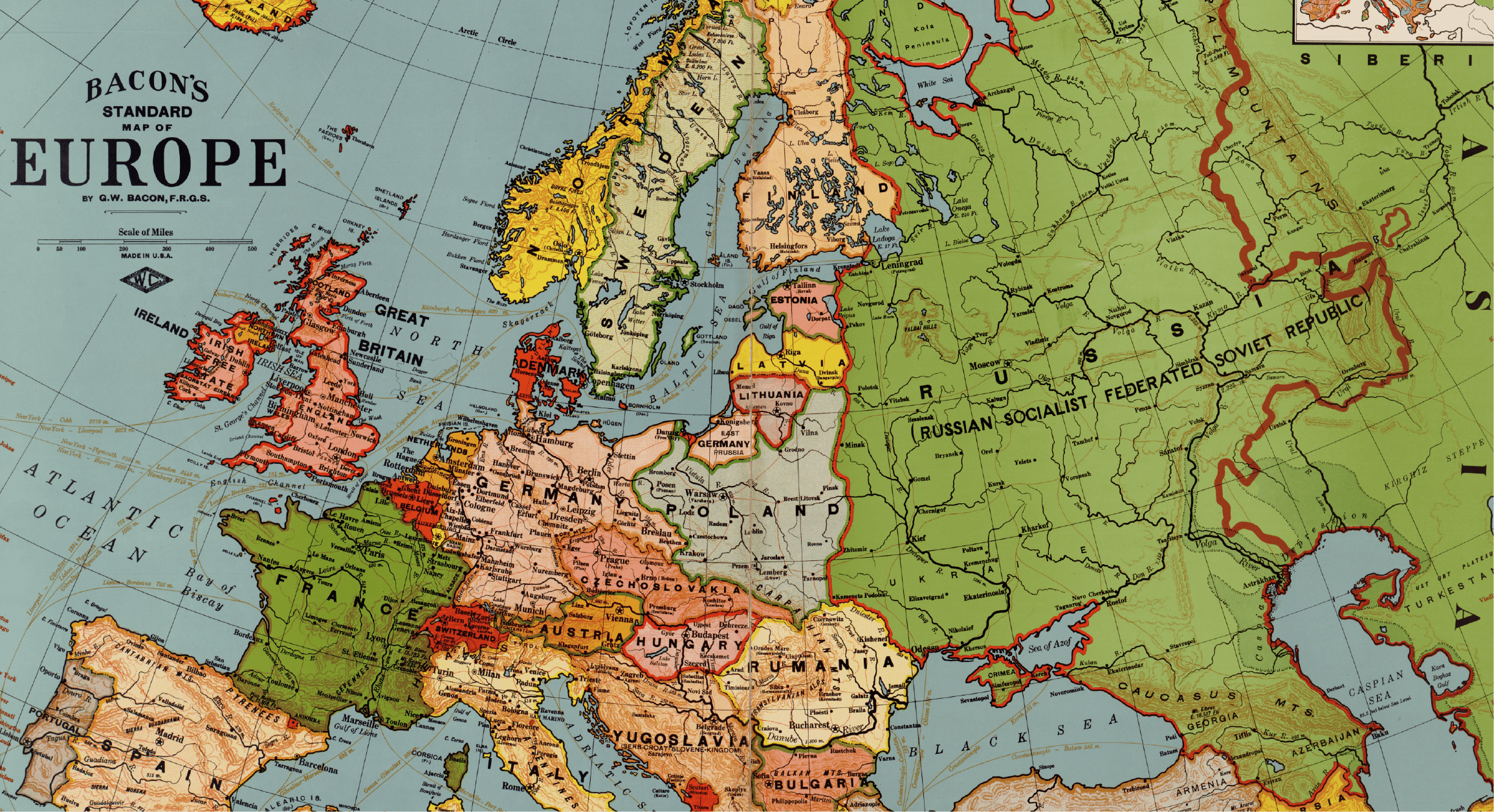
Europe Historical Maps
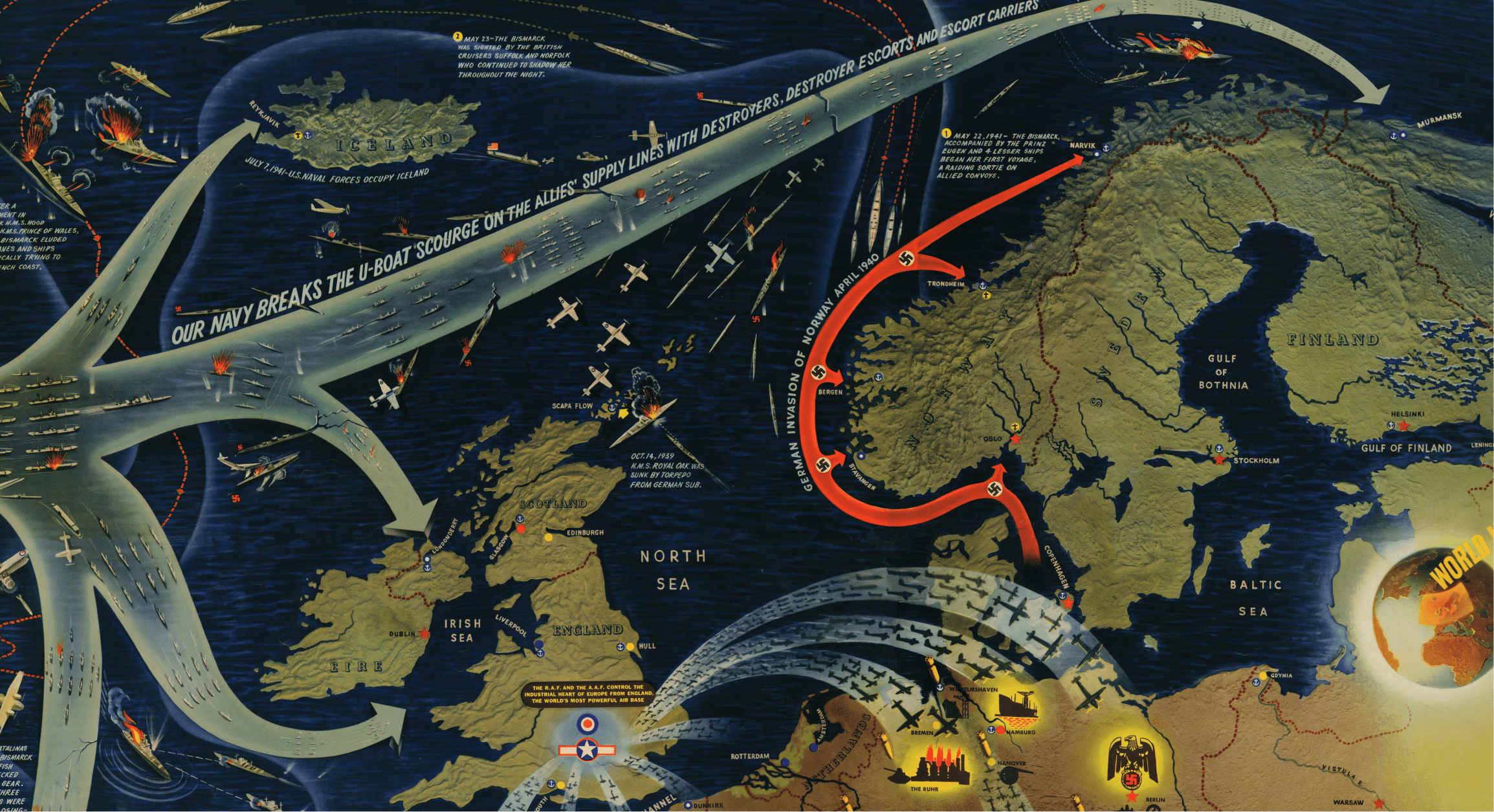
War Maps
Yes. The collection includes historical maps of Africa, Asia, Europe, South America, and other continents as depicted by cartographers from the sixteenth through nineteenth centuries. Each map reflects the geographic understanding and artistic style of its era.
Yes. Many historical country maps show borders, territories, and political boundaries as they existed in their original time period. These maps illustrate how empires, colonies, and nations shifted over centuries, making them valuable for understanding geopolitical history.
Historical continent maps reflect the geographic knowledge of their era, which means coastlines may be approximate, interior regions may be labeled differently or left blank, and political boundaries reflect long-dissolved empires. The artistic elements, typography, and decorative features are distinctly period-specific.
The collection includes historical maps of many individual countries and regions. A heritage wall featuring a historical map of your ancestral homeland is a popular use. Browse the Continents and Countries collection or contact the team if you need help locating a specific country or region.
Yes. Maps from the colonial era clearly show the territorial divisions of European empires across Africa, Asia, and the Americas. These maps are essential reference materials for understanding colonialism, territorial disputes, and the formation of modern nation-states.
The collection includes European maps from the late medieval period through the nineteenth century, covering eras such as the Renaissance, the Reformation, the Napoleonic wars, and the age of nation-state formation. Map detail and accuracy increase in maps from later centuries.
All reproductions are printed on archival-quality paper with fade-resistant inks. Colors, line work, and text are faithfully reproduced from high-resolution scans of original maps. The result is a display-ready print that captures the character of the original while lasting for years under normal indoor conditions.
Yes. The collection includes maps from eras when major empires like the British Empire, Ottoman Empire, Austro-Hungarian Empire, and others were at their territorial peak. These maps show the full geographic extent of each empire as contemporary cartographers recorded it.
Historical country and continent maps are widely used in academic settings for lectures, presentations, and publications. High-resolution reproductions provide clear detail suitable for projection or printed handouts. Educators appreciate the primary-source authenticity of the cartographic imagery.
Historical continent maps are standard-sized prints on archival paper, ideal for framing. Historical Vintage and Antique Wallpaper Murals reproduce similar imagery at wall-sized scale as peel-and-stick or paste-applied wallpaper. Choose prints for individual framed pieces and murals for full-wall coverage.