US States, Cities and Regions Historical Maps
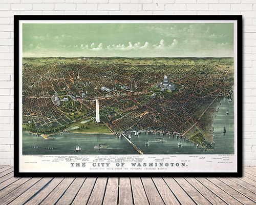
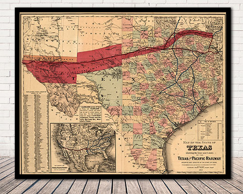
We offer a wide selection of thousands of historical and vintage reproduction map prints ranging from stunning illustrated panoramic birds-eye city view maps to old maps covering entire states; each map is a fine art giclee print offered on acid-free archive paper. Historic map prints look absolutely stunning on the wall and are the perfect addition to any decor. These historical documents are the perfect way to discover the past of your favorite cities, satisfy your fascination with history, or utilizing maps for genealogy exploration. The history of the United States has been well documented through maps since the first appearance of America (labeled Terra Incgognita) in Martin Waldseemuller’s Strasbourg edition of the Ptolemy Atlas in 1513. Our extensive collection of historical maps includes maps that illustrate the earliest formations of states and regions as well as maps that depict battles fought during the American Revolution and the Civil War. Panoramic maps of American cities and towns, often called bird’s-eye views or perspective maps, offer a glimpse into the life of a town or city that is “frozen-in-time”, capturing the town as it appeared from an elevated perspective, and often listing prominent businesses and residents. Spanning most of the 19th century, cartographic artists such as Thaddeus Mortimer Fowler, Oakley H. Bailey and Albert Ruger provided maps that served to promote a city’s commercial and residential potential, often featuring architectural renderings of public and commercial establishments, as well as private homes. These maps stand as a testament to American ambition and hope as a newly created nation faced their bright future. We are constantly working to expand our collection of historic maps. Please revisit often to see what’s new.

Blue Waterways Historic Maps
Historical City Map Prints by State
State Historical Map Prints
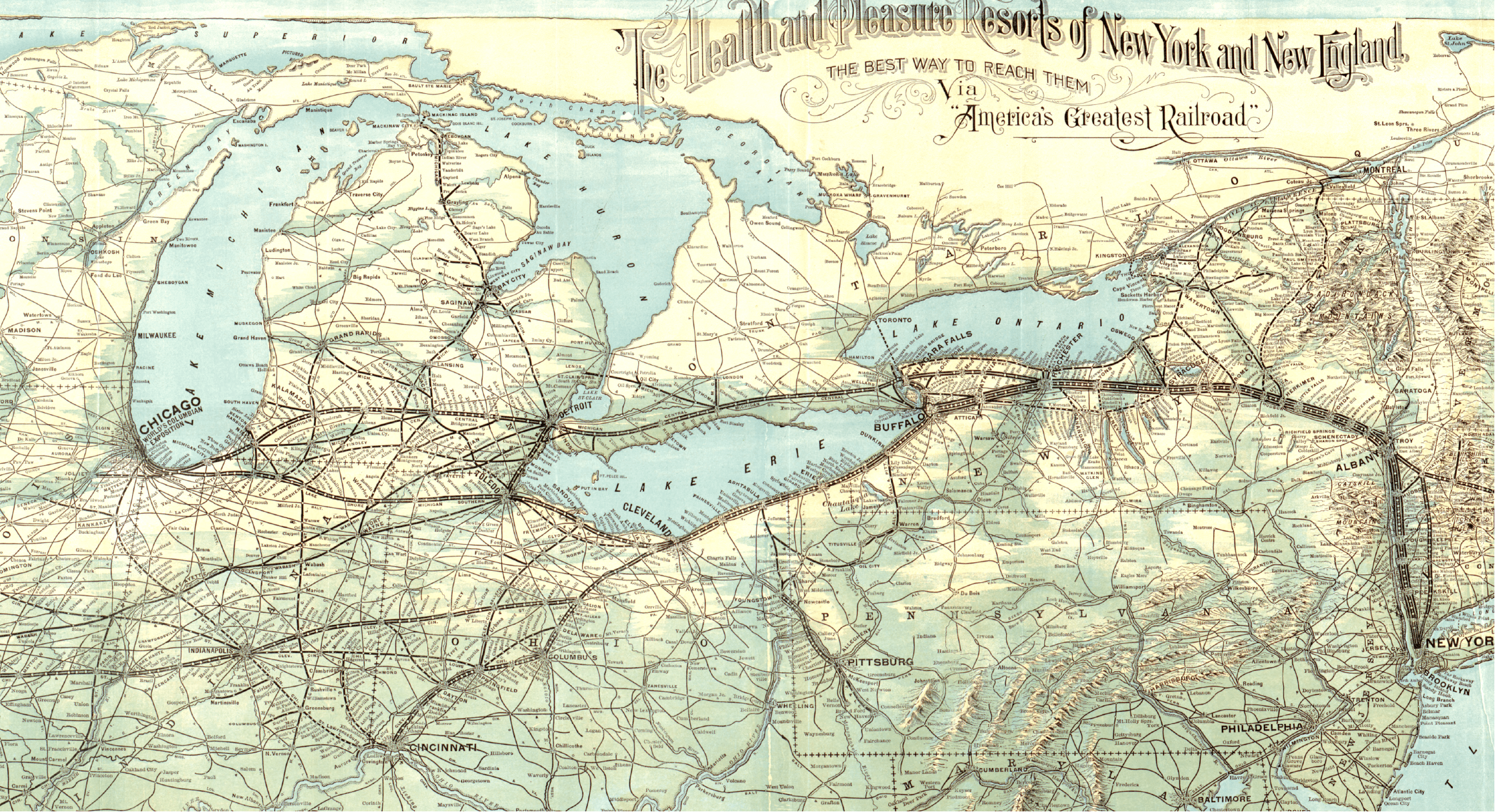
Historical Railroad Map Prints
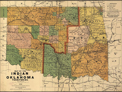
Native American Regions Historical Maps
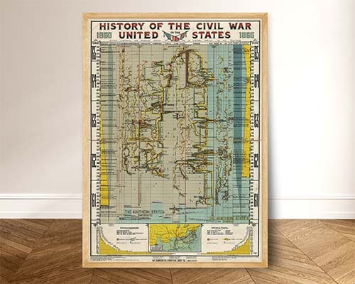
American Revolution & Civil War Maps
Yes. Historical US state and city maps are reproduced from authenticated archival originals, including surveys, military maps, and early municipal plans. Each reproduction preserves the original cartographic detail, lettering, and artistic elements of the source document.
Yes. The collection includes historical city maps and bird's-eye views of major American cities including New York, San Francisco, Chicago, Boston, New Orleans, and many others. These maps capture the street layouts, landmarks, and waterfronts as they appeared in their original era.
US historical maps span from the colonial era through the early twentieth century. The collection includes pre-Revolutionary War surveys, Civil War-era military maps, westward expansion route maps, and early statehood maps showing territorial boundaries as they evolved.
Absolutely. Historical map reproductions are printed on archival-quality paper suitable for framing. The antique styling, hand-drawn detail, and aged color palettes make these maps compelling wall art for offices, libraries, and living rooms. Standard frame sizes are available.
Historical state and regional maps are valuable genealogy tools. They show county boundaries, townships, settlements, and road networks as they existed when your ancestors lived there. Comparing historical boundaries against modern maps helps locate ancestral properties and communities.
Yes. Regional historical maps cover areas such as New England, the Great Lakes, the Mississippi River Valley, the Pacific Northwest, and the American Southwest. These regional views provide broader geographic context than individual state or city maps.
Sizes vary by map. Most historical reproductions are available in standard sizes ranging from approximately 24 x 18 inches, up to some very large sizes. The original aspect ratio of each source map is preserved. Specific dimensions are listed on each product page.
These are high-quality modern reproductions printed on archival paper using archival inks. They faithfully replicate the look and detail of the original antique maps without the fragility, cost, or preservation concerns of actual antiques. The reproductions are designed for display and daily enjoyment.
Historical city maps are among the most popular history-themed gifts. A reproduction map of someone's hometown or alma mater city from a century ago creates a meaningful, personal connection to local history. They are popular for birthdays, retirements, and housewarming gifts.
Yes. Historical map reproductions are excellent primary-source teaching aids for US history courses. They illustrate territorial expansion, Civil War campaigns, colonial settlement patterns, and urban development in ways that textbooks cannot. Educators frequently use them for classroom display and student projects.