


World Physical Satellite Image Map - Pacific Ocean Centered
Description
An ultra high quality world satellite image map print available with no text labels or in a version featuring countries, national capital cities, and major bodies of water labeled.
This stunningly detailed satellite image map features a less common Pacific Rim view of the world. A multitude of various data sources are combined to produce this maps unique detail of the planet. Land imagery is based on data collected by NASA's MODIS satellite instrumentation. Ocean bathymetric information is derived from the GEBCO (General Bathymetric Chart of the Oceans). Antarctica imagery is from the RAMP II dataset (Radarsat Antarctic Mapping Project Elevation Model).
This map depicts the earth during the month of August so there is little snow coverage in the northern hemisphere landmasses, although little snow is apparent in the southern hemisphere it is at its maximum extent due to it being winter in the region. Tens of thousands of the earths physical features can be clearly identified in astounding detail. Labeled version features country borders outlined in red.
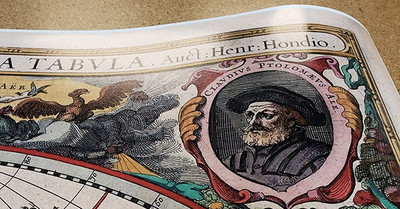
Each map is produced as a detailed museum quality archive print. This special printing process is known as Giclee (zhee-CLAY) and is commonly used to produce very high quality fine art prints. Printed on Archive Paper, Luster Photo Paper, Matte Canvas or Metal.
Map print ships rolled up in a durable cardboard tube. Frame is not included.
Materials
Archival Paper

Premium fine art paper that provides accurate color reproduction with high-contrast, high-resolution print output and maximum image permanence. A high-quality print ready for framing.
More
- Museum quality paper for high-quality fine art.
- Ultra smooth, neutral white matte finish.
- Heavy-weight 230 gsm, 9.5 mil thickness.
- Printed with pigment inks for longer print life and enhanced fade resistance.
- Pigment based Canon LUCIA inks provide smooth tones and rich colors in fine, precise detail.
Luster Photo Paper
A premium semi-gloss photo paper with a subtle texture that produces a vivid, richly detailed print. This material results in an exquisitely detailed giclee print of substantially higher quality than a standard poster.
More
- Printed on 10 mil premium luster photo paper resulting in a brilliant, colorful image with a vivid life-like quality.
- Pigment based Canon LUCIA inks provide smooth tones and rich colors in fine, precise detail.
- Inks have a lightfastness rating of over 100 years, guaranteeing minimal noticeable fading over a very long period of time.
- Printed using very high resolution source files.
- Giclee printing is superior to traditional lithography in a number of ways: colors are brighter, lasts longer, and is a higher resolution.
Peel & Stick Wall Decal
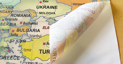
A versatile peel & stick fabric material with repositionable self-adhesive backing. A polyester canvas material that can be used multiple times without damaging walls or leaving a residue.
More
- Easy to install and sticks to just about any flat surface.
- Removable without damaging walls or paint. Can be re-positioned / re-applied multiple times without losing adhesion. Leaves no residue!
- Adhesive stays in place for many years even under high humidity. Does not weaken.
- Non-toxic, safe for a kids room. No PVC, Glycol-Ether or Formaldehyde.
- Great for rental houses & apartments. Resists wrinkles, bubbling, shrinking, and tears. Simply peel, place, & stick!
- Not suitable for textured walls.
- View More Info
Canvas on Wood Rails
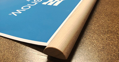
A canvas giclee print is mounted to wooden hanging rails placed along the top and bottom of the map. Ready to hang on the wall using the attached hanging cord. Wood rails feature a natural finish.
More
- Premium 19 mil canvas material.
- Wood rails are 1 1/8" wide, round front.
- USA sourced solid maple wood.
- High quality giclee fine art print with a lightfastness rating of over 100 years.
- Pigment based Canon LUCIA inks provide smooth tones and rich colors in fine, precise detail.
Canvas Gallery Wrap
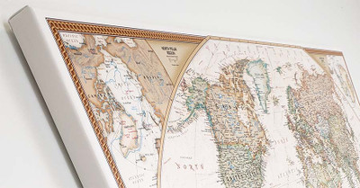
A high quality canvas giclee print is hand stretched over a sturdy wood frame. Printed on demand and handcrafted in Seattle, WA. The canvas gallery wrap serves as a stunning piece of art ready to hang on your wall.
More
- Premium 19 mil canvas material.
- Pigment based Canon LUCIA inks provide smooth tones and rich colors in fine, precise detail.
- High quality giclee fine art print with a lightfastness rating of over 100 years.
- Durable canvas mounted to a 1" deep wood frame.
- Ready to hang with included easy-to-use hanging kit.
Framed Map Print - Black Finish
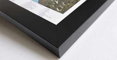
Our gallery quality frames are made of solid wood and feature optical-grade acrylic. Each framed map is printed on premium archival matte fine art paper.
More
- Printed on thick, luxurious acid-free fine art paper & dry-mounted to foam board.
- Pigment inks ensure a vivid print with amazing colors and excellent fade resistance.
- Solid wood frame with a black finish has a 1.25" face & 7/8" depth.
- Kraft paper protective backing & hanging wire installed.
Framed Map Print - Natural Oak Finish
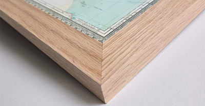
Our gallery quality frames are made of solid wood and feature optical-grade acrylic. Each framed map is printed on premium archival matte fine art paper.
More
- Printed on thick, luxurious acid-free fine art paper & dry-mounted to foam board.
- Pigment inks ensure a vivid print with amazing colors and excellent fade resistance.
- Solid wood frame with a natural oak finish has a 1.25" face & 7/8" depth.
- Kraft paper protective backing & hanging wire installed.


