Best Classroom World Maps for Teachers
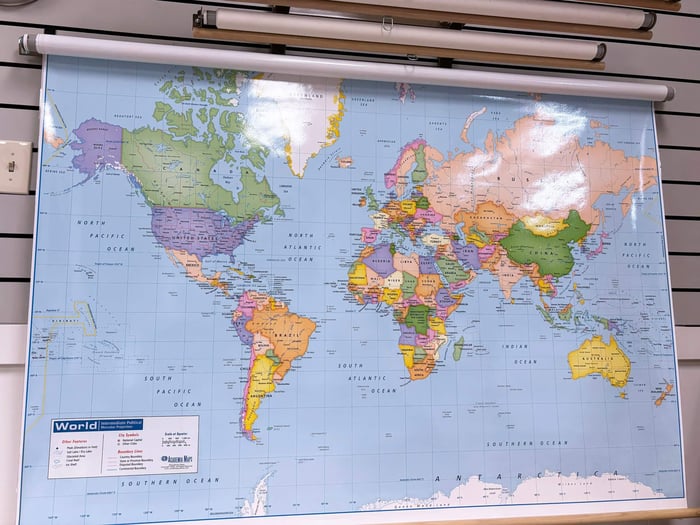
Table of Contents
Choosing the right map matters
Choosing the best classroom world maps for teachers isn't just about finding something to fill wall space. The right map becomes an essential teaching tool that sparks curiosity, facilitates discussion, and helps students develop spatial awareness and global perspective. Whether you're teaching kindergarteners their first geography lessons or guiding high school students through complex geopolitical analysis, having the appropriate classroom map makes all the difference in how effectively you can engage your students.
With so many options available, from traditional paper posters to interactive laminated maps and space-saving spring roller systems, finding the perfect fit for your classroom needs can feel overwhelming. This guide will help you navigate the world of educational maps and identify which features matter most for your specific teaching environment and grade level.
Finding the Right Map for Your Students
Not all classroom maps serve the same educational purpose, and what works beautifully for your second graders will likely frustrate or bore high schoolers down the hall. The key is matching your map to where your students are developmentally and what you're actually trying to teach them. A well-chosen map becomes more than just wall decoration - it's a visual reference point your students will look to throughout the year, whether they're connecting a history lesson to a location or finding a country mentioned in the news. Here's how to think about maps for different grade levels and teaching situations. We've rounded up some of our best classroom world maps for teachers below.
Early Elementary: Building Geographic Foundations
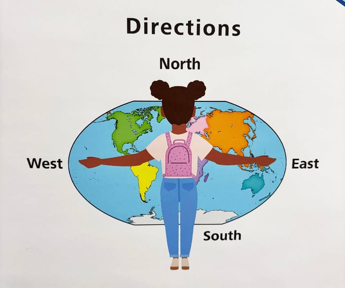
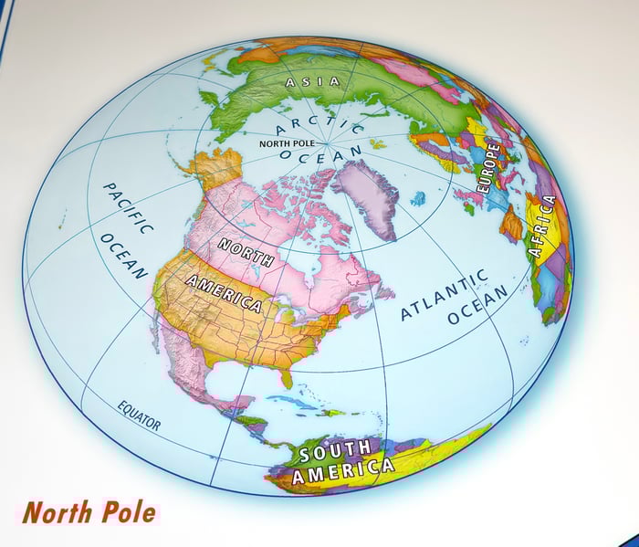
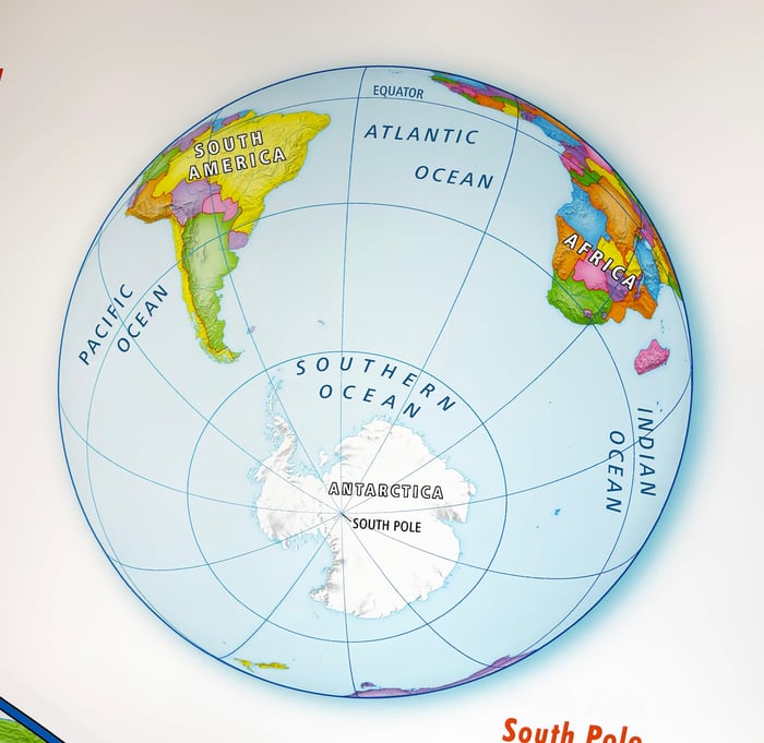
For pre-K through first grade students, the goal is introducing basic map concepts in a way that feels accessible and exciting rather than confusing. Early learner maps use simplified geography with reduced detail, focusing on helping children understand fundamental ideas like continents, oceans, and the concept that the world is round.
Our Early Learner World Classroom Map demonstrates this approach perfectly. With large, clear text and simplified map elements, it teaches common geographic terms while maintaining visual clarity. Bright colors help distinguish different landmasses, and the overall design prevents the confusion that can come from too much detail. These maps often identify major countries and capital cities but skip the smaller nations and intricate borders that younger students don't need yet.
 |  |
It's important to mention that at this level, durability is your friend. Young children are naturally hands-on learners, and that's a good thing - you want them pointing, touching, and interacting with the map. Laminated options or spring roller mounted maps are built to handle all that enthusiastic exploration that comes with early elementary classrooms.
Elementary and Middle School: Building Skills and Critical Thinking
Second grade through middle school is where students really develop their geographic knowledge and start thinking critically about maps. At the younger end, students are ready for slightly more complexity while still needing clear, age-appropriate presentation. By middle school, they can handle significantly more detailed maps and begin understanding the nuances of cartography.
 |  |  |
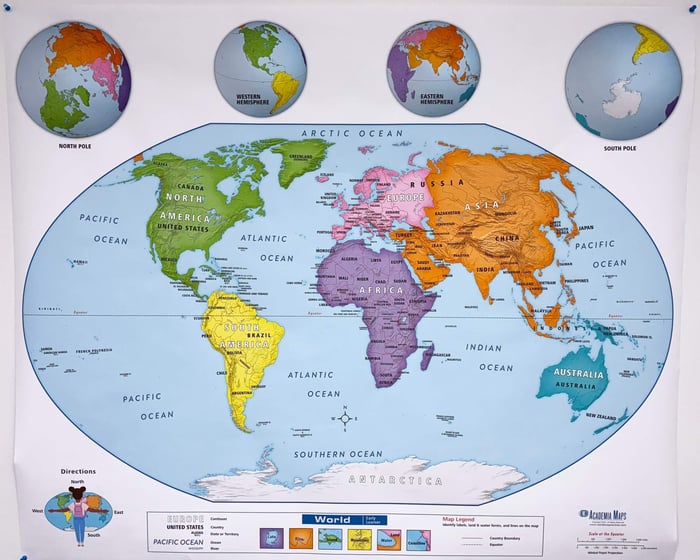
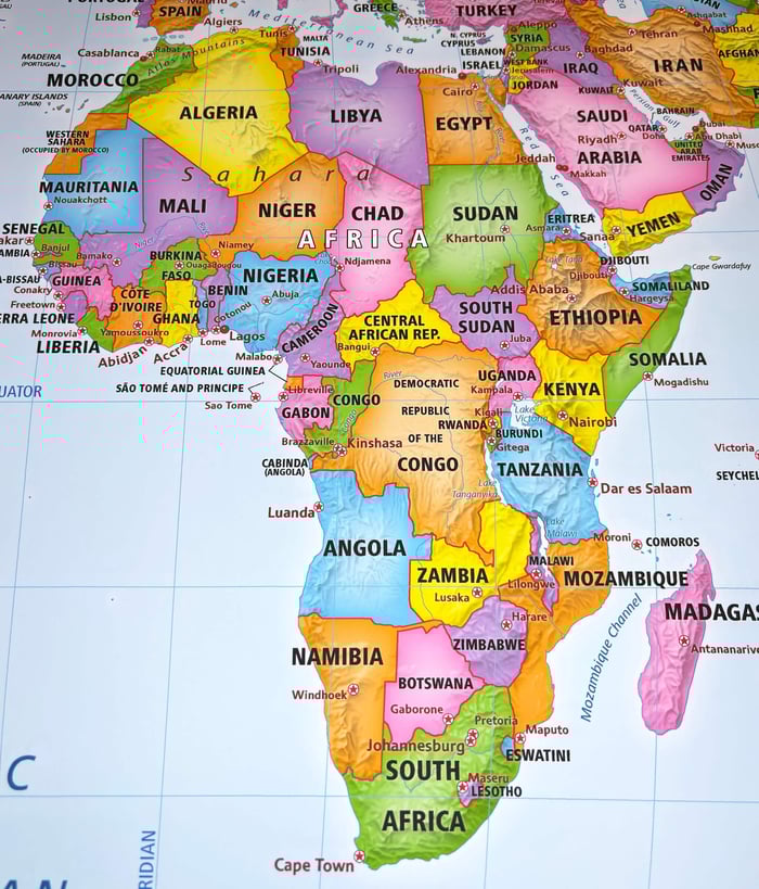
Primary learning maps add layers of information like more country labels, major cities, and basic physical features such as significant mountain ranges or rivers. The World Primary Learning Political classroom map maintains clear, readable text and distinct color coding while introducing more geographic data, making it one of the best classroom world maps for teachers. Students at this level are developing reading skills and can handle more text labels, making this added detail educational rather than overwhelming.
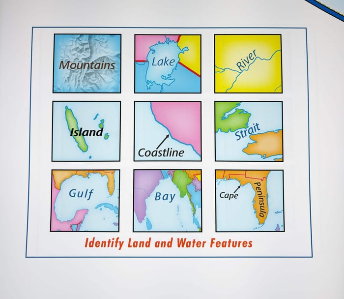
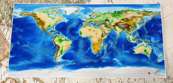
This is also an excellent stage to introduce the difference between political maps (showing borders and countries) and physical maps (displaying terrain, elevation, and natural features). Having both available helps students understand that maps can represent different types of information about the same place. A physical map with topographic detail connects to earth science lessons about tectonics, climate, and ecosystems, while political maps support social studies and current events discussions.
 Political Map Political Map | 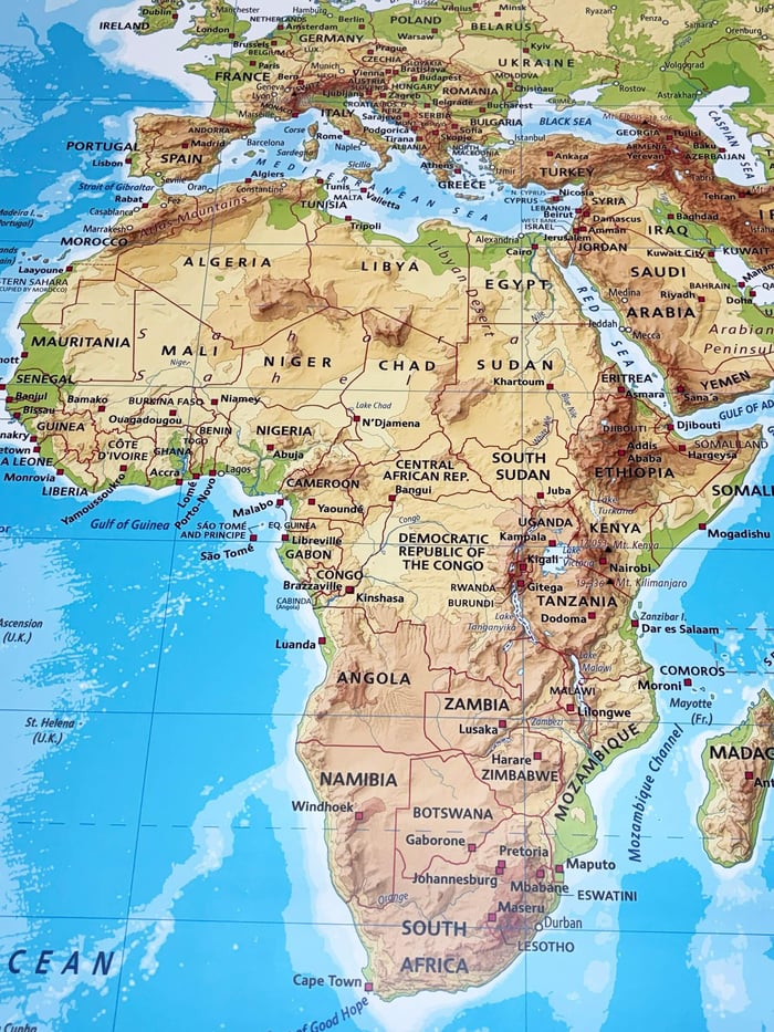 Physical Map Physical Map |
As students progress, consider maps that support cross-curricular learning and having multiple map types available. A combination spring roller system that allows you to switch between different map styles provides the flexibility these grade levels need. Laminated surfaces with write-on capability are valuable here, allowing for interactive marking during lessons that can be cleaned off and reused.
High School and College: Advanced Analysis and Specialized Learning
High school and college classrooms require professional-grade educational maps with comprehensive detail and, often, specialized focus. Advanced world maps include extensive labeling of cities, geographical features, and political boundaries. At this level, students benefit from maps that support analytical thinking about global systems, historical patterns, and geopolitical relationships.
The Advanced World Political Classroom Map delivers the detail older students need for serious geographic study. With thorough labeling and clear cartography, these maps serve as reference tools for everything from AP Human Geography to international relations courses.

High school is also where specialized maps become valuable teaching resources. Earth science classrooms benefit enormously from maps showing plate tectonics, climate zones, or geological features. History courses might use historical world maps showing different time periods, like the World History 6-Map Set or maps depicting decolonization patterns.
Multi-map spring roller combinations are particularly practical for high school classrooms where space is limited but teaching needs are diverse. These systems mount several different maps on a single spring roller mechanism, allowing teachers to pull down a political map for one lesson and switch to a physical map or historical map for the next. Custom combo bundles can include up to eight different maps on one roller, maximizing your wall space efficiency.

Outline maps, which show only borders without labels, become essential assessment tools at this level. Students can demonstrate their geographic knowledge by filling in countries, capitals, or physical features, making these markable classroom maps excellent for testing and review activities.
Understanding Map Projections: Why It Matters in Your Classroom
Map projections are mathematical methods for representing the curved surface of Earth on a flat map, and every projection involves compromise. Since you can't flatten a sphere without distortion, cartographers must choose which properties to preserve: size, shape, distance, or direction. Understanding these trade-offs helps students think critically about how information is presented and interpreted.
The Mercator projection, developed in 1569 for nautical navigation, preserves angles and shapes, making it useful for plotting straight-line courses at sea. However, it dramatically distorts size, especially near the poles. This has led to legitimate criticism that the Mercator projection reinforces a Eurocentric worldview by making northern hemisphere countries appear much larger than they actually are.
Alternative projections address these concerns in different ways. The Gall Orthographic projection (often called the Peters projection after its popularization in the 1970s) maintains accurate land area sizes, showing countries at their true relative sizes. This can lead to valuable classroom discussions about representation and perspective. Some school districts have even adopted these equal-area projections specifically to give students a more accurate understanding of global geography.
The Equal Earth projection, a more recent development, attempts to balance multiple concerns by minimizing distortion across several properties. It looks more familiar than the Peters projection while still showing countries at reasonably accurate relative sizes.
Having maps with different projections available in your classroom provides opportunities to discuss why these choices matter. You might display a Mercator projection alongside a Peters projection and ask students to compare what they notice. These conversations develop critical thinking skills that extend beyond geography into media literacy and how information is framed in general.
Essential Features for Classroom Maps
Beyond choosing the right content and projection for your grade level, certain practical features dramatically affect how well a map serves your teaching needs.
Lamination and Durability
Classroom maps endure considerably more wear than maps in other settings. Students touch them, teachers point at them, and they're exposed to classroom conditions day after day, year after year. Full encapsulation lamination, where the entire map is sealed between protective layers, provides crucial protection against tears, moisture, and general handling.
 fully encapsulated laminated print
Laminated surfaces also enable interactive use with dry-erase markers or grease pencils. This write-on capability transforms your map into a dynamic tool you can mark up during lessons and clean off afterward. Whether you're tracing trade routes, highlighting regions, or letting students mark locations, this interactive element keeps lessons engaging while making abstract concepts more concrete.
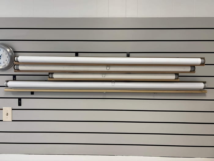
Spring Roller Mounting
Spring roller mounted maps offer significant advantages for classrooms, particularly where wall space is at a premium. These pull-down maps mount above your whiteboard or on any wall, rolling up when not in use to save space and protect the map from damage.
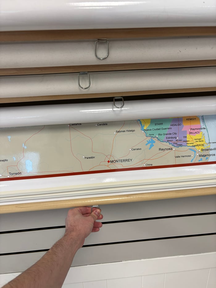
The real genius of spring roller systems becomes apparent with combination sets. Instead of dedicating different wall sections to multiple maps, you can have a political map, physical map, and perhaps a historical map or outline map all mounted on the same roller system. Pull down whichever one you need for that day's lesson, and the others stay protected out of the way.
Spring rollers also solve the installation challenge. Rather than dealing with pins or adhesive that might damage walls (a concern in many schools), the mounting bracket installs once, and your maps remain accessible but protected indefinitely.
Size Considerations
Classroom maps need to be large enough for students at the back of the room to read clearly. For most standard classrooms, you're looking at maps that are roughly four feet wide or larger - big enough that place names remain legible from 20-30 feet away. Smaller maps might be fine for small group settings or offices, but in a classroom with twenty to thirty students, bigger is generally better for visibility.
That said, you also need to consider your available wall space and whether the map will be permanently displayed or rolled up when not in use. Spring roller systems accommodate very large maps without requiring permanent wall space, which is why they've remained popular in schools for decades.
Making Your Selection: Practical Considerations
With so many excellent options available, here are the key questions to ask yourself when selecting classroom maps:
What grade level am I teaching? This determines the appropriate level of detail and complexity. Don't overwhelm younger students with information they're not ready for, and don't bore older students with oversimplified maps.
What subjects will I teach using this map? A history teacher might prioritize historical maps or combo sets with multiple time periods, while a geography teacher might need both political and physical maps readily available.
How much wall space do I have? If space is limited, spring roller combinations let you have multiple maps in the footprint of one.
Will students interact directly with the map? If so, laminated surfaces with write-on capability are essential, and durability becomes even more important.
What's my budget? While spring roller systems and laminated maps cost more upfront, they last significantly longer than paper maps, often making them more economical over time. A quality classroom map can serve your teaching needs for a decade or more with proper care.
Do I need to address specific learning standards? Some curricula require teaching about map projections or specific geographic content that might influence which maps you choose.
Investing in Quality Educational Resources
The best classroom world maps for teachers are those that match your specific teaching needs, grade level, and practical constraints. Whether you opt for a simple laminated wall map, a versatile spring roller system, or a collection of specialized maps for different subjects, you're investing in a resource that will facilitate countless learning moments throughout its lifetime in your classroom.
Quality educational maps do more than display information. They inspire curiosity, support critical thinking, and help students develop a global perspective that serves them throughout their lives. When a middle schooler can confidently locate countries in the news, or a high school student understands how geography has shaped human history, or an elementary student excitedly identifies continents and oceans, your map investment pays dividends.
At World Maps Online, we offer comprehensive selections of classroom maps organized by grade level, subject area, and format. From early learner maps to advanced combo spring roller systems, from earth science posters to historical world maps, we provide the educational mapping resources teachers need to create engaging, geographically literate classrooms.
Ready to find the perfect maps for your classroom? Browse our full collection of classroom maps or explore maps by grade level to find exactly what your students need. Have questions about which maps work best for your specific teaching situation? We're here to help you make the right choice for your classroom.