United States Wall Maps
Explore our remarkable collection of United States wall maps, offering a variety of options, select a paper map poster print, laminated map, wood rail mounted map, peel & stick wall decal map, canvas gallery wrap or wood framed maps.
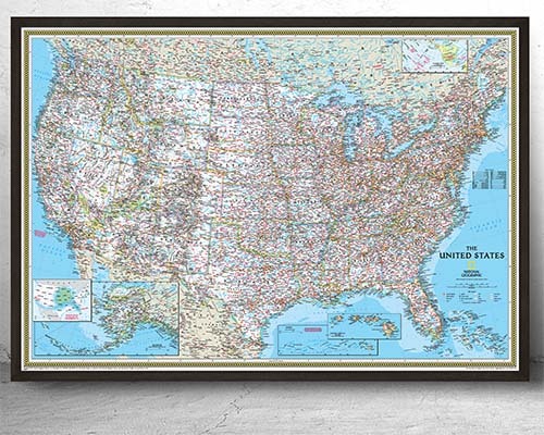
United States Political Wall Maps
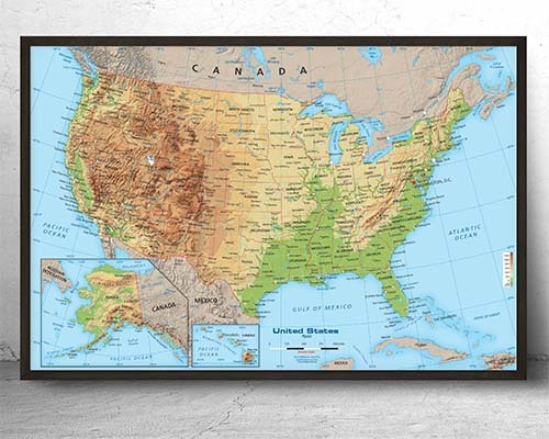
United States Physical Wall Maps
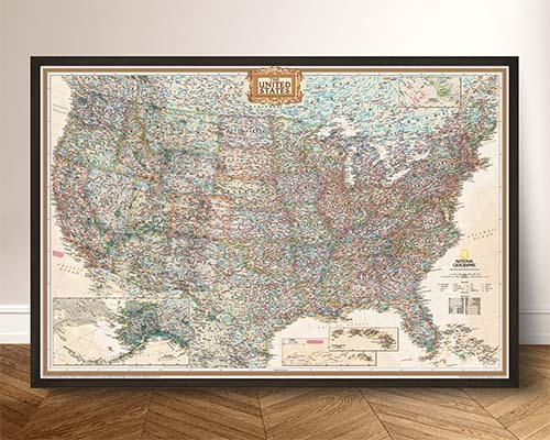
Best Selling USA Wall Maps
USA Regional Maps
USA Wall Maps - Entire Collection
A political US wall map with distinct color coding for each state provides the clearest state-by-state display. Look for maps in larger sizes (48" or wider) where even the smaller northeastern states are legible. The United States Wall Maps collection offers multiple styles optimized for clear state boundaries.
A state-only map is best for general reference and decor. A county-level map is better for business use; real estate, sales territory planning, logistics, and government work—where county boundaries matter. County maps are significantly more detailed and may require a larger size for legibility.
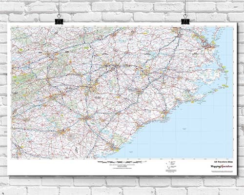
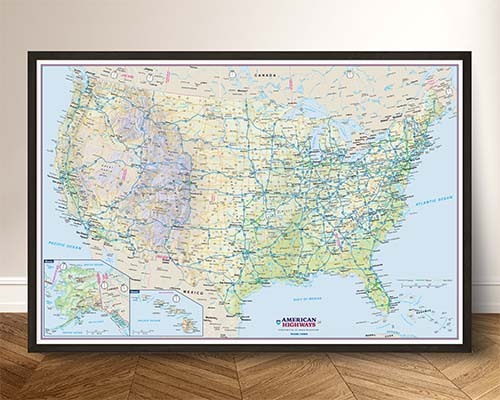
Transportation-focused US wall maps display the interstate highway system, major highways, and key routes alongside state boundaries and cities. These are popular for logistics companies, trucking operations, and travel planning. Look for maps specifically labeled as transportation or road atlas style. Here's an example: US Interstate Map
Quality US wall maps range from approximately $50 for a standard paper print to several hundred dollars for premium finishes like canvas gallery wraps, custom framing, or extra-large laminated formats. The price reflects the finish, size, and mounting option selected rather than the cartographic quality, which is consistently high across all options.
Framed maps arrive display-ready with a polished, professional look—ideal for offices and formal spaces. Loose prints offer flexibility to choose your own frame or use alternative mounting options like wood rails or lamination. Framed options cost more but eliminate the effort and expense of custom framing.
A laminated US wall map is the best choice for sales territory work because you can draw, color-code, and annotate territories using dry-erase markers and wipe clean to update as needed. Choose a map with clear state and county boundaries in a large format (48" or wider) for easy marking and team visibility.
Yes, if you choose a laminated finish. Laminated wall maps work with dry-erase markers, allowing you to draw routes, highlight regions, and mark territories. The marks wipe clean for reuse. Non-laminated paper and canvas maps should not be written on as marker ink will permanently stain the surface.
Yes. Political US wall maps display state capitals, major metropolitan areas, and significant cities. More detailed versions include county seats, smaller cities, and towns. The level of city detail varies by map—product descriptions indicate the scope of geographic features and labels included.
For classroom use, a map at least 48" wide ensures visibility from the back of the room. A 60"×40" or larger format is ideal for a prominent wall display. Laminated versions allow teachers to annotate during lessons with dry-erase markers. See also the Classroom Maps collection for education-specific options.
Canvas gallery wraps and framed maps arrive with mounting hardware already attached—simply hang on a nail or hook. Wood rail-mounted maps include hanging hardware on the top rail. Paper and laminated prints may need separate hanging solutions such as poster strips, map rails, or custom framing.