

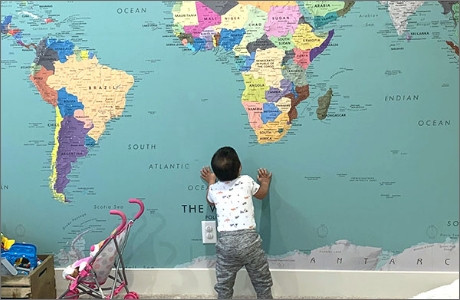
Europe Political Classroom Map Wall Mural
Description
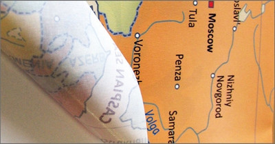
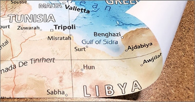
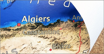
This colorful political map of Europe is offered in numerous large wall mural sizes. The map features countries in contrasting colors making them easy to identify. Political boundaries are outlined in red and major cities, capitals, rivers, lakes, mountains, as well as main roads are labeled on the map. A map legend identifies various features on the map.
An excellent wall mural map for classroom instruction. The intermediate Europe political map features comprehensive content, making it suitable for teaching grades 6-12+. This large wall map mural is a great way to bring new purpose to an empty wall in your school or classroom.
Materials
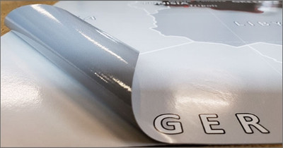
Peel & Stick Fabric Removable Wallpaper
A thin canvas material that is removable & reusable multiple times without losing adhesive strength. Great for rental houses & apartments as it can be removed without damaging paint or leaving residue. Popular with renters.
More
- Easy to install and sticks to just about any flat surface. Use it on doors, ceilings, tiles, and windows.
- Heavy-weight 230 gsm, 9.5 mil thickness.
- 99% opaque block-out hides overlapping panels for a seamless look.
- Non-toxic, safe for a kids room. No PVC, Glycol-Ether or Formaldehyde. Class A or 1 fire rated.
- Adhesive stays in place for many years even under high humidity & outdoor installation in all weather conditions. Install it for a day or a decade.
- Matte finish. Resists wrinkles, bubbling, shrinking, and tears. Does not weaken.
- Not suitable for textured walls.
- View More Info
Pre-Pasted Wallpaper
Standard Pre-pasted PVC-free wallpaper material featuring water activated adhesive. The wallcovering material is odorless & non-toxic. GREENGUARD Children & Schools Certified and FSC Certified. Printed with eco-friendly latex inks.
More
- A 7mil thick pre-pasted wallpaper with water activated paste.
- Ultra smooth matte finish with vivid color and high definition detail.
- Mold & Mildew resistant. Class A fire rating. Water resistant wipeable surface.
- View More Info
Durable Type II Wallpaper
A durable commercial grade wallpaper that is ideal for high traffic public spaces. Surface is scrub and scratch resistant. Odorless & non-toxic GREENGUARD Gold Certified.
More
- A 17mil thick commercial grade Type II (ASTM F793) compliant wallpaper. Meets EN233 European Wallcovering Standard.
- Ultra smooth matte finish with vivid color and high definition detail. Excellent colorfastness rating.
- Highly mold & mildew resistant. Class A fire rating. Water resistant.
- Heavy duty backing compatible with common wallcovering pastes.
Laminated Vinyl Peel & Stick
Durable removable vinyl wallcovering with dry-erase marker compatible lamination. Suitable for indoor and outdoor installations.
More
- Coated with a dry-erase film laminate that provides extra durability.
- Write-on surface is compatible with dry or wet erase markers.
- Repositionable adhesive that is removable for a period up to 1 year.
- Versatile, all-weather resistant material. Suitable for many applications including vehicle wraps.
Custom Size Mural
We can create a custom size mural. Fill out the form below or e-mail your request. We will follow up with pricing, a proof for review, and a link to place an order. Custom orders typically ship within 4-5 business days.
Installation
Our map wall murals are installed just like regular wallpaper, in multiple panels for ease of installation.
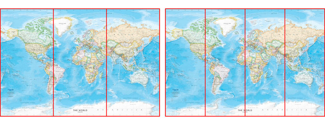
Murals are Produced in 3-Panel and 4-Panel Configurations
Peel & Stick Fabric Removable Wallpaper is an easy to install DIY option ideal for rental properties or temporary installs as it can be removed leaving no damage to paint or walls. Simply peel, place, and stick!
PEEL & STICK FABRIC INSTRUCTIONSPVC-free Wallpaper is a wet-strength pre-pasted wallpaper material. Paste can be activated by soaking panels or using a paste activator spray.
PVC-FREE WALLPAPER INSTRUCTIONSDurable Type II Wallpaper is a commerical grade wallcovering material with a textile scrim backing. This material does require a wallpaper adhesive for installation.
DURABLE TYPE-II WALLPAPER INSTRUCTIONSLaminated Vinyl Peel & Stick is an ultra-conformable calendared adhesive-backed vinyl with UV gloss laminate. Durable enough for outdoor installs including vehicle wraps. Professional installation is recommended.
LAMINATED VINYL INSTRUCTIONSMap Customization
Maps can be modifided with a custom color scheme to better fit your decor, a personalized title, or even adding custom points of interest. We also offer a full range of custom cartographic services. Contact us now with your custom request.
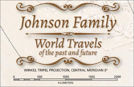
Custom Map Title
Personalize a map with a title such as your family name or add a custom designed map legend. Many decorative cartouche styles and fonts area available.
Modify Color Scheme
Maps can be modifided with a custom color scheme to better fit your decor. We can help you come up with a design that is completly unique to you.
Add a Logo or Infographic
We can add a logo for your organization, school, or business. Infographics and supplemental information can also be added to the map for a custom exhibit display.
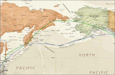
Add Placemarkers or GIS Data
Mark specific locations on the map or add custom travel routes. We can take your point, line, or polygon GIS data and add it to one of our existing maps.

Custom Cartography
We offer a full range of custom cartographic services including custom area street maps, educational reference maps, maps for exhibitions, and even custom board game maps.
Contact us to learn more about our custom mapping services.


