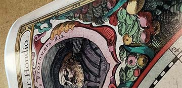
La Crosse, Wis. 1873. Geo. H. Ellsbury, del. Milwaukee Lith. & Eng. Co.
Beautiful pictorial view map of the historic Mississippi River town of La Crosse, Wisconsin, drawn by George H. Ellsbury in 1873, reprint. The largest city on Wisconsin's western border, La Crosse was settled in 1841, when Nathan Myrick decided to establish a trading post up the river from Prairie du Chien, where he found too many other fur traders already entrenched. New York native Myrick, initially built his trading post on Barron Island, but moved to the mainland the following year and partnered with H. J. B. Miller to run the post. This proved an ideal location, near the junction of the Mississippi, the La Crosse and the Black Rivers. A small village began to develop around the trading post throughout the 1840's. The village was platted in 1851 and had a population of almost 2,000 by 1855. The completion of the La Crosse & Milwaukee Rail Line in 1858, combined with the Mississippi River steamboat traffic, made La Crosse a major transportation hub and boosted development dramatically.
This map captures the city as it appeared just eight years after the Civil War ended. In 1861, the Union called for 75,000 enlisted men to join the battle for the Union. Many men from La Crosse joined the Eighth Wisconsin Volunteers, as well as the Light Guards.
The following article appeared in the "La Crosse Union & Daily Democrat" on January 10, 1860:
"The Light Guards, mustering some thirty muskets, with a full retinue of officers, musicians and camp followers, set sail for Winona on Monday morning at 10 o'clock. They were closely packed in two large vehicles one drawn by four greys, and the other by four bays. A good many of our citizens were on hand to note their departure. The boys gave three cheers and the "tiger" for La Crosse, and started off with band playing and colors flying. We have no doubt they will find good fellows like themselves in our flourishing sister city."
Lively activity is depicted near the steamboat landing, with the vessels "The Belle of La Crosse" and the "The Alex McGregor" illustrated in detail.