Historic Railroad Map of the Western United States - 1888
Description
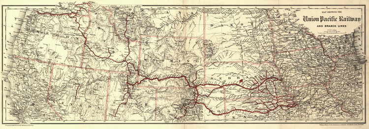
Map showing the Union Pacific Railway and branch lines.
The Union Pacific Railroad began in 1862 with the Pacific Railroad Act. The Act of Congress initiated the construction of new railroads west of the Missouri River to harness control of western resources during the American Civil War.
The Union Pacific was constructed west from Council Bluffs, Iowa. At the same time the Central Pacific was laid out east from San Francisco. The two lines met up at Promontory Summit in Utah in 1869 to much fanfare.
This detailed relief map of the western United States from Illinois to California was published in 1888 by G.W. & C.B. Colton & Co. It shows cities, towns, forts, boundaries, waterways and mountains. The Union Pacific Railroad and its branches are shown in red.
Materials
Archive Paper

Premium fine art paper that provides accurate color reproduction with high-contrast, high-resolution print output and maximum image permanence. A high-quality print ready for framing.
More
- Museum quality paper for high-quality fine art.
- Ultra smooth, neutral white matte finish.
- Heavy-weight 230 gsm, 9.5 mil thickness.
- Printed with pigment inks for longer print life and enhanced fade resistance.
- Pigment based Canon LUCIA inks provide smooth tones and rich colors in fine, precise detail.

Made In The USA

School Purchase Orders


