Southern United States Vintage Railroad Map Print (1862)
Item:1W-SS-RR-1862
MSRP:
Was:
Now:
$50.00
(You save)
UPC:
Free U.S.
Shipping
30-Day
Guarantee
Made in
the USA
Museum
Quality
Description
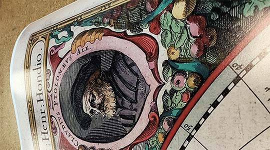
Lloyd's Map of the Southern States showing all the railroads, their stations and distances compiled from the latest government and other reliable sources. This map was drawn during the American Civil War. It was made by the United States Coast Surveyors, by order of congress, for the use of our Merchantmen and Navy.
Discriptions of United States southeastern navigable waterways at the bottom of the map include:
Toms River Bay, is a small harbor of minor importance, situated on the coast of Ocean County, New Jersey. It is navigable for small vessels. The town of Toms River is situated at the head of this bay, and is the county seat of Ocean County. Location, 35 miles southeast by east of Trenton.
Delaware Bay, at the mouth of the Delaware River, is an arm of the sea 75 miles long, and from 20 to 30 miles wide. Navigation is accompanied with much danger, as many shoals exist. Below Port Penn, about 70 miles from the ocean, there exists no natural barrier, which is the case for many miles from New York. To remedy this in measure, the government have erected an immense breakwater, just inside of Cape Henlopen. in which vessels can make an anchorage and be secure in all weather.
Chesapeake Bay, in the states of Maryland and Virginia. Its entrance is between Cape Charles on the north and Cape Henry on the south, a distance of 12 miles. It is the largest arm of the sea in the United States, and extends inland 270 miles. It makes an unequal division of Maryland, leaving the lower part of the peninsula separated from the main portion of Virginia. Its width varies from 7 to 20 miles, and is usually of a depth of from 7 to 9 fathoms deep. Navigation is quite easy. It affords a harbor commodious enough to ride the navies of the world and leave room enough for commercial intercourse. It receives the rivers Susquehanna at its northern termination, and the Potomac and James on the west side; also the rivers Rappahonnock, the Patuxent, Patapsco, the Chester, Elk, Choptank, and Nanticoke, besides numerous smaller streams. The city of Baltimore is the principal commercial city situated upon the banks, although many smaller ones make an extensive total when consolidated. The numerous fisheries are of great importance to the inhabitants living upon its shore. It is of more then usual importance at this time, in consequence of its being the scene of numerous engagements between the United States fleet and Confederate batteries. The line of division between the Confederate States and those of the North fall in its waters. Fortress Monroe, considered the key to this bay and the state of Virginia, is also situated upon its banks. Fort McHenry also occupies a position of importance, being in possession of the Federals at Baltimore, and situated on the Patapsco River, a minor arm of the Chesapeake.
Georgetown Entrance and Winyaw Bay, are situated in Georgetown County, South Carolina. The bay is 14 miles long and 2 miles wide, navigable for large vessels. The Black, Great Pedee, and Wacamon Rivers find an outlet through this bay to the sea. Batteries command the entrance to the harbor.
Charleston Harbor, South Carolina, a large estuary with a width of nearly 2 miles and extending southeast from Charleston 7 miles to the ocean, in entering which passes between Sullivan's and Morrison's Islands. Cooper and Ashley Rivers empty into the bay on either side of a tongue of land, on which the city of Charleston is built. The depth of these rivers is from 30 to 40 feet, very wide and commodious, and capable of accommodating the largest ships. Vessels drawing 16 feet can enter Charleston Harbor at high tide. The city of Charleston, with its beautiful villas and fragrant gardens, teeming with sweetness on every side, its orange trees, magnolias and Palmettos, assure the stranger that elegance, wealth, and luxury are the products of thrift and enterprise. The city was the scene of the first conflict between the Federal Government and Confederates; but its history is so well known, that it needs no further comment. The fortifications for the defence of Charleston are, Fort Sumpter, Fort Moultrie, on Sullivan's Island, Castle Pinckney, 2 miles below the city, and Fort Johnson, 4 miles below, also batteries all along the shore.
Cape Canaveral, is in the lower end of Volusia County, Florida, on the Atlantic Coast. It is separated from the mainland by Indian River, which is separated from the ocean by an extremely narrow strip of land, extending for nearly 80 miles, close to the sea shore. Indian River has an outlet at Indian River Inlet, near Fort Capron, nearly in the centre of the eastern boundary of Brevard County.
Bayport, Florida, the county seat of Hernando County is situated nearly on the seashore, and is of secondary importance. They also form the gulf terminus of the Fernandina & Gulf Railroad.
Cedar Keys, Florida, are composed of several small islands on the western side of the peninsula. Cedar Key Bay has its uppermost extremity to the northward of these Keys. They are principally the residence of fishermen. The mouth of the Suwannee River empties into the gulf at a distance of 12 miles to the northwest of Cedar Keys.
Rio Grande River, is the southwestern boundary of the United States, it extends to the Rocky Mountains, it empties into the Gulf of Mexico, 7 miles below Brazos Santiago, the last American town on the Gulf Coast. The Rio Grande is navigable for steamboats to Loredo and Fort McIntosh, 700 miles. Its banks are composed of rich agricultural soil, capable of producing almost incalcuable products.
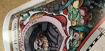
This map of the southeastern United States was published in 1862 by James T. Lloyd. It shows cities, towns, villages, forts, counties, harbors, and rivers. The map was signed by Millard Fillmore.
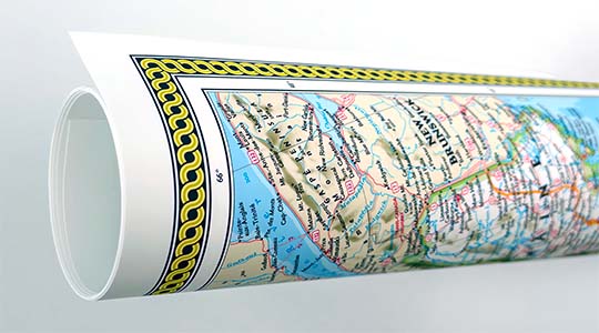
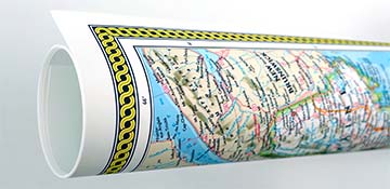
We use top-notch materials printed on demand using the Giclée printing method, so you get amazing detail and bright colors every time.
Archival Paper
Premium fine art paper that provides accurate color reproduction with high-contrast, high-resolution print output and maximum image permanence. A high-quality Giclée print ready for framing.
Museum quality paper for high-quality fine art.
Ultra smooth, neutral white matte finish.
Heavy-weight 230 gsm, 9.5 mil thickness.
Printed with pigment inks for longer print life and enhanced fade resistance.
Pigment based Canon LUCIA inks provide smooth tones and rich colors in fine, precise detail.
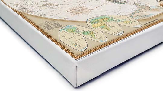
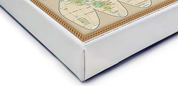
Canvas Gallery Wrap
A high quality canvas giclee print is hand stretched over a sturdy wood frame. Printed on demand and handcrafted in Seattle, WA. The canvas gallery wrap serves as a stunning piece of art ready to hang on your wall.
Premium 19 mil canvas material.
Pigment based Canon LUCIA inks provide smooth tones and rich colors in fine, precise detail.
High quality giclee fine art print with a lightfastness rating of over 100 years.
Durable canvas mounted to a 1.25" deep wood frame.
Ready to hang with included easy-to-use hanging kit.
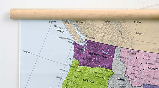
Canvas on Wood Rails
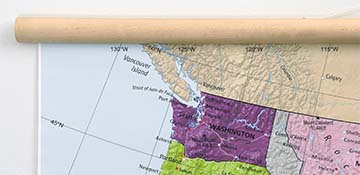
A canvas giclee print that is mounted to wood hanging rails placed along the top and bottom of the map. Rail mounted maps are ready to hang via the attached hanging cord. Solid wood rails have a natural finish.
Premium 19 mil canvas material.
Wood rails are 1 1/8" wide, round front.
USA sourced solid maple wood.
High quality giclee fine art print with a lightfastness rating of over 100 years.
Pigment based Canon LUCIA inks provide smooth tones and rich colors in fine, precise detail.
Luster Photo Paper
A premium semi-gloss photo paper with a subtle texture that produces a vivid, richly detailed print. This material results in an exquisitely detailed giclee print of substantially higher quality than a standard poster.
Printed on 10 mil premium luster photo paper resulting in a brilliant, colorful image with a vivid life-like quality.
Pigment based Canon LUCIA inks provide smooth tones and rich colors in fine, precise detail.
Inks have a lightfastness rating of over 100 years, guaranteeing minimal noticeable fading over a very long period of time.
Printed using very high resolution source files.
Giclee printing is superior to traditional lithography in a number of ways: colors are brighter, lasts longer, and is a higher resolution.
Framed Print
Our gallery quality frames are made of solid wood and feature optical-grade acrylic. Each framed map is printed on premium archival matte fine art paper.
Printed on thick, luxurious acid-free fine art paper & dry-mounted to foam board.
Pigment inks ensure a vivid print with amazing colors and excellent fade resistance.
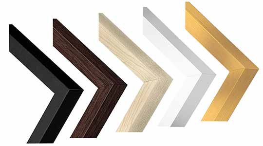
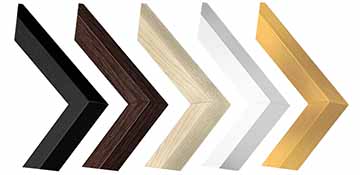
Solid wood frame in 5 finishes has a 7/8" face & 1.25" depth.
Kraft paper protective backing & hanging wire installed.
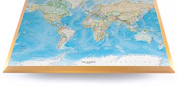
Plaque Mount
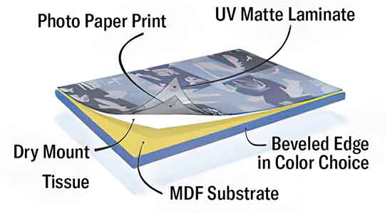
A museum grade display featuring high-resolution printing on premium photo paper, mounted on a durable wood plaque with a protective matte laminate. Surface can be cleaned with glass cleaner.
A premium photo print is dry-mounted to onto wood substrate (MDF).
Features a highly durable laminated surface that is scratch-resistant, water-resistant and fade-resistant.
Lamination is a non-glare matte finsh that can be wiped clean with a damp cloth or glass cleaner.
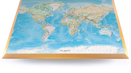
Mounted to 3/8" thick MDF wood panel with a 3/8" wide beveled edge available in premium foil color options.
Keyhole slot with velvet feet on the corners for easy wall mounting. Hanging hardware included.
Plaque Mounting Process
Gallery quality map prints made in the USA
We specialize in producing high-quality, detailed maps using advanced printing technologies and premium materials. Stringent quality control and ultra-high-resolution printing guarantee absolute clarity and precise detail at any size. Whether it's a smaller wall map print or a gigantic wallpaper map mural, no print will appear blurry or pixelated. You can expect every detail on the map to be sharp and clear.
Finely Crafted Cartographic Works of Art
Many of the maps we provide are created by our small team of cartographers under the name Academia Maps.
Museum Quality Materials
We source the best materials for our map prints and wallpaper maps. Premium archival inks guarantee rich vibrant colors with excellent fade resistance.
USA Print Production
We are a small business located in Seattle, WA that has been printing maps for over 15 years. Each map is printed on-demand using high-end fine art printers.
Shipping Costs
Free Ground Shipping within the contiguous United States and a flat rate of $20.00 to AK and HI.
Canada via UPS Standard is $40.00 USD.
Worldwide Shipping is available and shipping costs will be calculated at checkout.
Shipping Times
Most items are made to order and ship from our Seattle, WA facility. Typical production lead times are listed below. Shipping transit time is 2-5 business days depending on the delivery location. If you need your map by a certain deadline please contact us for expedited options.
Archival Paper, Laminated Maps, and Peel & Stick - 5-7 business days
Wood Rail Mounting - 3-4 weeks
Canvas Gallery Wraps & Framed Maps - 3-5 business days
Push Pin Maps - 3-5 business days
Spring Roller Maps - Varies, see product description
Wallpaper Map Murals - 7-10 business days
Returns
If you are unhappy with your order for any reason you can return it within 30 days of the delivery date. Customized items are non-returnable.
Yes, we can produce a majority of the map titles found on our website in a custom size. If you would like to request a custom size, take note of the map title and item#, then follow one of the links below to make your request. We will follow up with a link to checkout.
(for rolled or mounted prints)
(for larger peel & stick / wallpaper maps)
All of our maps are currently labeled as "Gulf of Mexico". Since our map products are printed to order, we can offer the alternate "Gulf of America" labeling by request.
If you would like your map to be labeled Gulf of America instead of Gulf of Mexico, simply request this in the comments section at checkout, and we will update the map.
We accept purchase orders from schools and government entities. You can e-mail a copy of your PO to [email protected].
View more information and download our W-9.
No problem, send a screenshot or PDF of your shopping cart to [email protected] and will promptly follow up with a quotation.
Our products are printed on demand and have the following production lead times:
Archival Paper, Laminated Maps, and Peel & Stick - 5-7 business days
Wood Rail Mounting - 3-4 weeks
Canvas Gallery Wraps & Framed Maps - 3-5 business days
Spring Roller Maps - Varies, see product description
Shipping transit time is 2-5 business days and will vary depending on your location. Most products ship from Seattle, WA.
Many of the maps found on our website can be customized, including adding a personalized title/legend or company logo, modifying the color scheme, change text labels, adding points of interest, and placing GIS data on the map.
If the order is shipping outside of Washington state, sales tax may not apply. We collect sales taxes per state and local laws. Sales tax is calculated at checkout based on the delivery address.
We can ship to nearly any country. The shipping cost is determined for Canada and most European countries at checkout. If you find that shipping is unavailable to your country when checking out then please contact us with a list of the products you would like to order as well as size and material options.
We can produce a custom map for any location in the world. Whether you are looking for a detailed city street map or high resolution satellite imagery of a remote area, we have you covered.
Because maps aren't just décor—they're personal stories, travel memories, and future adventures waiting to happen. SHOP BESTSELLING MAPS
🎁 Meaningful: Track travels, spark memories, plan new experiences.
🎄 Perfect for gifts: Unique, educational, and visually stunning.
🏠 Fits any home décor: Modern, vintage, minimalist & artistic styles available.
✏️ Personalizable: Add names, family titles, travel quotes (push-pin maps).
✈️ Great for travelers, students, families, teachers & offices.
Wall Maps Material Info
We use museum grade papers and canvas along with high quality solid wood mounting options.
Made in the USA
Archival Paper
Premium Giclée fine art print on thick acid-free paper with a matte finish. Features rich, vibrant colors with precise detail.
Luster Photo Paper
Giclée fine art print on semi-gloss photo paper. A richly detailed print with vivid colors.
Canvas on Wood Rails
High-quality giclée print on artist-grade canvas mounted to natural finish solid wood hanging rails placed along the top and bottom of the canvas. Hanging cord at top.
Canvas Gallery Wrap
High-quality giclée print on artist-grade canvas. Wrapped around a sturdy wooden frame, this print is perfect for adding depth and texture to any space.
Framed Map Print
Printed on high-grade fine art paper and mounted in a solid wood frame available in 5 finishes. The print is protected behind optical-grade clear acrylic.
Plaque Mount
A high resolution photo print dry-mounted to wood and sealed with a durable matte laminate. A sleek frameless look with a beveled edge that is available in multiple color finishes.
Size Guide
These mockups are to be used as a general visual aid to assist you in choosing a size. The measurements may not reflect the exact sizes of the product you are viewing. It is always best practice to measure your wall space prior to ordering.
Our wall maps and wallpaper map murals are handcrafted by our small team in Seattle, WA.
School Purchase Orders
We accept purchase orders from schools and other government institutions. Learn more here.
High Quality Materials
Maps are printed on premium fine art papers, canvas, and durable wallcovering materials using archival inks.
Stunning Cartography
Original and up-to-date maps designed by our cartographic team at Academia Maps include a range of high quality maps for geographic exploration, home decor, and classroom learning.