Maps showing the Toledo, Cincinnati & St. Louis Railroad and its connections.
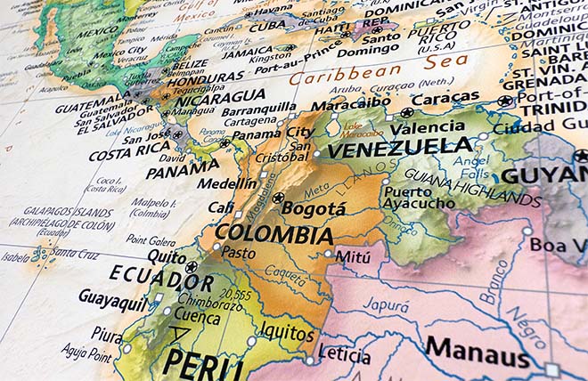
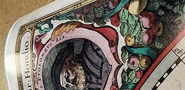
This map of the Middle West United States was published in 1881 by G.W. & C.B. Colton & Co. It features portions of Iowa, Wisconsin, Michigan, Ohio, Kentucky, Indiana, Illinois, Missouri, Kansas, Arkansas and Tennessee. Shown are counties, cities, towns, waterways, coal fields, and the railroad and steamboat network of the 1880's. Included is an inset map of the lower U.S. states and Mexico.
The Toledo, Cincinnati & St. Louis Railroad was a narrow gauge (3 foot) line that began as a subsidiary of the Toledo, Delphos & Burlington Railroad, which had earlier merged with the 4 ft 10 in gauge Iron Railroad. The two lines merged in 1881 retaining the Toledo, Cincinnati & St. Louis name. A third rail was installed within the larger gauge rails of the portion that had been the Iron Railroad to accommodate the narrow gauge locomotives of the Toledo, Cincinnati & St. Louis Railroad. Two years later the railroad was forced into bankruptcy and later was split up, converted to standard (4 ft 8 ½ in) gauge, and sold in portions.
Between the Little Miami and Great Miami rivers on the north shore of the Ohio River, Cincinnati began as a small settlement called "Losantiville" in 1788. Losantiville faced the mouth of the Licking River. Its name was changed in 1790 to Cincinnati.
Construction began in 1825 on the Miami and Erie Canal. The canal began operations in 1827 linking Cincinnati to Middletown, and then later Toledo, Ohio.
Toledo was founded along the west bank of the Maumee River in 1833. The city grew fast with the addition of the Miami and Erie Canal, as well as other connecting canals. Toledo boasted furniture manufacturers, carriage makers and breweries. Toledo became a major glassmaking town, producing windows, bottles and glass art. When the railroads began to replace the canals as the preferred mode of transportation, Toledo became an important center for several railroad companies.
After the American Civil War, Cincinnati prospered with the production of iron. It also was an important meatpacking, woodworking and millinery town. The Little Miami Railroad began serving Cincinnati in 1836. The first road and railway bridge crossing the Mississippi River was completed at St. Louis in 1874. The bridge was the longest arch bridge in the world at that time with a length of 1,964 meters. It was the first time true steel had been used in bridgework.
In 1881 Thomas Edison and Alexander Graham Bell formed the Oriental Telephone Company of New York. In that same year the Canadian Pacific Railway was incorporated.
We use top-notch materials printed on demand using the Giclée printing method, so you get amazing detail and bright colors every time.
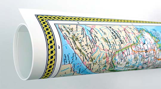
Archival Paper
Premium fine art paper that provides accurate color reproduction with high-contrast, high-resolution print output and maximum image permanence. A high-quality Giclée print ready for framing.
Museum quality paper for high-quality fine art.
Ultra smooth, neutral white matte finish.
Heavy-weight 230 gsm, 9.5 mil thickness.
Printed with pigment inks for longer print life and enhanced fade resistance.
Pigment based Canon LUCIA inks provide smooth tones and rich colors in fine, precise detail.
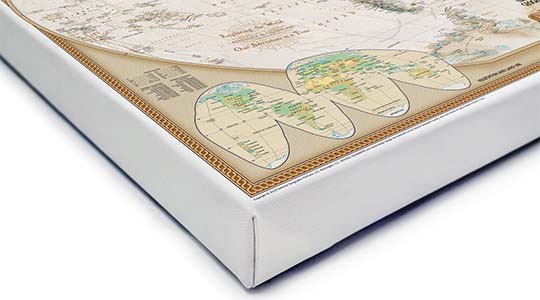
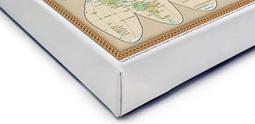
Canvas Gallery Wrap
A high quality canvas giclee print is hand stretched over a sturdy wood frame. Printed on demand and handcrafted in Seattle, WA. The canvas gallery wrap serves as a stunning piece of art ready to hang on your wall.
Premium 19 mil canvas material.
Pigment based Canon LUCIA inks provide smooth tones and rich colors in fine, precise detail.
High quality giclee fine art print with a lightfastness rating of over 100 years.
Durable canvas mounted to a 1.25" deep wood frame.
Ready to hang with included easy-to-use hanging kit.
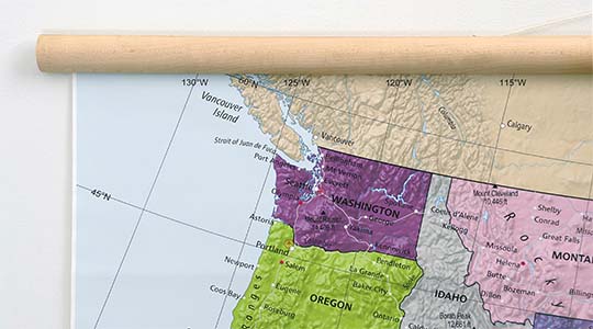
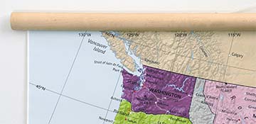
Canvas on Wood Rails
A canvas giclee print that is mounted to wood hanging rails placed along the top and bottom of the map. Rail mounted maps are ready to hang via the attached hanging cord. Solid wood rails have a natural finish.
Premium 19 mil canvas material.
Wood rails are 1 1/8" wide, round front.
USA sourced solid maple wood.
High quality giclee fine art print with a lightfastness rating of over 100 years.
Pigment based Canon LUCIA inks provide smooth tones and rich colors in fine, precise detail.
Luster Photo Paper
A premium semi-gloss photo paper with a subtle texture that produces a vivid, richly detailed print. This material results in an exquisitely detailed giclee print of substantially higher quality than a standard poster.
Printed on 10 mil premium luster photo paper resulting in a brilliant, colorful image with a vivid life-like quality.
Pigment based Canon LUCIA inks provide smooth tones and rich colors in fine, precise detail.
Inks have a lightfastness rating of over 100 years, guaranteeing minimal noticeable fading over a very long period of time.
Printed using very high resolution source files.
Giclee printing is superior to traditional lithography in a number of ways: colors are brighter, lasts longer, and is a higher resolution.
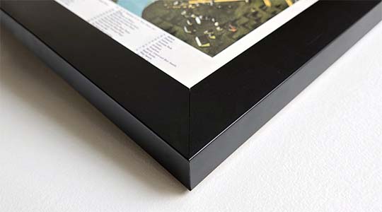
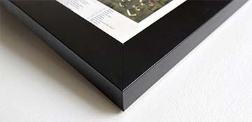
Framed Map Print - Black Finish
Our gallery quality frames are made of solid wood and feature optical-grade acrylic. Each framed map is printed on premium archival matte fine art paper.
Printed on thick, luxurious acid-free fine art paper & dry-mounted to foam board.
Pigment inks ensure a vivid print with amazing colors and excellent fade resistance.
Solid wood frame with a black finish has a 1.25" face & 7/8" depth.
Kraft paper protective backing & hanging wire installed.
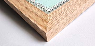
Framed Map Print - Natural Oak Finish
Our gallery quality frames are made of solid wood and feature optical-grade acrylic. Each framed map is printed on premium archival matte fine art paper.
Printed on thick, luxurious acid-free fine art paper & dry-mounted to foam board.
Pigment inks ensure a vivid print with amazing colors and excellent fade resistance.
Solid wood frame with a natural oak finish has a 1.25" face & 7/8" depth.
Kraft paper protective backing & hanging wire installed.
Gallery quality map prints made in the USA
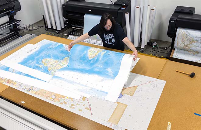
We specialize in producing high-quality, detailed maps using advanced printing technologies and premium materials. Stringent quality control and ultra-high-resolution printing guarantee absolute clarity and precise detail at any size. Whether it's a smaller wall map print or a gigantic wallpaper map mural, no print will appear blurry or pixelated. You can expect every detail on the map to be sharp and clear.
Finely Crafted Cartographic Works of Art
Many of the maps we provide are created by our small team of cartographers under the name Academia Maps.
Museum Quality Materials
We source the best materials for our map prints and wallpaper maps. Premium archival inks guarantee rich vibrant colors with excellent fade resistance.
USA Print Production
We are a small business located in Seattle, WA that has been printing maps for over 15 years. Each map is printed on-demand using high-end fine art printers.
Shipping Costs
Free Ground Shipping within the contiguous United States and a flat rate of $20.00 to AK and HI.
Canada via UPS Standard is $40.00 USD.
Worldwide Shipping is available and shipping costs will be calculated at checkout.
Shipping Times
Most items are made to order and ship from our Seattle, WA facility. Typical production lead times are listed below. Shipping transit time is 2-5 business days depending on the delivery location. If you need your map by a certain deadline please contact us for expedited options.
Archival Paper, Laminated Maps, and Peel & Stick - 5-7 business days
Wood Rail Mounting - 3-4 weeks
Canvas Gallery Wraps & Framed Maps - 3-5 business days
Push Pin Maps - 3-5 business days
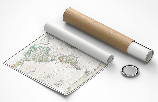
Spring Roller Maps - Varies, see product description
Wallpaper Map Murals - 7-10 business days
Returns
If you are unhappy with your order for any reason you can return it within 30 days of the delivery date. Customized items are non-returnable.
Yes, we can produce a majority of the map titles found on our website in a custom size. If you would like to request a custom size, take note of the map title and item#, then follow one of the links below to make your request. We will follow up with a link to checkout.
(for rolled or mounted prints)
(for larger peel & stick / wallpaper maps)
We accept purchase orders from schools and government entities. You can e-mail a copy of your PO to [email protected].
View more information and download our W-9.
No problem, send a screenshot or PDF of your shopping cart to [email protected] and will promptly follow up with a quotation.
Our products are printed on demand and have the following production lead times:
Archival Paper, Laminated Maps, and Peel & Stick - 5-7 business days
Wood Rail Mounting - 3-4 weeks
Canvas Gallery Wraps & Framed Maps - 3-5 business days
Spring Roller Maps - Varies, see product description
Shipping transit time is 2-5 business days and will vary depending on your location. Most products ship from Seattle, WA.
Many of the maps found on our website can be customized, including adding a personalized title/legend or company logo, modifying the color scheme, change text labels, adding points of interest, and placing GIS data on the map.
If the order is shipping outside of Washington state, sales tax may not apply. We collect sales taxes per state and local laws. Sales tax is calculated at checkout based on the delivery address.
We can ship to nearly any country. The shipping cost is determined for Canada and most European countries at checkout. If you find that shipping is unavailable to your country when checking out then please contact us with a list of the products you would like to order as well as size and material options.
We can produce a custom map for any location in the world. Whether you are looking for a detailed city street map or high resolution satellite imagery of a remote area, we have you covered.
15% Off! all wall maps, push pin maps, and map wallpaper murals.
Use discount code: BLACK at checkout to apply the discount.
Why Maps Are the Gift They'll Never Forget
Because maps aren't just décor—they're personal stories, travel memories, and future adventures waiting to happen. SHOP BLACK FRIDAY MAP EVENT
🎁 Meaningful: Track travels, spark memories, plan new experiences.
🎄 Perfect for the holidays: Unique, educational, and visually stunning.
🏠 Fits any home décor: Modern, vintage, minimalist & artistic styles available.
✏️ Personalizable: Add names, family titles, travel quotes (push-pin maps).
✈️ Great for travelers, students, families, teachers & offices.
*discount excludes classroom spring roller mounted maps and map sets.
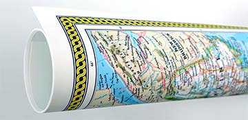
Wall Maps Material Info
We use museum grade papers and canvas along with high quality solid wood mounting options.
Made in the USA
Archival Paper
Premium Giclée fine art print on thick acid-free paper with a matte finish. Features rich, vibrant colors with precise detail.
Luster Photo Paper
Giclée fine art print on semi-gloss photo paper. A richly detailed print with vivid colors.
Canvas on Wood Rails
High-quality giclée print on artist-grade canvas mounted to natural finish solid wood hanging rails placed along the top and bottom of the canvas. Hanging cord at top.
Canvas Gallery Wrap
High-quality giclée print on artist-grade canvas. Wrapped around a sturdy wooden frame, this print is perfect for adding depth and texture to any space.
Framed Map Print - Black
Printed on high-grade fine art paper and mounted in a solid wood frame with a black finish. The print is protected behind optical-grade clear acrylic.
Framed Map Print - Natural Oak
Printed on high-grade fine art paper and mounted in a solid wood frame with a natural oak finish. The print is protected behind optical-grade clear acrylic.
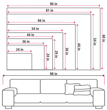
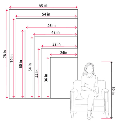
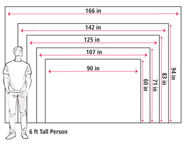
Size Guide
These mockups are to be used as a general visual aid to assist you in choosing a size. The measurements may not reflect the exact sizes of the product you are viewing. It is always best practice to measure your wall space prior to ordering.
Our wall maps and wallpaper map murals are handcrafted by our small team in Seattle, WA.
School Purchase Orders
We accept purchase orders from schools and other government institutions. Learn more here.
High Quality Materials
Maps are printed on premium fine art papers, canvas, and durable wallcovering materials using archival inks.
Stunning Cartography
Original and up-to-date maps designed by our cartographic team at Academia Maps include a range of high quality maps for geographic exploration, home decor, and classroom learning.