

Nevada Reference Wall Map
Description
This colorful and detailed map of Nevada allows you to easily identify major thoroughfares, highways, freeways, major streets, national parks, landmarks, rivers, and major bodies of water. Shaded relief provides a 3-D visual representation of Nevada's topography. Color indexed areas indicate national parks, wildlife refuge, forests, Indian reservations, military sites, urban areas, and large incorporated cities. State counties are labeled and boundaries are outlined. Comprehensive city and county index makes it easy to locate even the smallest town.
With an extensive amount of geographic information on the state of Nevada, this is an ideal map for state classroom studies. Also an excellent reference map for commercial business needs or personal home use. Key Features:
With an extensive amount of geographic information on the state of Nevada, this is an ideal map for state classroom studies. Also an excellent reference map for commercial business needs or personal home use. Key Features:
- Cities, Towns, County Names and Boundaries.
- Lakes, Rivers, Mountain Ranges and Peaks, Deserts.
- National Parks and Forests, Wildlife Refuge, State Parks.
- Urban Aggregation, Indian Reservations, Military Areas.
- Airports, Points of Interest, Landmarks, and Recreation.
- Freeways, Primary & Secondary Highways, Major Roads.
- Inset maps of Las Vegas, Las Vegas Strip / Casinos, Reno, Carson City, Lake Tahoe, Bullhead City / Laughlin.
Ships rolled in a durable cardboard tube.
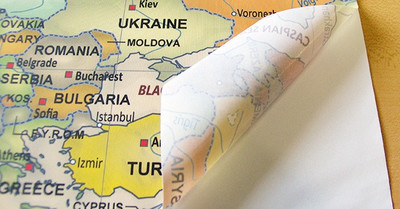
Materials
Archival Paper

Premium fine art paper that provides accurate color reproduction with high-contrast, high-resolution print output and maximum image permanence. A high-quality print ready for framing.
More
- Museum quality paper for high-quality fine art.
- Ultra smooth, neutral white matte finish.
- Heavy-weight 230 gsm, 9.5 mil thickness.
- Printed with pigment inks for longer print life and enhanced fade resistance.
- Pigment based Canon LUCIA inks provide smooth tones and rich colors in fine, precise detail.
Laminated Map Print
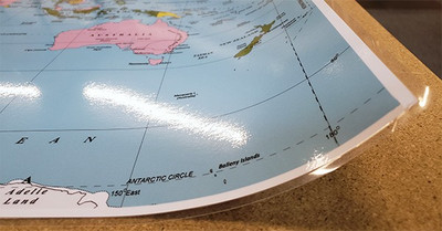
A fully laminated paper print. Durable and ready to hang on the wall using push-pins, double sided tape, or poster hanging rails. A great inexpensive map option that features a wet or dry-erase markable surface.
More
- High quality 3 mil hot lamination.
- Print is laminated both front and back with full encapsulation. Completely waterproof.
- Compatible with dry or wet erase markers. Perfect for classroom use.
Peel & Stick Wall Decal
A versatile peel & stick fabric material with repositionable self-adhesive backing. A polyester canvas material that can be used multiple times without damaging walls or leaving a residue.
More
- Easy to install and sticks to just about any flat surface.
- Removable without damaging walls or paint. Can be re-positioned / re-applied multiple times without losing adhesion. Leaves no residue!
- Adhesive stays in place for many years even under high humidity. Does not weaken.
- Non-toxic, safe for a kids room. No PVC, Glycol-Ether or Formaldehyde.
- Great for rental houses & apartments. Resists wrinkles, bubbling, shrinking, and tears. Simply peel, place, & stick!
- Not suitable for textured walls.
- View More Info
Laminated on Wood Rails
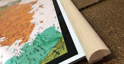
A laminated paper print is mounted to wooden hanging rails placed along the top and bottom of the map. Ready to hang on the wall using the attached hanging cord. Wood rails feature a natural finish.
More
- Durable 3 mil laminated print.
- Wood rails are 1 1/8" wide, round front.
- USA sourced solid maple wood.
- Laminated map is compatible with wet or dry-erase markers.
Canvas on Wood Rails
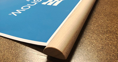
A canvas giclee print is mounted to wooden hanging rails placed along the top and bottom of the map. Ready to hang on the wall using the attached hanging cord. Wood rails feature a natural finish.
More
- Premium 19 mil canvas material.
- Wood rails are 1 1/8" wide, round front.
- USA sourced solid maple wood.
- High quality giclee fine art print with a lightfastness rating of over 100 years.
- Pigment based Canon LUCIA inks provide smooth tones and rich colors in fine, precise detail.
Canvas Gallery Wrap
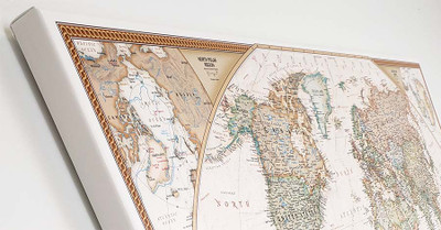
A high quality canvas giclee print is hand stretched over a sturdy wood frame. Printed on demand and handcrafted in Seattle, WA. The canvas gallery wrap serves as a stunning piece of art ready to hang on your wall.
More
- Premium 19 mil canvas material.
- Pigment based Canon LUCIA inks provide smooth tones and rich colors in fine, precise detail.
- High quality giclee fine art print with a lightfastness rating of over 100 years.
- Durable canvas mounted to a 1" deep wood frame.
- Ready to hang with included easy-to-use hanging kit.
Framed Map Print - Black Finish
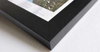
Our gallery quality frames are made of solid wood and feature optical-grade acrylic. Each framed map is printed on premium archival matte fine art paper.
More
- Printed on thick, luxurious acid-free fine art paper & dry-mounted to foam board.
- Pigment inks ensure a vivid print with amazing colors and excellent fade resistance.
- Solid wood frame with a black finish has a 1.25" face & 7/8" depth.
- Kraft paper protective backing & hanging wire installed.
Framed Map Print - Natural Oak Finish
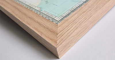
Our gallery quality frames are made of solid wood and feature optical-grade acrylic. Each framed map is printed on premium archival matte fine art paper.
More
- Printed on thick, luxurious acid-free fine art paper & dry-mounted to foam board.
- Pigment inks ensure a vivid print with amazing colors and excellent fade resistance.
- Solid wood frame with a natural oak finish has a 1.25" face & 7/8" depth.
- Kraft paper protective backing & hanging wire installed.


