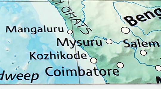
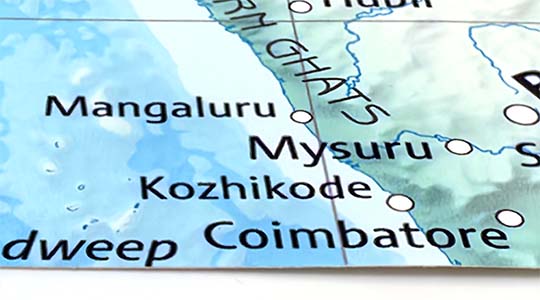
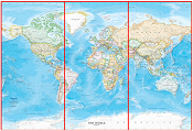
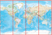
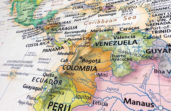
This colorful political map of Australia & Oceania is offered in numerous large wall mural sizes. The map features countries and Australian territories in contrasting colors making them easy to identify. Political boundaries are outlined in red and major cities, capitals, rivers, lakes, mountains, as well as main roads are labeled on the map. A map legend identifies various features on the map.
An excellent wall mural map for classroom instruction. The intermediate Australia & Oceania political map features comprehensive content, making it suitable for teaching grades 6-12+. This large wall map mural is a great way to bring new purpose to an empty wall in your school or classroom.
We use top-notch materials printed on demand using the Giclée printing method, so you get amazing detail and bright colors every time.
Durable Type II Wallpaper
A durable commercial grade wallpaper that is ideal for high traffic public spaces. Surface is scrub and scratch resistant. Odorless & non-toxic GREENGUARD Gold Certified.
A 17mil thick commercial grade Type II (ASTM F793) compliant wallpaper. Meets EN233 European Wallcovering Standard.
Ultra smooth matte finish with vivid color and high definition detail. Excellent colorfastness rating.
Highly mold & mildew resistant. Class A fire rating. Water resistant.
Heavy duty scrim backing compatible with common wallcovering pastes.
Laminated Vinyl Peel & Stick
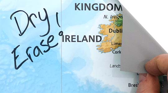
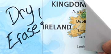
Durable removable vinyl wallcovering with dry-erase marker compatible lamination.
Coated with a dry-erase film laminate that provides extra durability.
Write-on surface is compatible with dry or wet erase markers.
Repositionable adhesive that is removable for a period up to 1 year.
Versatile, scratch and scrub resistant material. Suitable for installation in public spaces.
Recommended for flat painted dry-wall. Ask us about options for brick, cinderblock, and textured surfaces.
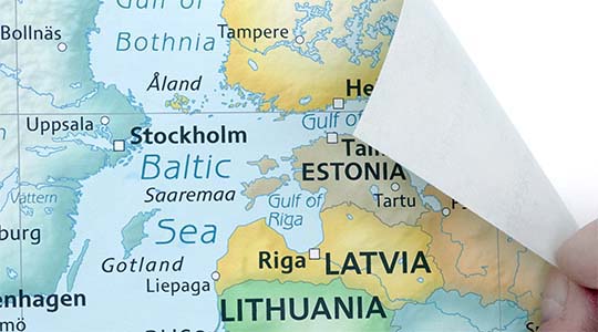
Peel & Stick Fabric Removable Wallpaper
A thin canvas material that is removable & reusable multiple times without losing adhesive strength. Great for rental houses & apartments as it can be removed without damaging paint or leaving residue. Popular with renters.
Easy to install and sticks to just about any flat surface. Use it on doors, ceilings, tiles, and windows.
Heavy-weight 230 gsm, 9.5 mil thickness.
99% opaque block-out hides overlapping panels for a seamless look.
Non-toxic, safe for a kids room. No PVC, Glycol-Ether or Formaldehyde. Class A or 1 fire rated.
Adhesive stays in place for many years even under high humidity & outdoor installation in all weather conditions. Install it for a day or a decade.
Matte finish. Resists wrinkles, bubbling, shrinking, and tears. Does not weaken.
Not suitable for textured walls. Ask us about our high-tack peel & stick options.
Standard Pre-pasted PVC-free wallpaper material featuring water activated adhesive. The wallcovering material is odorless & non-toxic. GREENGUARD Children & Schools Certified and FSC Certified. Printed with eco-friendly latex inks.
A 7mil thick pre-pasted wallpaper with water activated paste.
Ultra smooth matte finish with vivid color and high definition detail.
Mold & Mildew resistant. Class A fire rating. Water resistant wipeable surface.
Peel & Stick Fabric Removable Wallpaper is an easy to install DIY option ideal for rental properties or temporary installs as it can be removed leaving no damage to paint or walls. Simply peel, place, and stick!
Durable Type II Wallpaper is a commerical grade wallcovering material with a textile scrim backing. This material does require a wallpaper adhesive for installation.
Laminated Vinyl Peel & Stick is an ultra-conformable calendared adhesive-backed vinyl with UV gloss laminate. Durable enough for outdoor installs including vehicle wraps. Professional installation is recommended.
Gallery quality map prints made in the USA
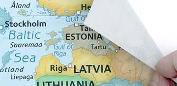
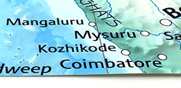
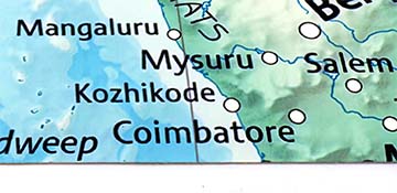
We specialize in producing high-quality, detailed maps using advanced printing technologies and premium materials. Stringent quality control and ultra-high-resolution printing guarantee absolute clarity and precise detail at any size. Whether it's a smaller wall map print or a gigantic wallpaper map mural, no print will appear blurry or pixelated. You can expect every detail on the map to be sharp and clear.
Finely Crafted Cartographic Works of Art
Many of the maps we provide are created by our small team of cartographers under the name Academia Maps.
Museum Quality Materials
We source the best materials for our map prints and wallpaper maps. Premium archival inks guarantee rich vibrant colors with excellent fade resistance.
USA Print Production
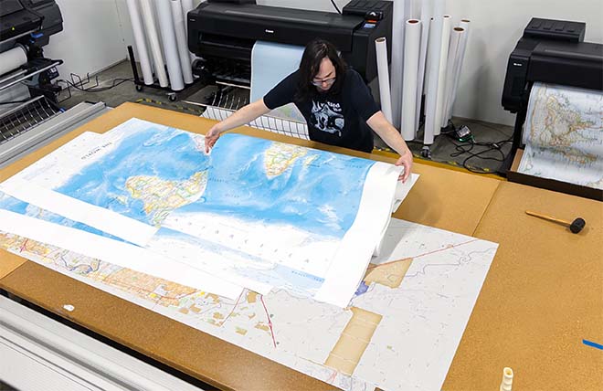
We are a small business located in Seattle, WA that has been printing maps for over 15 years. Each map is printed on-demand using high-end fine art printers.
Shipping Costs
Free Ground Shipping within the contiguous United States and a flat rate of $20.00 to AK and HI.
Canada via UPS Standard is $40.00 USD.
Worldwide Shipping is available and shipping costs will be calculated at checkout.
Shipping Times
Most items are made to order and ship from our Seattle, WA facility. Typical production lead times are listed below. Shipping transit time is 2-5 business days depending on the delivery location. If you need your map by a certain deadline please contact us for expedited options.
Archival Paper, Laminated Maps, and Peel & Stick - 5-7 business days
Wood Rail Mounting - 3-4 weeks
Canvas Gallery Wraps & Framed Maps - 3-5 business days
Push Pin Maps - 3-5 business days
Spring Roller Maps - Varies, see product description
Wallpaper Map Murals - 7-10 business days
Returns
If you are unhappy with your order for any reason you can return it within 30 days of the delivery date. Customized items are non-returnable.
Yes, we can produce a majority of the map titles found on our website in a custom size. If you would like to request a custom size, take note of the map title and item#, then follow one of the links below to make your request. We will follow up with a link to checkout.
(for rolled or mounted prints)
(for larger peel & stick / wallpaper maps)
All of our maps are currently labeled as "Gulf of Mexico". Since our map products are printed to order, we can offer the alternate "Gulf of America" labeling by request.
If you would like your map to be labeled Gulf of America instead of Gulf of Mexico, simply request this in the comments section at checkout, and we will update the map.
We accept purchase orders from schools and government entities. You can e-mail a copy of your PO to contact@worldmapsonline.com.
View more information and download our W-9.
No problem, send a screenshot or PDF of your shopping cart to contact@worldmapsonline.com and will promptly follow up with a quotation.
Our products are printed on demand and have the following production lead times:
Archival Paper, Laminated Maps, and Peel & Stick - 5-7 business days
Wood Rail Mounting - 3-4 weeks
Canvas Gallery Wraps & Framed Maps - 3-5 business days
Spring Roller Maps - Varies, see product description
Shipping transit time is 2-5 business days and will vary depending on your location. Most products ship from Seattle, WA.
Many of the maps found on our website can be customized, including adding a personalized title/legend or company logo, modifying the color scheme, change text labels, adding points of interest, and placing GIS data on the map.
If the order is shipping outside of Washington state, sales tax may not apply. We collect sales taxes per state and local laws. Sales tax is calculated at checkout based on the delivery address.
We can ship to nearly any country. The shipping cost is determined for Canada and most European countries at checkout. If you find that shipping is unavailable to your country when checking out then please contact us with a list of the products you would like to order as well as size and material options.
We can produce a custom map for any location in the world. Whether you are looking for a detailed city street map or high resolution satellite imagery of a remote area, we have you covered.
Because maps aren't just décor—they're personal stories, travel memories, and future adventures waiting to happen. SHOP BESTSELLING MAPS
🎁 Meaningful: Track travels, spark memories, plan new experiences.
🎄 Perfect for gifts: Unique, educational, and visually stunning.
🏠 Fits any home décor: Modern, vintage, minimalist & artistic styles available.
✏️ Personalizable: Add names, family titles, travel quotes (push-pin maps).
✈️ Great for travelers, students, families, teachers & offices.
Map Murals Material Info
Our wallcovering materials are of the utmost quality. Every mural is printed in stunning ultra high resolution, ensuring crisp text labels and clarity of intricate map details.
Made in the USA
Peel & Stick Fabric
Self-adhesive removable fabric wallcovering material. Made of 100% polyester and features a matte finish with ultra-fine texture, like a thin canvas. Dependable adhesive allows the print to be removed and re-applied multiple times without leaving residue on the wall.
Pre-Pasted Wallpaper
Traditional wallpaper material with water activated adhesive for easy application. Has a smooth matte finish and is PVC-free.
Durable Type II Wallpaper
A Type II commercial grade wallpaper with a scrim backing. Ideal for high-traffic areas with it's scrub and scratch resistant surface. Smooth matte finish & PVC-free.
Laminated Vinyl Self-Adhesive
Peel & stick adhesive-backed vinyl wallcovering material with a glossy laminate compatible with dry or wet-erase markers.
Our most durable option, great for installation in classrooms, public areas, or even outdoors.
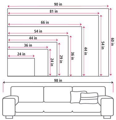
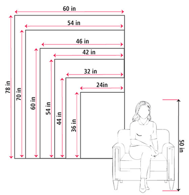
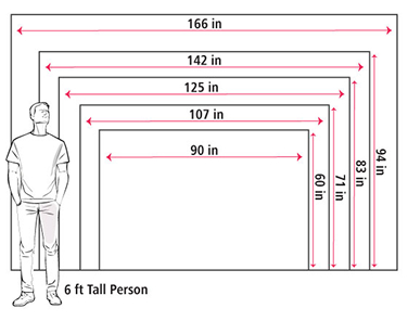
Size Guide
These mockups are to be used as a general visual aid to assist you in choosing a size. The measurements may not reflect the exact sizes of the product you are viewing. It is always best practice to measure your wall space prior to ordering.
Our wall maps and wallpaper map murals are handcrafted by our small team in Seattle, WA.
School Purchase Orders
We accept purchase orders from schools and other government institutions. Learn more here.
High Quality Materials
Maps are printed on premium fine art papers, canvas, and durable wallcovering materials using archival inks.
Stunning Cartography
Original and up-to-date maps designed by our cartographic team at Academia Maps include a range of high quality maps for geographic exploration, home decor, and classroom learning.