Panoramic map of Morrisville, VT, Lamoille County, drawn and published by Geo. E. Norris in 1889. This brief description of Lamoille County appeared in the 1883-84 Gazetteer of Lamoille and Orleans Counties, VT:
"Lamoille County, next to Grand Isle the smallest in the State, lies north of the central part of the same, between latitude 44�� 24', and 44�� 46', and longitude 4�� 7', 4�� 34', bounded north by Franklin and Orleans counties, east by portions of Orange, Caledonia, and Washington counties, south by Washington county, and west by Franklin and Chittenden counties. Its extent from north to south is about 27 miles, and nearly the same from east to west, thus giving it an area of about 420 square miles, or 268,800 acres, which contains a population of 12,684. In surface it is varied by all the charms of nature, from towering cloud-capped mountains to the sylvan dales and silvery lakeletes that adorn its nestling valleys. Turn which way you will, the lover of the beautiful in nature cannot fail to meet with that which will both charm and captive the senses. Upon the north and west rise Mansfield, Sterling, and White0face mountains in their splendor. Upon the south and east are Hog-back and Elmore mountains, while between them extend broad intervals of excellent farming land. Mount Mansfield, consisting of three distinct peaks, lies in the southern part of Cambridge, extending also into the towns of Underhill and Stowe. Its summit, 4,389 feet above tide water, is the highest point of land in the State. The name Mansfield is derived from the contour resemblance of the mountain to the face of a human being, the three peaks being designated as the Chin, the Nose, and the Lips. The Chin furnishes on of the grandest and most extensive views in New England. Standing upon its summit in a clear day, the observer looks down upon the country extending from the base of the mountain to Lake Champlain as he would upon a map, and beholds in the outspread panorama an agreeable diversity of hills and villages, forests and cultivated fields, villages and streams of water. Further along in the picture may be seen Lake Champlain, which at intervals is observed, far to the north and south, peering out in the blue distance like inlaid masses of highly polished silver, to give light and beauty to the scene. The valley of the lake may be traced its entire length, beyond which arise the majestic and picturesque Adirondacks, which give a romantic beauty to the background of the picture, and terminate the vision in that direction by their numerous pointed summits. Turning to the east, the wavy line of the horizon is broken by the sharp outlines of the White Mountains, which rise up in the dim distance sixty miles off, and form a marked feature in the landscape, while the intervening space is filled with innumerable summits of hills and mountains, with deep extended valleys, showing the location and courses of the Connecticut, Winooski and Lamoille, and their numerous tributaries. To the north can be seen the wide-spread valley of the St. Lawrence, and by the aid of a glass in a clear day steamers may be seen gliding upon its waters. The well-known figure of Montreal mountain, from which Cartier first looked upon the mountains of Vermont, rises in the hazy distance. Sterling Mountain is about four miles northeast from the chin, in the township of Morristown. Its altitude is a little less than 4,000 feet, and were it not for the proximity of Mansfield, would doubtless be regarded as one of the favorite resorts for "sight-seeing", for the same enchanting glories are visible from this peak that meet the eye on Mansfield. Between these two mountains a deep gorge intervenes, known as Smuggler's Notch, through which, in the early settlement, a bridle road was dept open, and tradition says contraband goods were secreted in and found their way through it; but latterly no one disturbs its solitude, except those seeking an exhibition of nature in her wildest and most romantic haunts."
Features numbered & lettered references to the following locations:
Congregational Church. Methodist Church. Baptist Church. Universalist Church. Town Hall. Post Office. People's Academy & Graded Schools. Railroad Station. Morrisville House, A. R. Terrill. Vermont House. News & Citizen, Lamoille Pub. Co.. Morrisville Foundry Co.. Pulp Mill. J. W. Daniels, Butter Tub Mfrs.. A. J. Smith, Livery & Feed. W. S. Cheney, Horses, Carriages and Sleighs. Hendee & Fisk, Attorneys. P. K. Gleed, Attorney. E. J. Hall, M. D., Office and Residence. J. A. Robinson, Dental Surgeon. H. B. Bryant, Station and Express Agent, M'g. International Telegraph. C. H. Slocum, Groceries, Clothing, Boots and Shoes. Geo. K. Courier, Boston Cash Store. G. W. Doty, Furniture, Carpets, Crockery, Paints and Oils. A. M. Churchill, Tinware, Stoves and Hardware. G. E. Woodward, M. D., Drugs and Medicines. A. O. Gates, Drugs, Medicines, Books, etc.. Frank E. Healey, Jr., Watches, Jewelry and Silverware. O. L. Woods, Merchant Tailor. Andrews & Hitchcock, Meats and Provisions. L. B. Boynton, Restaurant. S. B. Doty, Produce and Fertilizers. G. A. Barrows, Express and Truckman. G. W. Hendee, Residence. H. C. Fisk, Residence. P. K. Gleed, Residence. H. H. Powers, Residence. C. M. Boynton, Residence. A. M. Churchill, Residence. Mt. Mansfield. Mt. Sterling. Elmore Mountains.
We use top-notch materials printed on demand using the Giclée printing method, so you get amazing detail and bright colors every time.
Archival Paper
Premium fine art paper that provides accurate color reproduction with high-contrast, high-resolution print output and maximum image permanence. A high-quality Giclée print ready for framing.
Museum quality paper for high-quality fine art.
Ultra smooth, neutral white matte finish.
Heavy-weight 230 gsm, 9.5 mil thickness.
Printed with pigment inks for longer print life and enhanced fade resistance.
Pigment based Canon LUCIA inks provide smooth tones and rich colors in fine, precise detail.
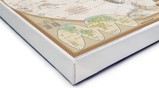
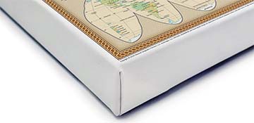
Canvas Gallery Wrap
A high quality canvas giclee print is hand stretched over a sturdy wood frame. Printed on demand and handcrafted in Seattle, WA. The canvas gallery wrap serves as a stunning piece of art ready to hang on your wall.
Premium 19 mil canvas material.
Pigment based Canon LUCIA inks provide smooth tones and rich colors in fine, precise detail.
High quality giclee fine art print with a lightfastness rating of over 100 years.
Durable canvas mounted to a 1.25" deep wood frame.
Ready to hang with included easy-to-use hanging kit.
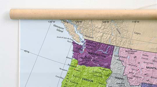
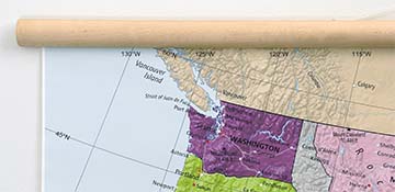
Canvas on Wood Rails
A canvas giclee print that is mounted to wood hanging rails placed along the top and bottom of the map. Rail mounted maps are ready to hang via the attached hanging cord. Solid wood rails have a natural finish.
Premium 19 mil canvas material.
Wood rails are 1 1/8" wide, round front.
USA sourced solid maple wood.
High quality giclee fine art print with a lightfastness rating of over 100 years.
Pigment based Canon LUCIA inks provide smooth tones and rich colors in fine, precise detail.
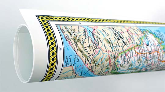
Luster Photo Paper
A premium semi-gloss photo paper with a subtle texture that produces a vivid, richly detailed print. This material results in an exquisitely detailed giclee print of substantially higher quality than a standard poster.
Printed on 10 mil premium luster photo paper resulting in a brilliant, colorful image with a vivid life-like quality.
Pigment based Canon LUCIA inks provide smooth tones and rich colors in fine, precise detail.
Inks have a lightfastness rating of over 100 years, guaranteeing minimal noticeable fading over a very long period of time.
Printed using very high resolution source files.
Giclee printing is superior to traditional lithography in a number of ways: colors are brighter, lasts longer, and is a higher resolution.
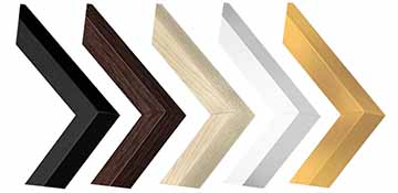
Framed Print
Our gallery quality frames are made of solid wood and feature optical-grade acrylic. Each framed map is printed on premium archival matte fine art paper.
Printed on thick, luxurious acid-free fine art paper & dry-mounted to foam board.
Pigment inks ensure a vivid print with amazing colors and excellent fade resistance.
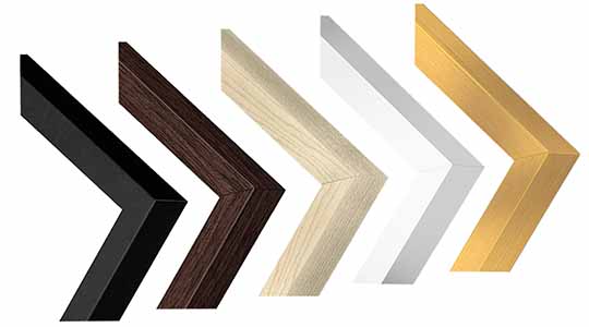
Solid wood frame in 5 finishes has a 7/8" face & 1.25" depth.
Kraft paper protective backing & hanging wire installed.
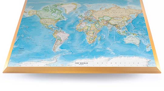
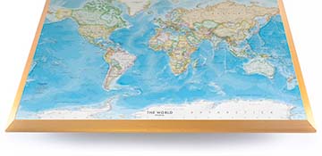
Plaque Mount
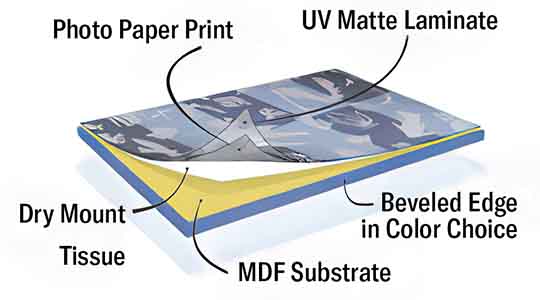
A museum grade display featuring high-resolution printing on premium photo paper, mounted on a durable wood plaque with a protective matte laminate. Surface can be cleaned with glass cleaner.
A premium photo print is dry-mounted to onto wood substrate (MDF).
Features a highly durable laminated surface that is scratch-resistant, water-resistant and fade-resistant.
Lamination is a non-glare matte finsh that can be wiped clean with a damp cloth or glass cleaner.
Mounted to 3/8" thick MDF wood panel with a 3/8" wide beveled edge available in premium foil color options.
Keyhole slot with velvet feet on the corners for easy wall mounting. Hanging hardware included.
Plaque Mounting Process
Gallery quality map prints made in the USA
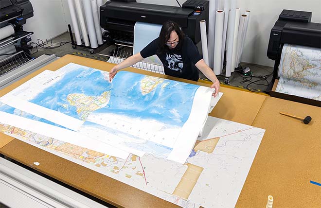
We specialize in producing high-quality, detailed maps using advanced printing technologies and premium materials. Stringent quality control and ultra-high-resolution printing guarantee absolute clarity and precise detail at any size. Whether it's a smaller wall map print or a gigantic wallpaper map mural, no print will appear blurry or pixelated. You can expect every detail on the map to be sharp and clear.
Finely Crafted Cartographic Works of Art
Many of the maps we provide are created by our small team of cartographers under the name Academia Maps.
Museum Quality Materials
We source the best materials for our map prints and wallpaper maps. Premium archival inks guarantee rich vibrant colors with excellent fade resistance.
USA Print Production
We are a small business located in Seattle, WA that has been printing maps for over 15 years. Each map is printed on-demand using high-end fine art printers.
Shipping Costs
Free Ground Shipping within the contiguous United States and a flat rate of $20.00 to AK and HI.
Canada via UPS Standard is $40.00 USD.
Worldwide Shipping is available and shipping costs will be calculated at checkout.
Shipping Times
Most items are made to order and ship from our Seattle, WA facility. Typical production lead times are listed below. Shipping transit time is 2-5 business days depending on the delivery location. If you need your map by a certain deadline please contact us for expedited options.
Archival Paper, Laminated Maps, and Peel & Stick - 5-7 business days
Wood Rail Mounting - 3-4 weeks
Canvas Gallery Wraps & Framed Maps - 3-5 business days
Push Pin Maps - 3-5 business days
Spring Roller Maps - Varies, see product description
Wallpaper Map Murals - 7-10 business days
Returns
If you are unhappy with your order for any reason you can return it within 30 days of the delivery date. Customized items are non-returnable.
Yes, we can produce a majority of the map titles found on our website in a custom size. If you would like to request a custom size, take note of the map title and item#, then follow one of the links below to make your request. We will follow up with a link to checkout.
(for rolled or mounted prints)
(for larger peel & stick / wallpaper maps)
All of our maps are currently labeled as "Gulf of Mexico". Since our map products are printed to order, we can offer the alternate "Gulf of America" labeling by request.
If you would like your map to be labeled Gulf of America instead of Gulf of Mexico, simply request this in the comments section at checkout, and we will update the map.
We accept purchase orders from schools and government entities. You can e-mail a copy of your PO to contact@worldmapsonline.com.
View more information and download our W-9.
No problem, send a screenshot or PDF of your shopping cart to contact@worldmapsonline.com and will promptly follow up with a quotation.
Our products are printed on demand and have the following production lead times:
Archival Paper, Laminated Maps, and Peel & Stick - 5-7 business days
Wood Rail Mounting - 3-4 weeks
Canvas Gallery Wraps & Framed Maps - 3-5 business days
Spring Roller Maps - Varies, see product description
Shipping transit time is 2-5 business days and will vary depending on your location. Most products ship from Seattle, WA.
Many of the maps found on our website can be customized, including adding a personalized title/legend or company logo, modifying the color scheme, change text labels, adding points of interest, and placing GIS data on the map.
If the order is shipping outside of Washington state, sales tax may not apply. We collect sales taxes per state and local laws. Sales tax is calculated at checkout based on the delivery address.
We can ship to nearly any country. The shipping cost is determined for Canada and most European countries at checkout. If you find that shipping is unavailable to your country when checking out then please contact us with a list of the products you would like to order as well as size and material options.
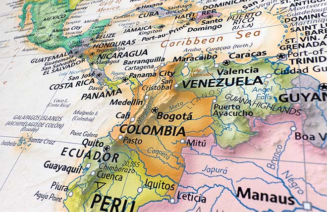
We can produce a custom map for any location in the world. Whether you are looking for a detailed city street map or high resolution satellite imagery of a remote area, we have you covered.
Because maps aren't just décor—they're personal stories, travel memories, and future adventures waiting to happen. SHOP BESTSELLING MAPS
🎁 Meaningful: Track travels, spark memories, plan new experiences.
🎄 Perfect for gifts: Unique, educational, and visually stunning.
🏠 Fits any home décor: Modern, vintage, minimalist & artistic styles available.
✏️ Personalizable: Add names, family titles, travel quotes (push-pin maps).
✈️ Great for travelers, students, families, teachers & offices.
Wall Maps Material Info
We use museum grade papers and canvas along with high quality solid wood mounting options.
Made in the USA
Archival Paper
Premium Giclée fine art print on thick acid-free paper with a matte finish. Features rich, vibrant colors with precise detail.
Luster Photo Paper
Giclée fine art print on semi-gloss photo paper. A richly detailed print with vivid colors.
Canvas on Wood Rails
High-quality giclée print on artist-grade canvas mounted to natural finish solid wood hanging rails placed along the top and bottom of the canvas. Hanging cord at top.
Canvas Gallery Wrap
High-quality giclée print on artist-grade canvas. Wrapped around a sturdy wooden frame, this print is perfect for adding depth and texture to any space.
Framed Map Print
Printed on high-grade fine art paper and mounted in a solid wood frame available in 5 finishes. The print is protected behind optical-grade clear acrylic.
Plaque Mount
A high resolution photo print dry-mounted to wood and sealed with a durable matte laminate. A sleek frameless look with a beveled edge that is available in multiple color finishes.
Size Guide
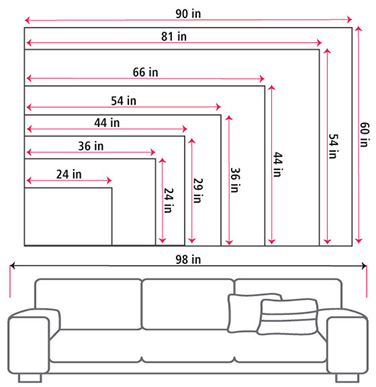
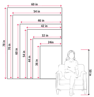
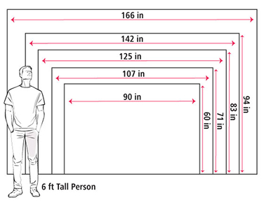
These mockups are to be used as a general visual aid to assist you in choosing a size. The measurements may not reflect the exact sizes of the product you are viewing. It is always best practice to measure your wall space prior to ordering.
Our wall maps and wallpaper map murals are handcrafted by our small team in Seattle, WA.
School Purchase Orders
We accept purchase orders from schools and other government institutions. Learn more here.
High Quality Materials
Maps are printed on premium fine art papers, canvas, and durable wallcovering materials using archival inks.
Stunning Cartography
Original and up-to-date maps designed by our cartographic team at Academia Maps include a range of high quality maps for geographic exploration, home decor, and classroom learning.