A New Sectional Map of the State of Kansas showing the route of the Union Pacific Railway - E.D. to Denver City, Col. and complete system of projected railroads. Information compiled and collected from the Departments of the Government at Washington, D.C. and other authentic sources by W.J. Keeler, C.E. 1867. Charles Du Bois, draughtsman. This detailed township and county map of Kansas shows drainage, mountains, salt marshes, and minerals deposits. Included are Indian reservations, roads, railroads and the land grants of the Union Pacific Railroad. To promote land sales this map features the following advertising booster:
"Union Pacific Railway Co. - E.D., has now for sale in Kansas, at from $1,25 to $10 per acre, large quantities of superior farming lands, and will soon have in market some 4,000,000 of acres, to be sold in tracts of 40 acres and upwards, to suit purchasers.
The lands offered for sale are situated within twenty miles of the road, and extend the whole length of the State from east to west, 420 miles, through the very heart of Kansas; embracing about 350,000 acres of the Pottowatomie reserve, offering the means of developing one of the fairest and most fertile region to be found in the wide range of the whole continent.
The valleys of the Kansas and Smokey Hill rivers are the richest, most delightful and fertile parts of the State. The soil is at least two and a half feet in length, and is remarkable for its enduring fertility, and produces the finest corn, wheat, rye, barley, sorghum, and hay. It is composed principally of ashes, deposited by annual fires, from time immemorial; no other kind of soil can possibly contain the same amount of food for plants.
Grain and Stock Raising. The world does not furnish a better grazing country than that found in these valleys; cattle readily fatten through the summer, and in the busiest portions of the spring farmers seldom feed their working teams.
Sheep are very prolific, and are not liable to disease. Abundant pasture for them is furnished by natural vegetation, which lasts throughout the greater part of the year; it costs but little to keep them in good condition through the winter. No branch of industries offers greater inducements for investment.
In the list of corn and stock-producing States, Kansasstands preeminently first; the season of vegetable growth is long; it is free from frosts nearly seven months of the year.
The season for planting corn continues through the months of April, May and June; winter wheat matures in June, and its average yield is about 30 bushels per acre. The corn crop yields from 50 to a 100 bushels per acre, according to the skill and labor bestowed upon it.
Fruit. Apples, peaches, pears, and plums are successfully cultivated. In fact, Kansas is peculiarly adapted to fruit-raising. The climate is also adapted to small fruits, and the cultivation for wine, being in the same latitude as the Catawba vineyards of Missouri and Ohio, while the grapes are richer and the yield more abundant.
Water. The Kansas valley is well watered by springs and streams, good wells are usually attained by digging from 15 to 30 feet. The water, owing to the limestone formation which prevails throughout the State, is pure and agreeable.
Climate. The climate is pleasant, and the atmosphere remarkably clear and bracing. The country is healthful and free from epidemics; owing to the absence of stagnant water, diseases are less frequent than in most western States.
Stone, Wood and Coal. Limestone is the principal rock found between the Missouri Riverand Fort Riley, along the line of the road. It makes a very superior building material, and can be quarried with great facility. A very fine sandstone occurs at various localities.
Sufficient timber is found for all practical purposes on the Kansas Riverand its branches. The hard woods especially adapted for building are white oak, walnut, coffee bean, honey locust, red elm, ash, mulberry, and the remaining species of oaks; besides these are the soft woods, such as cottonwood, hackberry, sycamore and water elm.
There is a large number of saw mills, erected near the line of railroad, so that there is no difficulty in procuring building materials.
The entire eastern portion of Kansas, from the State line to Manhattan, is underplayed with two layers of coal; the uppermost is from 8 to 30 inches thick, and crops out at various localities; on Stranger Creek, on the Pottawatomie Reserve, on the south side of the Kansas River, and on the Sac and Fox lands. It probably crops out in many other places. The second vein crops out near Fort Scott, and is 6 feet thick. This same vein, it is judged, from the geological formation of the country, exists about 265 feet beneath the surface of the Wyandotte levee.
Railroad Prospects of Kansas. There are 250 miles of railroad completed and in running order, comprising the Missouri River Railroad; a portion of the Atchison and Pike’s Peak; Leavenworth and Lawrence; and the Union Pacific. The latter is now being constructed at a rate of about 200 miles per annum. The valley along its route contains schools, churches, mills and manufacturing establishments of every branch of ordinary business. Traders, mechanics, and laboring men can readily find locations adapting to the prosecution of their respective callings. No State in the Union is increasing more rapidly in population, which has trebled in five years along the line of this railway.
The most important railroads projected are the Leavenworth, Lawrence and Galveston; Kansas and Neosho Valley; Union Pacific Southern Branch; Atchison, Topeka and Santa Fe; St. Louis and Santa Fe; and St. Joseph and Denver.
The government has endowed these roads liberally with lands; numerous flourishing towns and villages will spring into existence; permanent improvements will be made on or near the line of these great thoroughfares.
There is at this time a large demand for lands, owing to the increased immigration from Europe, and at the low prices for which they are offered by the Union Pacific Railway Company, eastern division, NW corner 5th and Elm Streets, St. Louis Missouri, or any of its offices in Kansas."
Map offers list of westward and eastward Air Line Distances and detailed list of projected railroads.
In promoting further westward travel, the map includes the folowing statement about Colorado:
"Colorado was organized a Territory March 2nd, 1861. It lies between 37�� and 41�� north latitude, and 102 and 109th meridians of west longitude, embracing the gold region of the Rocky Mountains; its capital is Golden City, and its area is 89,438 square miles, or 57,240,320 acres.
The climate of the South Platte and mountain region is mild and regular, and from its altitude very dry and of surprising purity, while the soil is rich and productive, being capable of producing corn, wheat, barley, potatoes, oats, turnips, and every kind of vegetable, in profusion, and of the most superior quality.
The section of the country lying along the eastern slope of the Rocky Mountains is represented as one of great beauty, well supplied with timber, and is exceedingly well watered by numerous streams, winding in various directions between gently sloping hills and ridges. Over these hills and on the broad plains at their base, buffaloes range by thousands feeding upon the bunch and buffalo grasses with which they are densely covered. Perhaps no country in the world is better adapted to grazing than this section, and none certainly has finer climate or more interesting scenery."
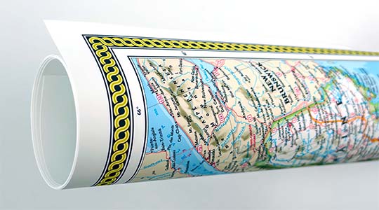
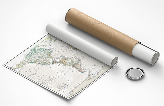
We use top-notch materials printed on demand using the Giclée printing method, so you get amazing detail and bright colors every time.
Archival Paper
Premium fine art paper that provides accurate color reproduction with high-contrast, high-resolution print output and maximum image permanence. A high-quality Giclée print ready for framing.
Museum quality paper for high-quality fine art.
Ultra smooth, neutral white matte finish.
Heavy-weight 230 gsm, 9.5 mil thickness.
Printed with pigment inks for longer print life and enhanced fade resistance.
Pigment based Canon LUCIA inks provide smooth tones and rich colors in fine, precise detail.
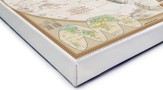
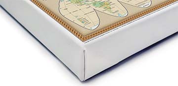
Canvas Gallery Wrap
A high quality canvas giclee print is hand stretched over a sturdy wood frame. Printed on demand and handcrafted in Seattle, WA. The canvas gallery wrap serves as a stunning piece of art ready to hang on your wall.
Premium 19 mil canvas material.
Pigment based Canon LUCIA inks provide smooth tones and rich colors in fine, precise detail.
High quality giclee fine art print with a lightfastness rating of over 100 years.
Durable canvas mounted to a 1.25" deep wood frame.
Ready to hang with included easy-to-use hanging kit.
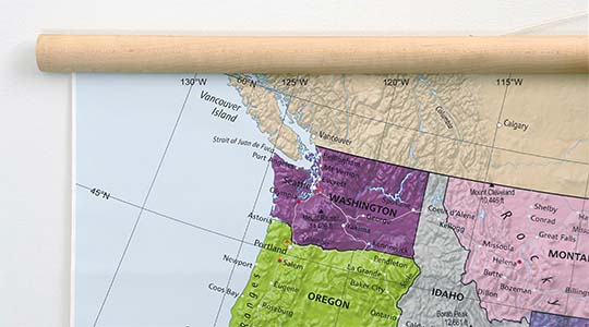
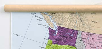
Canvas on Wood Rails
A canvas giclee print that is mounted to wood hanging rails placed along the top and bottom of the map. Rail mounted maps are ready to hang via the attached hanging cord. Solid wood rails have a natural finish.
Premium 19 mil canvas material.
Wood rails are 1 1/8" wide, round front.
USA sourced solid maple wood.
High quality giclee fine art print with a lightfastness rating of over 100 years.
Pigment based Canon LUCIA inks provide smooth tones and rich colors in fine, precise detail.
Luster Photo Paper
A premium semi-gloss photo paper with a subtle texture that produces a vivid, richly detailed print. This material results in an exquisitely detailed giclee print of substantially higher quality than a standard poster.
Printed on 10 mil premium luster photo paper resulting in a brilliant, colorful image with a vivid life-like quality.
Pigment based Canon LUCIA inks provide smooth tones and rich colors in fine, precise detail.
Inks have a lightfastness rating of over 100 years, guaranteeing minimal noticeable fading over a very long period of time.
Printed using very high resolution source files.
Giclee printing is superior to traditional lithography in a number of ways: colors are brighter, lasts longer, and is a higher resolution.
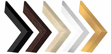
Framed Print
Our gallery quality frames are made of solid wood and feature optical-grade acrylic. Each framed map is printed on premium archival matte fine art paper.
Printed on thick, luxurious acid-free fine art paper & dry-mounted to foam board.
Pigment inks ensure a vivid print with amazing colors and excellent fade resistance.
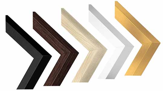
Solid wood frame in 5 finishes has a 7/8" face & 1.25" depth.
Kraft paper protective backing & hanging wire installed.
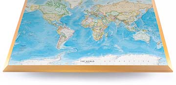
Plaque Mount
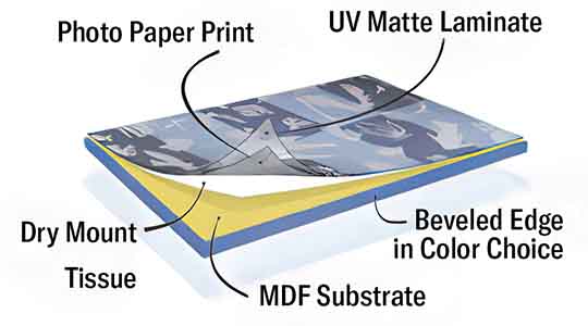
A museum grade display featuring high-resolution printing on premium photo paper, mounted on a durable wood plaque with a protective matte laminate. Surface can be cleaned with glass cleaner.
A premium photo print is dry-mounted to onto wood substrate (MDF).
Features a highly durable laminated surface that is scratch-resistant, water-resistant and fade-resistant.
Lamination is a non-glare matte finsh that can be wiped clean with a damp cloth or glass cleaner.
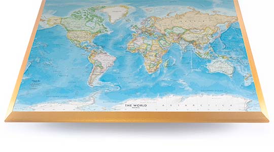
Mounted to 3/8" thick MDF wood panel with a 3/8" wide beveled edge available in premium foil color options.
Keyhole slot with velvet feet on the corners for easy wall mounting. Hanging hardware included.
Plaque Mounting Process
Gallery quality map prints made in the USA
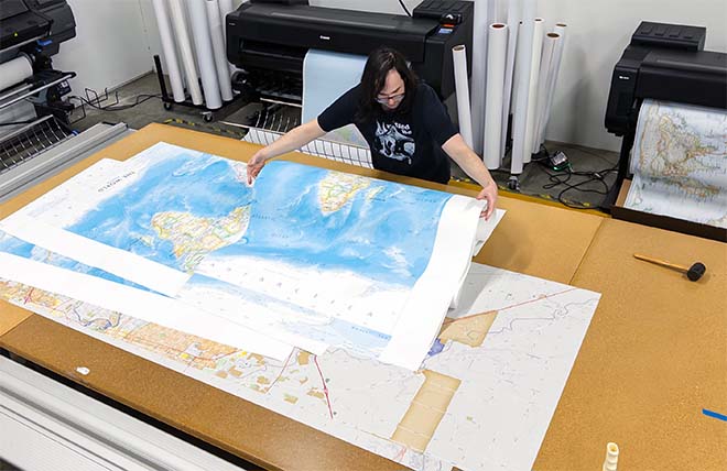
We specialize in producing high-quality, detailed maps using advanced printing technologies and premium materials. Stringent quality control and ultra-high-resolution printing guarantee absolute clarity and precise detail at any size. Whether it's a smaller wall map print or a gigantic wallpaper map mural, no print will appear blurry or pixelated. You can expect every detail on the map to be sharp and clear.
Finely Crafted Cartographic Works of Art
Many of the maps we provide are created by our small team of cartographers under the name Academia Maps.
Museum Quality Materials
We source the best materials for our map prints and wallpaper maps. Premium archival inks guarantee rich vibrant colors with excellent fade resistance.
USA Print Production
We are a small business located in Seattle, WA that has been printing maps for over 15 years. Each map is printed on-demand using high-end fine art printers.
Shipping Costs
Free Ground Shipping within the contiguous United States and a flat rate of $20.00 to AK and HI.
Canada via UPS Standard is $40.00 USD.
Worldwide Shipping is available and shipping costs will be calculated at checkout.
Shipping Times
Most items are made to order and ship from our Seattle, WA facility. Typical production lead times are listed below. Shipping transit time is 2-5 business days depending on the delivery location. If you need your map by a certain deadline please contact us for expedited options.
Archival Paper, Laminated Maps, and Peel & Stick - 5-7 business days
Wood Rail Mounting - 3-4 weeks
Canvas Gallery Wraps & Framed Maps - 3-5 business days
Push Pin Maps - 3-5 business days
Spring Roller Maps - Varies, see product description
Wallpaper Map Murals - 7-10 business days
Returns
If you are unhappy with your order for any reason you can return it within 30 days of the delivery date. Customized items are non-returnable.
Yes, we can produce a majority of the map titles found on our website in a custom size. If you would like to request a custom size, take note of the map title and item#, then follow one of the links below to make your request. We will follow up with a link to checkout.
(for rolled or mounted prints)
(for larger peel & stick / wallpaper maps)
All of our maps are currently labeled as "Gulf of Mexico". Since our map products are printed to order, we can offer the alternate "Gulf of America" labeling by request.
If you would like your map to be labeled Gulf of America instead of Gulf of Mexico, simply request this in the comments section at checkout, and we will update the map.
We accept purchase orders from schools and government entities. You can e-mail a copy of your PO to contact@worldmapsonline.com.
View more information and download our W-9.
No problem, send a screenshot or PDF of your shopping cart to contact@worldmapsonline.com and will promptly follow up with a quotation.
Our products are printed on demand and have the following production lead times:
Archival Paper, Laminated Maps, and Peel & Stick - 5-7 business days
Wood Rail Mounting - 3-4 weeks
Canvas Gallery Wraps & Framed Maps - 3-5 business days
Spring Roller Maps - Varies, see product description
Shipping transit time is 2-5 business days and will vary depending on your location. Most products ship from Seattle, WA.
Many of the maps found on our website can be customized, including adding a personalized title/legend or company logo, modifying the color scheme, change text labels, adding points of interest, and placing GIS data on the map.
If the order is shipping outside of Washington state, sales tax may not apply. We collect sales taxes per state and local laws. Sales tax is calculated at checkout based on the delivery address.
We can ship to nearly any country. The shipping cost is determined for Canada and most European countries at checkout. If you find that shipping is unavailable to your country when checking out then please contact us with a list of the products you would like to order as well as size and material options.
We can produce a custom map for any location in the world. Whether you are looking for a detailed city street map or high resolution satellite imagery of a remote area, we have you covered.
Because maps aren't just décor—they're personal stories, travel memories, and future adventures waiting to happen. SHOP BESTSELLING MAPS
🎁 Meaningful: Track travels, spark memories, plan new experiences.
🎄 Perfect for gifts: Unique, educational, and visually stunning.
🏠 Fits any home décor: Modern, vintage, minimalist & artistic styles available.
✏️ Personalizable: Add names, family titles, travel quotes (push-pin maps).
✈️ Great for travelers, students, families, teachers & offices.
Wall Maps Material Info
We use museum grade papers and canvas along with high quality solid wood mounting options.
Made in the USA
Archival Paper
Premium Giclée fine art print on thick acid-free paper with a matte finish. Features rich, vibrant colors with precise detail.
Luster Photo Paper
Giclée fine art print on semi-gloss photo paper. A richly detailed print with vivid colors.
Canvas on Wood Rails
High-quality giclée print on artist-grade canvas mounted to natural finish solid wood hanging rails placed along the top and bottom of the canvas. Hanging cord at top.
Canvas Gallery Wrap
High-quality giclée print on artist-grade canvas. Wrapped around a sturdy wooden frame, this print is perfect for adding depth and texture to any space.
Framed Map Print
Printed on high-grade fine art paper and mounted in a solid wood frame available in 5 finishes. The print is protected behind optical-grade clear acrylic.
Plaque Mount
A high resolution photo print dry-mounted to wood and sealed with a durable matte laminate. A sleek frameless look with a beveled edge that is available in multiple color finishes.
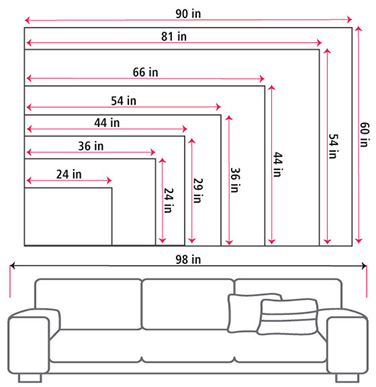
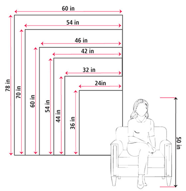
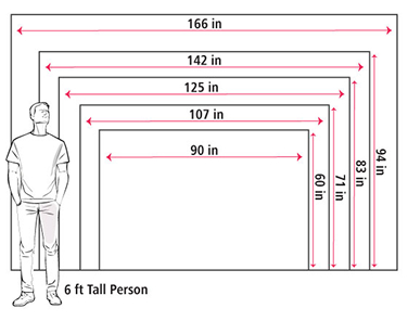
Size Guide
These mockups are to be used as a general visual aid to assist you in choosing a size. The measurements may not reflect the exact sizes of the product you are viewing. It is always best practice to measure your wall space prior to ordering.
Our wall maps and wallpaper map murals are handcrafted by our small team in Seattle, WA.
School Purchase Orders
We accept purchase orders from schools and other government institutions. Learn more here.
High Quality Materials
Maps are printed on premium fine art papers, canvas, and durable wallcovering materials using archival inks.
Stunning Cartography
Original and up-to-date maps designed by our cartographic team at Academia Maps include a range of high quality maps for geographic exploration, home decor, and classroom learning.