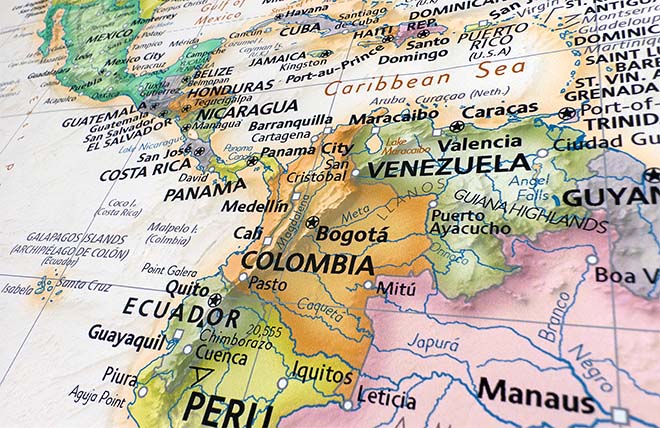
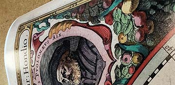
Bird's eye view of Macon, Ga.
Bird's Eye View map of Macon, Georgia, published in H., Wellge in 1887. While archeologists have established that the area was once an important agricultural village to the Mississippian Mound Building Culture, it was the Creek Indians who occupied the area that is now Macon when U. S. settlers first arrived. The Creek Indians ceded their lands east of the Ocmulgee River and Fort Benjamin Hawkins was built in 1806, under the direction of President Thomas Jefferson. A replica of the fort stands today in East Macon.
Settlers who lived in the vicinity of Fort Hawkins began to call the place "Newtown". When the newly formed Bibb County was established in 1822, the site was chosen as the county seat and given the name Macon. Many of the early settlers came from North Carolina originally, and they chose to name their city in honor of Nathaniel Macon, a North Carolina statesman. The new city planners envisioned a "City within a Park" concept, resulting in a city with broad streets and spacious parks. Macon residents were required to plant shade trees in their yards to support the overall plan. Its position along the Ocmulgee River contributed to the prosperity of the town, allowing cotton boats to transport cotton to market. The arrival of railroads in 1843 added to the ease of transporting goods. Wesleyan College, the nation's first college to grant degrees to women, opened in Macon in 1836.
During the Civil War, Macon was the official arsenal of the Confederacy and the site of Camp Oglethorpe, a prison camp for captured officers during the war. Macon City Hall was converted to use as a hospital and served as the temporary state capital in 1864. Sherman's famous "March to the Sea" spared Macon, though residents were prepared for the assault. Sherman decided to bypass the city, fearing a well organized attack by Confederate forces.
Following the Civil War, Macon continued to develop as a transportation hub, becoming increasingly important to the entire state of Georgia. When the U. S. fought the Spanish-American War (1898), Macon's active militia participated in the raid into Mexico to capture Pancho Villa. The training camps established in the Macon area for the Spanish-American War inspired the Chamber of Commerce to aggressively pursue more military training facilities in the area, resulting in tens of thousands of American "Doughboys" arriving in Macon to prepare for the nations entry into World War I. This map provides a view of the city just five years before the construction of Camp Wheeler.