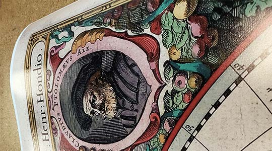
Bird's eye view of Norfolk, Portsmouth and Berkley, Norfolk Co., Va. Morning News Lith. Reproduction Bird's Eye View of Norfolk and Portsmouth, Virginia, drawn and published by Augustus Koch in 1891. An area with a long colonial history, the newly formed Norfolk County, which includes present day Norfolk, Chesapeake and parts of Portsmouth, was named for Norfolk, England, the birthplace of Adam Thoroughgood, an indentured servant who arrived in the colonies in 1622. Once Thoroughgood had earned his freedom, he became a leading citizen of the colony and was granted a large land holding along the Lynnhaven River in 1636, where he convinced more than a hundred people to settle. The city was granted a royal charter as a borough by King George II in 1736.
Norfolk became what was considered the most prosperous city in Virginia and served as a strong Loyalist support base during the American Revolution. Lord Dunmore, the Royal Governor of Virginia was forced to flee Norfolk in 1775 under pressure from the revolutionary forces. In 1776, on New Year's Day, Lord Dunmore returned with a fleet of three ships that bombarded the city for over eight hours. Over 800 buildings were destroyed and the patriots destroyed the remaining buildings to prevent them from being retaken by the British.
During the Civil War, Norfolk was witness to the first battle between ironclad naval boats in the spring of 1862, when the USS Monitor and the CSS Virginia fought the Battle of Hampton Roads off the northwest shore of the city's Sewell Point Peninsula. The city was surrendered to the Union forces in May, 1862 and remained under martial law for the duration of the war. This map captures the city as it appeared twenty-six years after the Civil War ended.
Features numbered references to the following locations:
NORFOLK 1. Norfolk City Hall 2. Norfolk County Ferries to Portsmouth and Berkley. 3. Norfolk Space and Power Company. 4. Norfolk and Western Railroad Depot. 4A. Union Depot (Proposed). 5. City Market House. 6. Clyde Line's Docks. 7. Grave's Ship Yards. 8. Old Dominion Steamship Company. 9. Mahoney's Dock and Ice Factory. 10. Baltimore Steam Packet Company. 11. Consolidated Compress Company. 12. Merchants and Miners Transportation Company. 13. Imperial Guano Company (Boston Wharf). 14. N. Y. P. & N. R. R. - Cape Charles Route (McCullough's Dock). 15. C. & O. R. R. Landing. 16. Strudwick & Co.'s (missing text). 17. Old Dominion Guano?(missing text). 18. Bergner & Engel (missing text). 19. North Carolina Stea (missing text). 20. St. Vincent DePaul (missing text). 21. Norfolk Retreat for the Sick. 22. Hare Building. 23. Cotton Exchange. 24. Post Office. 25. Young Men's Christian Association Building. 26. Steven's Block. 27. Loewenberg's Block. 28. Van Wick's Academy of Music. 29. Oberndorfer & Co., Wholesale Confectioners. 30. Odd Fellows' Hall. 31. Masonic Temple. 32. Nottingham & Wren's Ice Houses and Coal Docks. 33. Geo. W. Taylor's Ice House and Coal Dock. 34. Norfolk Academy. 35. Norfolk College for Young Ladies. 36. E. A. Watkins & Brother's Office and Planing Mill. 37. E. W. Face & Son's Brick Works. 38. Geo. Rettig & Son's Ice Factory.
PORTSMOUTH. 39. Court House. 40. Union Depot - Seaboard and Roanoke Railroad, and Atlantic and Danville Railroad. 41. City Market House and Armory (Proposed). 42. Atlantic and Danville Railroad Shops. 43. Seaboard Air Line Warehouses and Docks. 44. Sunny South Kindling Wood Factory. 45. E. C. Brooks & Co.'s Coal Yard. 46. J. C. Emmerson's Lumber Yard and Planing Mill. 47. Seaboard & Roanoke and Seaboard Air Line Railroad's General Offices. 48. Confederate Monument. 49. City Hall. 50. John R. Neely, Doors, Sash and Blinds.
BERKLEY 51. Stran Brothers' Lumber Dock. 52. Property of O. F. Smith. 53. Property of J. A. Woodard. 54. Property of Williamson and Billups. 55. Norfolk Southern Railroad Depot. 56. L. C. Jones' Ship Yard. 57. Thomas' Ship Yard. 58. Berkley Town Hall. 59. Greenleaf & Johnson's Lumber Company's Saw Mill (Sandy Point). 60. Greenleaf & Johnson's Butt Mill. 61. J. H. Jacock's Coal and Wood Yard. 62. Leckies & Collins' Mill and Dry Kilns. 63. G. H. Frey's Box Factory. 64. Albemarle and Chesapeake Canal Co.'s Steam Yacht. 65. Portsmouth Basket Works. 66. Cooke, Clarke & Co., Sash, Blind and Door Warehouse. 67. G. Armstrong & Son's Saw and Planing Mill.
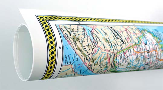
We use top-notch materials printed on demand using the Giclée printing method, so you get amazing detail and bright colors every time.
Archival Paper
Premium fine art paper that provides accurate color reproduction with high-contrast, high-resolution print output and maximum image permanence. A high-quality Giclée print ready for framing.
Museum quality paper for high-quality fine art.
Ultra smooth, neutral white matte finish.
Heavy-weight 230 gsm, 9.5 mil thickness.
Printed with pigment inks for longer print life and enhanced fade resistance.
Pigment based Canon LUCIA inks provide smooth tones and rich colors in fine, precise detail.
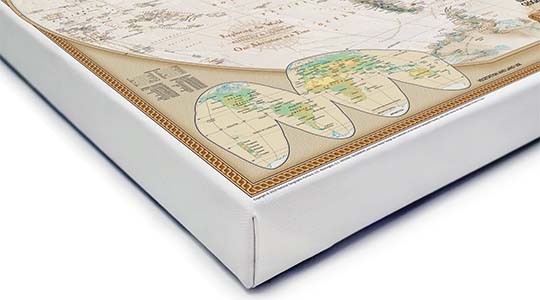
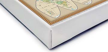
Canvas Gallery Wrap
A high quality canvas giclee print is hand stretched over a sturdy wood frame. Printed on demand and handcrafted in Seattle, WA. The canvas gallery wrap serves as a stunning piece of art ready to hang on your wall.
Premium 19 mil canvas material.
Pigment based Canon LUCIA inks provide smooth tones and rich colors in fine, precise detail.
High quality giclee fine art print with a lightfastness rating of over 100 years.
Durable canvas mounted to a 1.25" deep wood frame.
Ready to hang with included easy-to-use hanging kit.
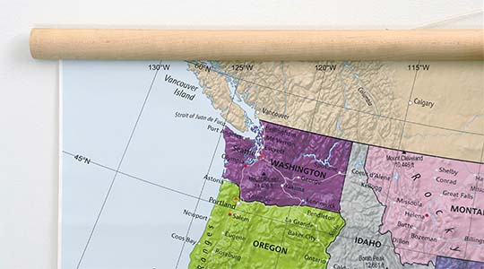
Canvas on Wood Rails
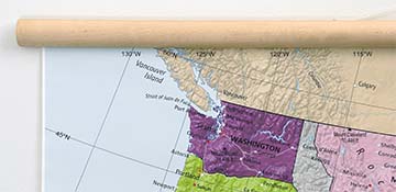
A canvas giclee print that is mounted to wood hanging rails placed along the top and bottom of the map. Rail mounted maps are ready to hang via the attached hanging cord. Solid wood rails have a natural finish.
Premium 19 mil canvas material.
Wood rails are 1 1/8" wide, round front.
USA sourced solid maple wood.
High quality giclee fine art print with a lightfastness rating of over 100 years.
Pigment based Canon LUCIA inks provide smooth tones and rich colors in fine, precise detail.
Luster Photo Paper
A premium semi-gloss photo paper with a subtle texture that produces a vivid, richly detailed print. This material results in an exquisitely detailed giclee print of substantially higher quality than a standard poster.
Printed on 10 mil premium luster photo paper resulting in a brilliant, colorful image with a vivid life-like quality.
Pigment based Canon LUCIA inks provide smooth tones and rich colors in fine, precise detail.
Inks have a lightfastness rating of over 100 years, guaranteeing minimal noticeable fading over a very long period of time.
Printed using very high resolution source files.
Giclee printing is superior to traditional lithography in a number of ways: colors are brighter, lasts longer, and is a higher resolution.
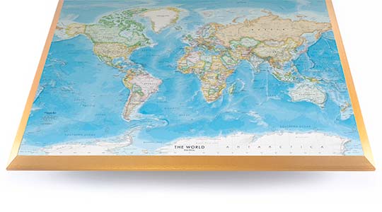
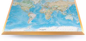
Framed Print
Our gallery quality frames are made of solid wood and feature optical-grade acrylic. Each framed map is printed on premium archival matte fine art paper.
Printed on thick, luxurious acid-free fine art paper & dry-mounted to foam board.
Pigment inks ensure a vivid print with amazing colors and excellent fade resistance.
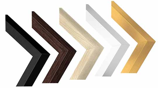
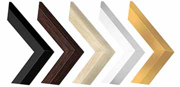
Solid wood frame in 5 finishes has a 7/8" face & 1.25" depth.
Kraft paper protective backing & hanging wire installed.
Plaque Mount
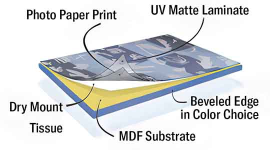
A museum grade display featuring high-resolution printing on premium photo paper, mounted on a durable wood plaque with a protective matte laminate. Surface can be cleaned with glass cleaner.
A premium photo print is dry-mounted to onto wood substrate (MDF).
Features a highly durable laminated surface that is scratch-resistant, water-resistant and fade-resistant.
Lamination is a non-glare matte finsh that can be wiped clean with a damp cloth or glass cleaner.
Mounted to 3/8" thick MDF wood panel with a 3/8" wide beveled edge available in premium foil color options.
Keyhole slot with velvet feet on the corners for easy wall mounting. Hanging hardware included.
Plaque Mounting Process
Gallery quality map prints made in the USA
We specialize in producing high-quality, detailed maps using advanced printing technologies and premium materials. Stringent quality control and ultra-high-resolution printing guarantee absolute clarity and precise detail at any size. Whether it's a smaller wall map print or a gigantic wallpaper map mural, no print will appear blurry or pixelated. You can expect every detail on the map to be sharp and clear.
Finely Crafted Cartographic Works of Art
Many of the maps we provide are created by our small team of cartographers under the name Academia Maps.
Museum Quality Materials
We source the best materials for our map prints and wallpaper maps. Premium archival inks guarantee rich vibrant colors with excellent fade resistance.
USA Print Production
We are a small business located in Seattle, WA that has been printing maps for over 15 years. Each map is printed on-demand using high-end fine art printers.
Shipping Costs
Free Ground Shipping within the contiguous United States and a flat rate of $20.00 to AK and HI.
Canada via UPS Standard is $40.00 USD.
Worldwide Shipping is available and shipping costs will be calculated at checkout.
Shipping Times
Most items are made to order and ship from our Seattle, WA facility. Typical production lead times are listed below. Shipping transit time is 2-5 business days depending on the delivery location. If you need your map by a certain deadline please contact us for expedited options.
Archival Paper, Laminated Maps, and Peel & Stick - 5-7 business days
Wood Rail Mounting - 3-4 weeks
Canvas Gallery Wraps & Framed Maps - 3-5 business days
Push Pin Maps - 3-5 business days
Spring Roller Maps - Varies, see product description
Wallpaper Map Murals - 7-10 business days
Returns
If you are unhappy with your order for any reason you can return it within 30 days of the delivery date. Customized items are non-returnable.
Yes, we can produce a majority of the map titles found on our website in a custom size. If you would like to request a custom size, take note of the map title and item#, then follow one of the links below to make your request. We will follow up with a link to checkout.
(for rolled or mounted prints)
(for larger peel & stick / wallpaper maps)
All of our maps are currently labeled as "Gulf of Mexico". Since our map products are printed to order, we can offer the alternate "Gulf of America" labeling by request.
If you would like your map to be labeled Gulf of America instead of Gulf of Mexico, simply request this in the comments section at checkout, and we will update the map.
We accept purchase orders from schools and government entities. You can e-mail a copy of your PO to contact@worldmapsonline.com.
View more information and download our W-9.
No problem, send a screenshot or PDF of your shopping cart to contact@worldmapsonline.com and will promptly follow up with a quotation.
Our products are printed on demand and have the following production lead times:
Archival Paper, Laminated Maps, and Peel & Stick - 5-7 business days
Wood Rail Mounting - 3-4 weeks
Canvas Gallery Wraps & Framed Maps - 3-5 business days
Spring Roller Maps - Varies, see product description
Shipping transit time is 2-5 business days and will vary depending on your location. Most products ship from Seattle, WA.
Many of the maps found on our website can be customized, including adding a personalized title/legend or company logo, modifying the color scheme, change text labels, adding points of interest, and placing GIS data on the map.
If the order is shipping outside of Washington state, sales tax may not apply. We collect sales taxes per state and local laws. Sales tax is calculated at checkout based on the delivery address.
We can ship to nearly any country. The shipping cost is determined for Canada and most European countries at checkout. If you find that shipping is unavailable to your country when checking out then please contact us with a list of the products you would like to order as well as size and material options.
We can produce a custom map for any location in the world. Whether you are looking for a detailed city street map or high resolution satellite imagery of a remote area, we have you covered.
Because maps aren't just décor—they're personal stories, travel memories, and future adventures waiting to happen. SHOP BESTSELLING MAPS
🎁 Meaningful: Track travels, spark memories, plan new experiences.
🎄 Perfect for gifts: Unique, educational, and visually stunning.
🏠 Fits any home décor: Modern, vintage, minimalist & artistic styles available.
✏️ Personalizable: Add names, family titles, travel quotes (push-pin maps).
✈️ Great for travelers, students, families, teachers & offices.
Wall Maps Material Info
We use museum grade papers and canvas along with high quality solid wood mounting options.
Made in the USA
Archival Paper
Premium Giclée fine art print on thick acid-free paper with a matte finish. Features rich, vibrant colors with precise detail.
Luster Photo Paper
Giclée fine art print on semi-gloss photo paper. A richly detailed print with vivid colors.
Canvas on Wood Rails
High-quality giclée print on artist-grade canvas mounted to natural finish solid wood hanging rails placed along the top and bottom of the canvas. Hanging cord at top.
Canvas Gallery Wrap
High-quality giclée print on artist-grade canvas. Wrapped around a sturdy wooden frame, this print is perfect for adding depth and texture to any space.
Framed Map Print
Printed on high-grade fine art paper and mounted in a solid wood frame available in 5 finishes. The print is protected behind optical-grade clear acrylic.
Plaque Mount
A high resolution photo print dry-mounted to wood and sealed with a durable matte laminate. A sleek frameless look with a beveled edge that is available in multiple color finishes.
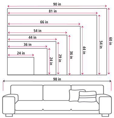
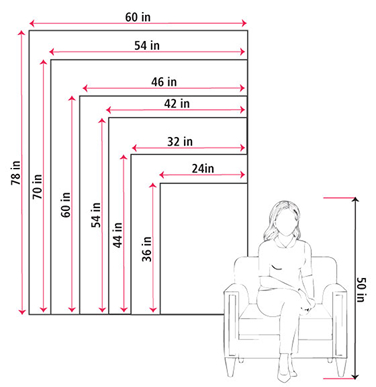
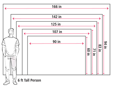
Size Guide
These mockups are to be used as a general visual aid to assist you in choosing a size. The measurements may not reflect the exact sizes of the product you are viewing. It is always best practice to measure your wall space prior to ordering.
Our wall maps and wallpaper map murals are handcrafted by our small team in Seattle, WA.
School Purchase Orders
We accept purchase orders from schools and other government institutions. Learn more here.
High Quality Materials
Maps are printed on premium fine art papers, canvas, and durable wallcovering materials using archival inks.
Stunning Cartography
Original and up-to-date maps designed by our cartographic team at Academia Maps include a range of high quality maps for geographic exploration, home decor, and classroom learning.